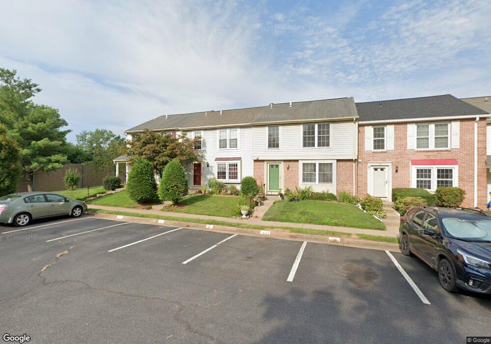
1132 Stevenson Ct Herndon, VA 20170
Estimated Value: $458,000 - $543,000
3
Beds
4
Baths
1,670
Sq Ft
$306/Sq Ft
Est. Value
About This Home
This home is located at 1132 Stevenson Ct, Herndon, VA 20170 and is currently estimated at $510,465, approximately $305 per square foot. 1132 Stevenson Ct is a home located in Fairfax County with nearby schools including Dranesville Elementary, Herndon Middle School, and Herndon High School.
Ownership History
Date
Name
Owned For
Owner Type
Purchase Details
Closed on
Nov 10, 2025
Sold by
Verma Arun K and Verma Namita K
Bought by
Verma Family Revocable Trust and Verma
Current Estimated Value
Purchase Details
Closed on
Feb 26, 2010
Sold by
Kennedy Marsha L
Bought by
Verma Arun K
Purchase Details
Closed on
Feb 3, 2003
Sold by
Woodward Robert
Bought by
Verma Arun
Home Financials for this Owner
Home Financials are based on the most recent Mortgage that was taken out on this home.
Original Mortgage
$174,400
Interest Rate
6.09%
Mortgage Type
New Conventional
Purchase Details
Closed on
Apr 2, 1997
Sold by
Gutschenritter Te Earl J and Gutschenritter Te Mildred
Bought by
Woodward Robert M and Woodward Kyong Hae Kim
Home Financials for this Owner
Home Financials are based on the most recent Mortgage that was taken out on this home.
Original Mortgage
$111,600
Interest Rate
7.5%
Mortgage Type
New Conventional
Create a Home Valuation Report for This Property
The Home Valuation Report is an in-depth analysis detailing your home's value as well as a comparison with similar homes in the area
Home Values in the Area
Average Home Value in this Area
Purchase History
| Date | Buyer | Sale Price | Title Company |
|---|---|---|---|
| Verma Family Revocable Trust | -- | None Listed On Document | |
| Verma Arun K | $120,000 | -- | |
| Verma Arun | $218,000 | -- | |
| Woodward Robert M | $124,000 | -- |
Source: Public Records
Mortgage History
| Date | Status | Borrower | Loan Amount |
|---|---|---|---|
| Previous Owner | Woodward Robert M | $174,400 | |
| Previous Owner | Woodward Robert M | $111,600 |
Source: Public Records
Tax History
| Year | Tax Paid | Tax Assessment Tax Assessment Total Assessment is a certain percentage of the fair market value that is determined by local assessors to be the total taxable value of land and additions on the property. | Land | Improvement |
|---|---|---|---|---|
| 2025 | $6,606 | $475,320 | $145,000 | $330,320 |
| 2024 | $6,606 | $465,690 | $145,000 | $320,690 |
| 2023 | $5,928 | $426,930 | $145,000 | $281,930 |
| 2022 | $5,817 | $412,970 | $135,000 | $277,970 |
| 2021 | $4,559 | $388,480 | $120,000 | $268,480 |
| 2020 | $4,297 | $363,040 | $115,000 | $248,040 |
| 2019 | $4,215 | $356,180 | $110,000 | $246,180 |
| 2018 | $3,712 | $322,790 | $107,000 | $215,790 |
| 2017 | $3,748 | $322,790 | $107,000 | $215,790 |
| 2016 | $3,770 | $325,390 | $107,000 | $218,390 |
| 2015 | $3,417 | $306,190 | $105,000 | $201,190 |
| 2014 | $3,204 | $287,760 | $105,000 | $182,760 |
Source: Public Records
Map
Nearby Homes
- 22070 County Rd 254l Rd Unit Lots 23, 24, 25 & 26
- 1044 Trevino Ln
- 1694 Winterwood Ct
- 865 Moffett Forge Rd
- 1176 Dublin Place
- 806 Grace St
- 125 Fortnightly Blvd
- 1731 Whitewood Ln
- 120 Fortnightly Blvd
- 1118 Shannon Place
- 815 Branch Dr Unit 207
- 12810 Lady Fairfax Cir
- 720 Park Ave
- 1212 Bond St
- 1515 Judd Ct
- 122 Briarwood Ct
- 805 Mosby Hollow Dr
- 1413 Bayshire Ln
- 805 Locust St Unit 6
- 12524 Philmont Dr
- 1130 Stevenson Ct
- 1134 Stevenson Ct
- 1128 Stevenson Ct
- 1136 Stevenson Ct
- 1126 Stevenson Ct
- 1124 Stevenson Ct
- 1108 Tway Ln
- 1110 Tway Ln
- 1106 Tway Ln
- 1104 Tway Ln
- 1102 Tway Ln
- 1122 Stevenson Ct
- 1100 Tway Ln
- 1118 Stevenson Ct
- 1112 Tway Ln
- 1104 Stevenson Ct
- 1102 Stevenson Ct
- 1106 Stevenson Ct
- 1100 Stevenson Ct
- 1108 Stevenson Ct
Your Personal Tour Guide
Ask me questions while you tour the home.