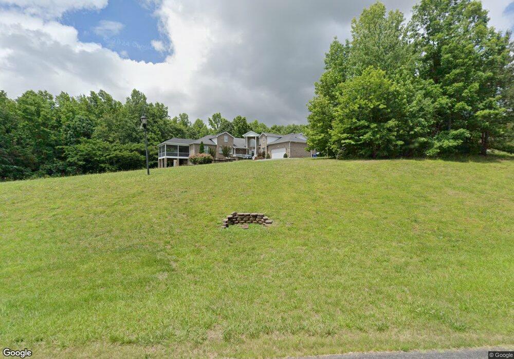
1132 Stonegate Dr Winston Salem, NC 27107
Estimated Value: $541,000 - $921,000
4
Beds
4
Baths
13,489
Sq Ft
$54/Sq Ft
Est. Value
About This Home
This home is located at 1132 Stonegate Dr, Winston Salem, NC 27107 and is currently estimated at $734,106, approximately $54 per square foot. 1132 Stonegate Dr is a home located in Davidson County with nearby schools including Wallburg Elementary School, Oak Grove Middle School, and Oak Grove High School.
Ownership History
Date
Name
Owned For
Owner Type
Purchase Details
Closed on
Sep 29, 2017
Sold by
Foster Gail Henderson and Foster Christopher B
Bought by
Tariq Ali A and Zaib Anam
Current Estimated Value
Home Financials for this Owner
Home Financials are based on the most recent Mortgage that was taken out on this home.
Original Mortgage
$260,000
Outstanding Balance
$216,764
Interest Rate
3.75%
Mortgage Type
Adjustable Rate Mortgage/ARM
Estimated Equity
$517,342
Purchase Details
Closed on
Nov 1, 1998
Create a Home Valuation Report for This Property
The Home Valuation Report is an in-depth analysis detailing your home's value as well as a comparison with similar homes in the area
Home Values in the Area
Average Home Value in this Area
Purchase History
| Date | Buyer | Sale Price | Title Company |
|---|---|---|---|
| Tariq Ali A | $325,000 | None Available | |
| -- | $53,000 | -- |
Source: Public Records
Mortgage History
| Date | Status | Borrower | Loan Amount |
|---|---|---|---|
| Open | Tariq Ali A | $260,000 |
Source: Public Records
Tax History Compared to Growth
Tax History
| Year | Tax Paid | Tax Assessment Tax Assessment Total Assessment is a certain percentage of the fair market value that is determined by local assessors to be the total taxable value of land and additions on the property. | Land | Improvement |
|---|---|---|---|---|
| 2025 | $4,298 | $651,330 | $0 | $0 |
| 2024 | $4,282 | $651,330 | $0 | $0 |
| 2023 | $4,282 | $651,330 | $0 | $0 |
| 2022 | $4,282 | $651,330 | $0 | $0 |
| 2021 | $4,106 | $651,330 | $0 | $0 |
| 2020 | $2,483 | $393,860 | $0 | $0 |
| 2019 | $2,521 | $393,860 | $0 | $0 |
| 2018 | $2,521 | $393,860 | $0 | $0 |
| 2017 | $2,521 | $393,860 | $0 | $0 |
| 2016 | $3,680 | $575,030 | $0 | $0 |
| 2015 | $3,680 | $575,030 | $0 | $0 |
| 2014 | $3,822 | $597,190 | $0 | $0 |
Source: Public Records
Map
Nearby Homes
- 470 Prescott Dr
- 193 Redcoat Ln
- 111 Linville Ln
- 0 Lee St
- 213 Red Hawk Ln
- 3775 Friendship Ledford Rd
- 386 Olde Lantern Dr
- 380 Olde Lantern Dr
- 387 Olde Lantern Dr
- 134 New Forest Dr
- 580 Tom Livengood Rd
- 150 New Forest Dr
- 312 Olde Lantern Dr
- 168 New Forest Dr
- 184 New Forest Dr
- 298 Olde Lantern Dr
- 309 Olde Lantern Dr
- 270 Olde Lantern Dr
- 138 Green Forest Ct
- 154 Green Forest Ct
- 1131 Stonegate Dr
- 1187 Stonegate Dr
- 1110 Stonegate Dr
- 423 Bradley Rd
- 453 Bradley Rd
- 399 Bradley Rd
- 1172 Stonegate Dr
- 375 Bradley Rd
- 1209 Stonegate Dr
- 1194 Stonegate Dr
- 102 Stonegate Dr
- 353 Bradley Rd
- 1216 Stonegate Dr
- 382 Bradley Rd
- 333 Bradley Rd
- 436 Bradley Rd
- 420 Bradley Rd
- 404 Bradley Rd
- 1233 Stonegate Dr
- 362 Bradley Rd