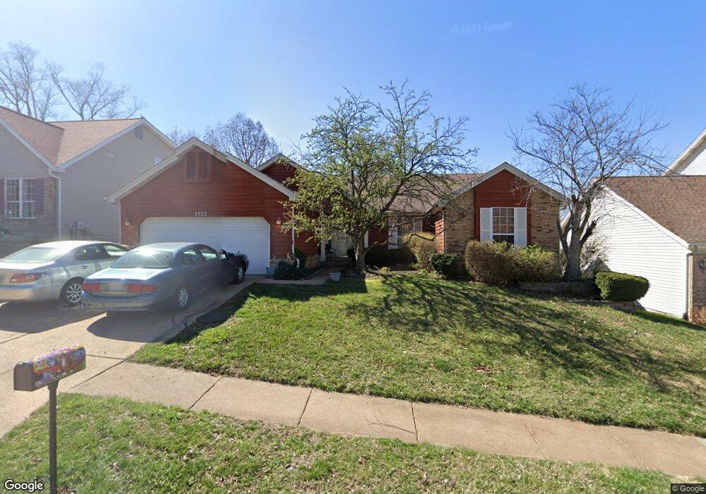
1133 Dunston Dr Saint Louis, MO 63146
Estimated Value: $392,000 - $489,000
4
Beds
3
Baths
1,894
Sq Ft
$227/Sq Ft
Est. Value
About This Home
This home is located at 1133 Dunston Dr, Saint Louis, MO 63146 and is currently estimated at $430,051, approximately $227 per square foot. 1133 Dunston Dr is a home located in St. Louis County with nearby schools including Willow Brook Elementary School, Pattonville Heights Middle School, and Pattonville High School.
Ownership History
Date
Name
Owned For
Owner Type
Purchase Details
Closed on
Dec 27, 2006
Sold by
Bragg Carolyn A and Steffen Carolyn A
Bought by
Lowe James and Lowe Judith H
Current Estimated Value
Home Financials for this Owner
Home Financials are based on the most recent Mortgage that was taken out on this home.
Original Mortgage
$240,000
Outstanding Balance
$141,814
Interest Rate
6.1%
Mortgage Type
Purchase Money Mortgage
Estimated Equity
$288,237
Purchase Details
Closed on
Oct 11, 2002
Sold by
Dolle Ann B
Bought by
Steffan Carolyn A
Home Financials for this Owner
Home Financials are based on the most recent Mortgage that was taken out on this home.
Original Mortgage
$75,000
Interest Rate
5.57%
Purchase Details
Closed on
Apr 13, 1999
Sold by
Dolle Gary L
Bought by
Dolle Ann B
Create a Home Valuation Report for This Property
The Home Valuation Report is an in-depth analysis detailing your home's value as well as a comparison with similar homes in the area
Home Values in the Area
Average Home Value in this Area
Purchase History
| Date | Buyer | Sale Price | Title Company |
|---|---|---|---|
| Lowe James | $300,000 | None Available | |
| Steffan Carolyn A | $253,000 | -- | |
| Dolle Ann B | -- | -- |
Source: Public Records
Mortgage History
| Date | Status | Borrower | Loan Amount |
|---|---|---|---|
| Open | Lowe James | $240,000 | |
| Previous Owner | Steffan Carolyn A | $75,000 |
Source: Public Records
Tax History Compared to Growth
Tax History
| Year | Tax Paid | Tax Assessment Tax Assessment Total Assessment is a certain percentage of the fair market value that is determined by local assessors to be the total taxable value of land and additions on the property. | Land | Improvement |
|---|---|---|---|---|
| 2025 | $4,788 | $70,770 | $12,310 | $58,460 |
| 2024 | $4,788 | $68,410 | $6,560 | $61,850 |
| 2023 | $4,806 | $68,410 | $6,560 | $61,850 |
| 2022 | $4,409 | $57,110 | $9,860 | $47,250 |
| 2021 | $4,385 | $57,110 | $9,860 | $47,250 |
| 2020 | $4,307 | $53,860 | $9,860 | $44,000 |
| 2019 | $4,280 | $53,860 | $9,860 | $44,000 |
| 2018 | $4,299 | $49,610 | $9,860 | $39,750 |
| 2017 | $4,310 | $49,610 | $9,860 | $39,750 |
| 2016 | $4,648 | $52,520 | $11,500 | $41,020 |
| 2015 | $4,578 | $52,520 | $11,500 | $41,020 |
| 2014 | $4,301 | $48,890 | $9,330 | $39,560 |
Source: Public Records
Map
Nearby Homes
- 50 Willow Brook Dr
- 1060 Port Diane Dr
- 1279 Guelbreth Ln Unit 210
- 1054 Willow Brook Dr
- 1251 Guelbreth Ln Unit 308
- 10387 Forest Brook Ln
- 10360 Forest Brook Ln Unit G
- 1033 Wilton Royal Dr Unit 210
- 1033 Wilton Royal Dr Unit 107
- 1033 Wilton Royal Dr Unit 204
- 10401 Briarbend Dr Unit 2
- 10381 Oxford Hill Dr Unit 24
- 10381 Oxford Hill Dr Unit 14
- 10381 Oxford Hill Dr Unit 6
- 10367 Oxford Hill Dr Unit 14
- 10367 Oxford Hill Dr Unit 6
- 10367 Oxford Hill Dr Unit 26
- 10352 Forest Brook Ln Unit H
- 10469 Briarbend Dr Unit 3
- 970 N Spoede Rd Unit 24
- 1137 Dunston Dr
- 1129 Dunston Dr
- 11150 Fairborough Ct
- 11156 Fairborough Ct
- 1141 Dunston Dr
- 11144 Fairborough Ct
- 11162 Fairborough Ct
- 1134 Dunston Dr
- 1138 Dunston Dr
- 1130 Dunston Dr
- 1142 Dunston Dr
- 11138 Fairborough Ct
- 1121 Dunston Dr
- 1145 Dunston Dr
- 11168 Fairborough Ct
- 1126 Dunston Dr
- 1146 Dunston Dr
- 11132 Fairborough Ct
- 1117 Dunston Dr
- 1149 Dunston Dr