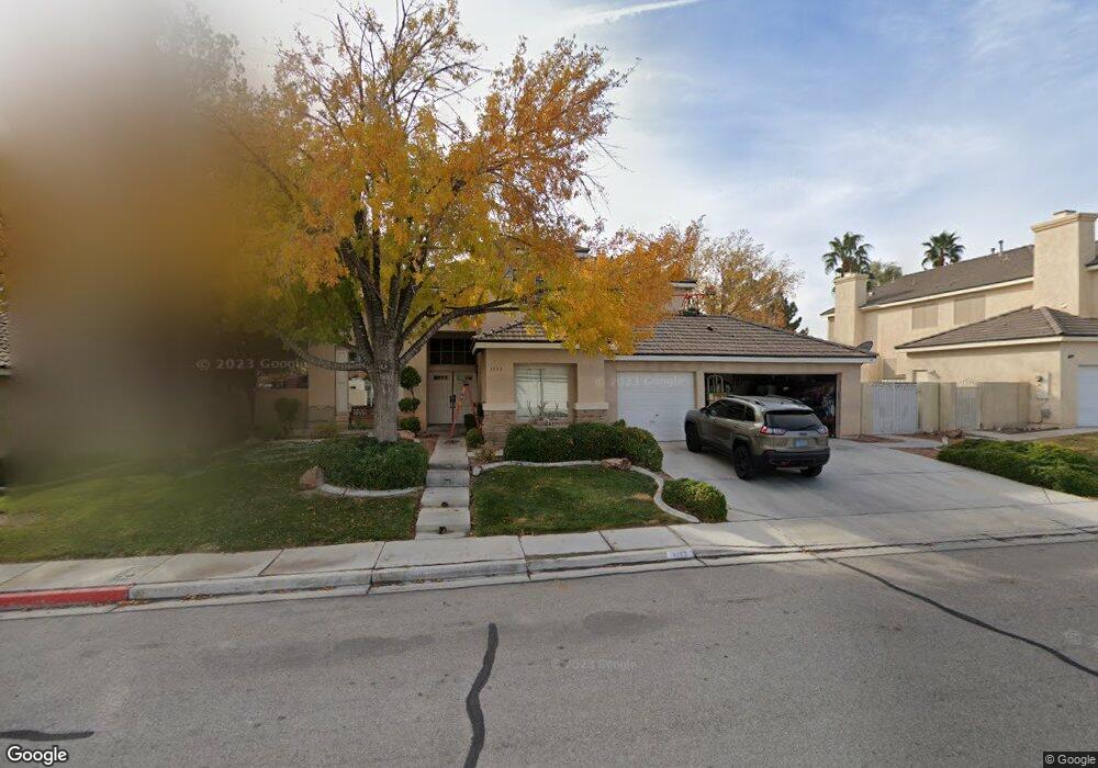
1133 Moorpoint Dr North Las Vegas, NV 89031
Craig Ranch NeighborhoodEstimated Value: $540,222 - $616,000
4
Beds
3
Baths
2,659
Sq Ft
$218/Sq Ft
Est. Value
About This Home
This home is located at 1133 Moorpoint Dr, North Las Vegas, NV 89031 and is currently estimated at $580,056, approximately $218 per square foot. 1133 Moorpoint Dr is a home located in Clark County with nearby schools including Lee Antonello Elementary School, Brian & Teri Cram Middle School, and Legacy High School.
Ownership History
Date
Name
Owned For
Owner Type
Purchase Details
Closed on
Oct 1, 2015
Sold by
Anderson Matthew Brian
Bought by
Anderson Angelique Irene
Current Estimated Value
Purchase Details
Closed on
Jan 9, 2015
Sold by
Anderson Candi A
Bought by
Anderson Matthew Brian
Purchase Details
Closed on
Jun 17, 1994
Sold by
Pardee Construction Company Of Nevada
Bought by
Anderson Matthew Brian and Anderson Candi Ann
Home Financials for this Owner
Home Financials are based on the most recent Mortgage that was taken out on this home.
Original Mortgage
$149,900
Interest Rate
8.51%
Create a Home Valuation Report for This Property
The Home Valuation Report is an in-depth analysis detailing your home's value as well as a comparison with similar homes in the area
Home Values in the Area
Average Home Value in this Area
Purchase History
| Date | Buyer | Sale Price | Title Company |
|---|---|---|---|
| Anderson Angelique Irene | -- | None Available | |
| Anderson Matthew Brian | -- | None Available | |
| Anderson Matthew Brian | $167,000 | National Title Company |
Source: Public Records
Mortgage History
| Date | Status | Borrower | Loan Amount |
|---|---|---|---|
| Previous Owner | Anderson Matthew Brian | $149,900 |
Source: Public Records
Tax History Compared to Growth
Tax History
| Year | Tax Paid | Tax Assessment Tax Assessment Total Assessment is a certain percentage of the fair market value that is determined by local assessors to be the total taxable value of land and additions on the property. | Land | Improvement |
|---|---|---|---|---|
| 2025 | $2,220 | $125,008 | $43,050 | $81,958 |
| 2024 | $2,155 | $125,008 | $43,050 | $81,958 |
| 2023 | $2,155 | $118,952 | $40,600 | $78,352 |
| 2022 | $2,093 | $106,142 | $34,300 | $71,842 |
| 2021 | $2,032 | $100,794 | $32,200 | $68,594 |
| 2020 | $1,970 | $99,415 | $31,150 | $68,265 |
| 2019 | $1,912 | $95,049 | $27,650 | $67,399 |
| 2018 | $1,878 | $86,157 | $21,350 | $64,807 |
| 2017 | $2,657 | $79,218 | $19,250 | $59,968 |
| 2016 | $1,759 | $69,893 | $16,450 | $53,443 |
| 2015 | $1,755 | $55,317 | $12,250 | $43,067 |
| 2014 | $1,703 | $50,304 | $10,500 | $39,804 |
Source: Public Records
Map
Nearby Homes
- 1003 Dover Glen Dr
- 6136 Benchmark Way
- 1323 Borderwood Ln
- 5912 Hollowridge Rd
- 825 Cornerstone Place
- 6219 Disruptor St Unit 3
- 901 Sage Hollow Cir
- 1515 Fort Dix Cir
- 6236 Badgerglen Place
- 721 W Azure Ave
- 1009 Nawkee Dr
- 717 W Azure Ave Unit 3
- 5808 Lone Song Rd
- 5871 Prairie Ridge Cir
- 920 Grey Hollow Ave
- 6126 Leaning Rock Ct
- 635 Dry Valley Ave
- 1611 Spotted Pony Dr
- 629 Blossom Berry Ct
- 6241 Golden Rain St
- 1125 Moorpoint Dr
- 1205 Moorpoint Dr
- 1140 Crescent Moon Dr
- 1202 Crescent Moon Dr
- 1132 Crescent Moon Dr
- 1134 Moorpoint Dr
- 1117 Moorpoint Dr
- 1213 Moorpoint Dr
- 1204 Moorpoint Dr
- 1126 Moorpoint Dr
- 1210 Crescent Moon Dr
- 1124 Crescent Moon Dr
- 1212 Moorpoint Dr
- 1118 Moorpoint Dr
- 1109 Moorpoint Dr
- 1221 Moorpoint Dr
- 1218 Crescent Moon Dr
- 1133 Dover Glen Dr
- 1203 Dover Glen Dr
- 1139 Crescent Moon Dr