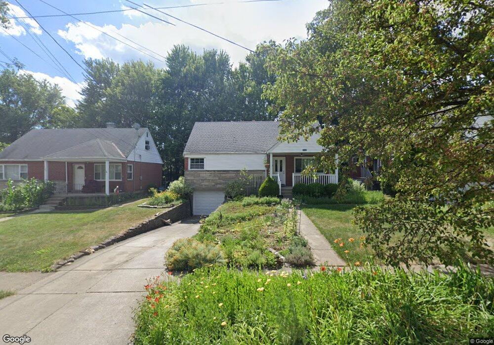
1133 Morado Dr Cincinnati, OH 45238
West Price Hill NeighborhoodEstimated Value: $172,473 - $210,000
4
Beds
1
Bath
1,173
Sq Ft
$161/Sq Ft
Est. Value
About This Home
This home is located at 1133 Morado Dr, Cincinnati, OH 45238 and is currently estimated at $188,618, approximately $160 per square foot. 1133 Morado Dr is a home located in Hamilton County with nearby schools including Covedale School, Gilbert A. Dater High School, and Western Hills High School.
Ownership History
Date
Name
Owned For
Owner Type
Purchase Details
Closed on
Sep 30, 1994
Sold by
Harnist Leonard J and Harnist Alvera M
Bought by
Lesch Karen M
Current Estimated Value
Home Financials for this Owner
Home Financials are based on the most recent Mortgage that was taken out on this home.
Original Mortgage
$52,200
Interest Rate
8.64%
Create a Home Valuation Report for This Property
The Home Valuation Report is an in-depth analysis detailing your home's value as well as a comparison with similar homes in the area
Home Values in the Area
Average Home Value in this Area
Purchase History
We collect this data history from publicly available records. To have your information removed, we recommend requesting removal directly through your county’s website.
| Date | Buyer | Sale Price | Title Company |
|---|---|---|---|
| Lesch Karen M | -- | -- |
Source: Public Records
Mortgage History
We collect this data history from publicly available records. To have your information removed, we recommend requesting removal directly through your county’s website.
| Date | Status | Borrower | Loan Amount |
|---|---|---|---|
| Previous Owner | Lesch Karen M | $52,200 |
Source: Public Records
Tax History
| Year | Tax Paid | Tax Assessment Tax Assessment Total Assessment is a certain percentage of the fair market value that is determined by local assessors to be the total taxable value of land and additions on the property. | Land | Improvement |
|---|---|---|---|---|
| 2025 | $2,434 | $39,340 | $5,257 | $34,083 |
| 2024 | $2,360 | $39,340 | $5,257 | $34,083 |
| 2023 | $2,413 | $39,340 | $5,257 | $34,083 |
| 2022 | $1,782 | $25,992 | $5,226 | $20,766 |
| 2021 | $1,712 | $25,992 | $5,226 | $20,766 |
| 2020 | $1,762 | $25,992 | $5,226 | $20,766 |
| 2019 | $1,750 | $23,629 | $4,750 | $18,879 |
| 2018 | $1,753 | $23,629 | $4,750 | $18,879 |
| 2017 | $1,665 | $23,629 | $4,750 | $18,879 |
| 2016 | $1,931 | $27,049 | $5,072 | $21,977 |
| 2015 | $1,742 | $27,049 | $5,072 | $21,977 |
| 2014 | $1,754 | $27,049 | $5,072 | $21,977 |
| 2013 | $2,026 | $30,738 | $5,765 | $24,973 |
Source: Public Records
Map
Nearby Homes
- 1175 Nancy Lee Ln
- 5032 Willnet Dr
- 5165 Highview Dr
- 5140 Willnet Dr
- 1083 Benz Ave
- 990 Covedale Ave
- 5114 Cleves Warsaw Pike
- 5018 Rapid Run Rd
- 1151 Rulison Ave
- 5005 Western Hills Ave
- 4925 Ralph Ave
- 1320 Beechmeadow Ln
- 1051 Alcliff Ln
- 4952 Western Hills Ave
- 4764 Dale Ave
- 5070 Western Hills Ave
- 4816 Glenway Ave
- 5176 Dundas Dr
- 5153 Dresden Ct
- 4808 Guerley Rd
- 1137 Morado Dr
- 1129 Morado Dr
- 1141 Morado Dr
- 1125 Morado Dr
- 1100 Covedale Ave
- 1106 Covedale Ave
- 1106 Covedale Ave Unit 2
- 1096 Covedale Ave
- 1145 Morado Dr
- 1121 Morado Dr
- 1134 Morado Dr
- 1138 Morado Dr
- 1130 Morado Dr
- 1112 Covedale Ave
- 1142 Morado Dr
- 1149 Morado Dr
- 1092 Covedale Ave
- 1126 Morado Dr
- 1117 Morado Dr
- 1146 Morado Dr
Your Personal Tour Guide
Ask me questions while you tour the home.