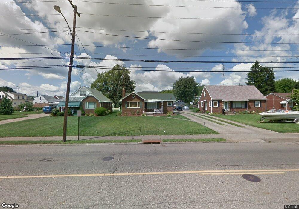
1133 Raff Rd SW Canton, OH 44710
Estimated Value: $126,014 - $157,000
2
Beds
1
Bath
1,092
Sq Ft
$126/Sq Ft
Est. Value
About This Home
This home is located at 1133 Raff Rd SW, Canton, OH 44710 and is currently estimated at $137,754, approximately $126 per square foot. 1133 Raff Rd SW is a home located in Stark County with nearby schools including Harter Elementary School, Early Learning Center @ Schreiber, and Clarendon Intermediate School.
Ownership History
Date
Name
Owned For
Owner Type
Purchase Details
Closed on
Jun 17, 2002
Sold by
First Union Home Equity Bank Na
Bought by
Uhrin Ii Stephen M
Current Estimated Value
Home Financials for this Owner
Home Financials are based on the most recent Mortgage that was taken out on this home.
Original Mortgage
$66,000
Outstanding Balance
$28,143
Interest Rate
6.93%
Estimated Equity
$109,611
Purchase Details
Closed on
Mar 25, 2002
Sold by
Ann Dillard Betsy
Bought by
First Union Home Equity Bank Na
Purchase Details
Closed on
Feb 26, 2002
Sold by
Dillard Betsy Ann
Bought by
First Union Home Equity Bank Na
Purchase Details
Closed on
Feb 22, 1994
Purchase Details
Closed on
Jan 25, 1994
Purchase Details
Closed on
Dec 10, 1993
Create a Home Valuation Report for This Property
The Home Valuation Report is an in-depth analysis detailing your home's value as well as a comparison with similar homes in the area
Home Values in the Area
Average Home Value in this Area
Purchase History
| Date | Buyer | Sale Price | Title Company |
|---|---|---|---|
| Uhrin Ii Stephen M | $66,000 | -- | |
| First Union Home Equity Bank Na | $55,000 | -- | |
| First Union Home Equity Bank Na | $55,000 | -- | |
| -- | $59,900 | -- | |
| -- | $49,000 | -- | |
| -- | -- | -- |
Source: Public Records
Mortgage History
| Date | Status | Borrower | Loan Amount |
|---|---|---|---|
| Open | Uhrin Ii Stephen M | $66,000 |
Source: Public Records
Tax History
| Year | Tax Paid | Tax Assessment Tax Assessment Total Assessment is a certain percentage of the fair market value that is determined by local assessors to be the total taxable value of land and additions on the property. | Land | Improvement |
|---|---|---|---|---|
| 2025 | -- | $33,710 | $11,450 | $22,260 |
| 2024 | -- | $33,710 | $11,450 | $22,260 |
| 2023 | $1,767 | $28,980 | $9,660 | $19,320 |
| 2022 | $1,720 | $28,980 | $9,660 | $19,320 |
| 2021 | $1,738 | $28,980 | $9,660 | $19,320 |
| 2020 | $1,599 | $23,880 | $7,950 | $15,930 |
| 2019 | $1,401 | $23,880 | $7,950 | $15,930 |
Source: Public Records
Map
Nearby Homes
- 1207 Linwood Ave SW
- 1154 Roslyn Ave SW
- 1208 Roslyn Ave SW
- 3211 11th St SW
- 900 Roslyn Ave SW
- 1212 Maryland Ave SW
- 1225 Concord Ave SW
- 3204 14th St SW
- 1425 Crescent Rd SW
- 929 Wertz Ave SW
- 123 Linwood Ave NW
- 616 Maryland Ave SW
- 3029 7th St SW
- 212 Maryland Ave SW
- 4522 7th St SW
- 131 Roslyn Ave NW
- 218 Raff Rd NW
- 2711 Blair Place SW
- 2911 7th St SW
- 1248 Dartmouth Ave SW
- 1127 Raff Rd SW
- 1139 Raff Rd SW
- 1123 Raff Rd SW
- 1149 Raff Rd SW
- 3717 12th St SW
- 3723 12th St SW
- 1117 Raff Rd SW
- 1136 Benskin Ave SW
- 1140 Benskin Ave SW
- 1153 Raff Rd SW
- 1132 Benskin Ave SW
- 3727 12th St SW
- 1111 Raff Rd SW
- 3733 12th St SW
- 1132 Raff Rd SW
- 1140 Raff Rd SW
- 1126 Raff Rd SW
- 1122 Benskin Ave SW
- 1105 Raff Rd SW
- 3737 12th St SW
Your Personal Tour Guide
Ask me questions while you tour the home.