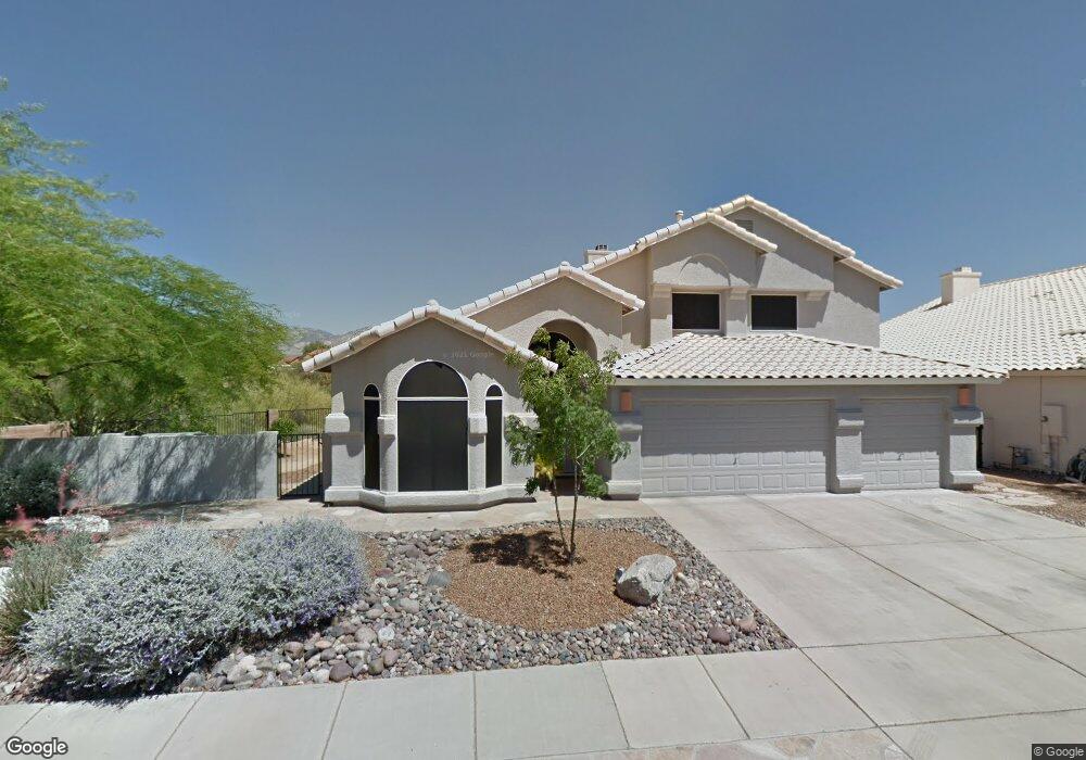
11336 N Silver Pheasant Loop Tucson, AZ 85737
Estimated Value: $509,007 - $656,000
Studio
3
Baths
2,996
Sq Ft
$200/Sq Ft
Est. Value
About This Home
This home is located at 11336 N Silver Pheasant Loop, Tucson, AZ 85737 and is currently estimated at $597,752, approximately $199 per square foot. 11336 N Silver Pheasant Loop is a home located in Pima County with nearby schools including Copper Creek Elementary School, Ironwood Ridge High School, and Leman Academy Of Excellence-Oro Valley Arizona.
Ownership History
Date
Name
Owned For
Owner Type
Purchase Details
Closed on
Mar 3, 2025
Sold by
Adams John T and Adams Candis M
Bought by
Adams Family Trust and Adams
Current Estimated Value
Create a Home Valuation Report for This Property
The Home Valuation Report is an in-depth analysis detailing your home's value as well as a comparison with similar homes in the area
Home Values in the Area
Average Home Value in this Area
Purchase History
| Date | Buyer | Sale Price | Title Company |
|---|---|---|---|
| Adams Family Trust | -- | None Listed On Document |
Source: Public Records
Tax History
| Year | Tax Paid | Tax Assessment Tax Assessment Total Assessment is a certain percentage of the fair market value that is determined by local assessors to be the total taxable value of land and additions on the property. | Land | Improvement |
|---|---|---|---|---|
| 2026 | $4,562 | $38,598 | -- | -- |
| 2025 | $4,562 | $36,760 | -- | -- |
| 2024 | $4,369 | $35,009 | -- | -- |
| 2023 | $4,203 | $33,342 | $0 | $0 |
| 2022 | $4,001 | $31,755 | $0 | $0 |
| 2021 | $3,958 | $28,848 | $0 | $0 |
| 2020 | $3,894 | $28,848 | $0 | $0 |
| 2019 | $3,771 | $30,653 | $0 | $0 |
| 2018 | $3,609 | $25,488 | $0 | $0 |
| 2017 | $3,621 | $25,488 | $0 | $0 |
| 2016 | $3,585 | $26,126 | $0 | $0 |
| 2015 | $3,486 | $24,882 | $0 | $0 |
Source: Public Records
Map
Nearby Homes
- 11366 N Silver Pheasant Loop
- 11292 N Quail Springs Place
- 11268 N Running River Place
- 11426 N Silver Pheasant Loop
- 1054 W Squawbush Ct
- 11361 N Canada Creek Dr
- 11341 N Canada Creek Dr
- 1133 W Masters Cir
- 11321 N Palmetto Dunes Ave
- 11440 N Palmetto Dunes Ave
- 11571 N Copper Spring Trail
- 1478 W Sand Pebble Dr
- 1556 W Periwinkle Place
- 11122 N Desert Flower Dr
- 1427 W Cathedral Way
- 11781 N Dragoon Springs Dr
- 1497 W Carmel Pointe Dr
- 1472 W Cathedral Way
- 10845 N Summer Moon Place
- 11846 N Copper Butte Dr
- 11330 N Silver Pheasant Loop
- 11324 N Silver Pheasant Loop
- 11341 N Silver Pheasant Loop
- 11335 N Silver Pheasant Loop
- 11355 N Silver Pheasant Loop
- 11329 N Silver Pheasant Loop
- 11354 N Silver Pheasant Loop
- 11318 N Silver Pheasant Loop
- 11360 N Silver Pheasant Loop
- 11319 N Silver Pheasant Loop
- 11367 N Silver Pheasant Loop
- 11311 N Quail Springs Place
- 1233 W Sunset Point Place
- 1239 W Sunset Point Place
- 1227 W Sunset Point Place
- 11312 N Silver Pheasant Loop
- 11311 N Silver Pheasant Loop
- 1245 W Sunset Point Place
- 11373 N Silver Pheasant Loop
- 11372 N Silver Pheasant Loop
Your Personal Tour Guide
Ask me questions while you tour the home.