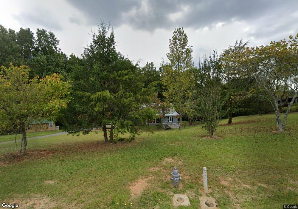
1134 Bill Ramsey Rd Clarkesville, GA 30523
Estimated Value: $303,990 - $384,000
3
Beds
2
Baths
2,022
Sq Ft
$167/Sq Ft
Est. Value
About This Home
This home is located at 1134 Bill Ramsey Rd, Clarkesville, GA 30523 and is currently estimated at $336,748, approximately $166 per square foot. 1134 Bill Ramsey Rd is a home located in Habersham County with nearby schools including Clarkesville Elementary School, North Habersham Middle School, and Habersham Success Academy.
Ownership History
Date
Name
Owned For
Owner Type
Purchase Details
Closed on
Mar 29, 2022
Sold by
Abernathy Allen Miles Estate
Bought by
Abernathy Bonnie Gertrude
Current Estimated Value
Purchase Details
Closed on
Apr 14, 2021
Sold by
Cash Jason Kenneth Edward
Bought by
Cash Jason Kenneth Edward and Cash Kenneth A
Purchase Details
Closed on
Feb 8, 2021
Sold by
Cash Lillian Joan Houser
Bought by
Cash Jason Kenneth Edward
Purchase Details
Closed on
Jun 8, 2016
Sold by
Cash George Edward
Bought by
Cash Lilliam J
Create a Home Valuation Report for This Property
The Home Valuation Report is an in-depth analysis detailing your home's value as well as a comparison with similar homes in the area
Home Values in the Area
Average Home Value in this Area
Purchase History
| Date | Buyer | Sale Price | Title Company |
|---|---|---|---|
| Abernathy Bonnie Gertrude | -- | -- | |
| Cash Jason Kenneth Edward | -- | -- | |
| Cash Jason Kenneth Edward | -- | -- | |
| Cash Lilliam J | -- | -- |
Source: Public Records
Tax History Compared to Growth
Tax History
| Year | Tax Paid | Tax Assessment Tax Assessment Total Assessment is a certain percentage of the fair market value that is determined by local assessors to be the total taxable value of land and additions on the property. | Land | Improvement |
|---|---|---|---|---|
| 2025 | $2,177 | $100,993 | $23,240 | $77,753 |
| 2024 | -- | $83,932 | $12,528 | $71,404 |
| 2023 | $1,860 | $71,648 | $12,528 | $59,120 |
| 2022 | $1,614 | $61,912 | $11,136 | $50,776 |
| 2021 | $1,448 | $55,796 | $10,440 | $45,356 |
| 2020 | $1,330 | $49,448 | $10,440 | $39,008 |
| 2019 | $1,331 | $49,448 | $10,440 | $39,008 |
| 2018 | $1,321 | $49,448 | $10,440 | $39,008 |
| 2017 | $1,239 | $46,124 | $10,440 | $35,684 |
| 2016 | $1,203 | $115,310 | $10,440 | $35,684 |
| 2015 | $1,189 | $115,310 | $10,440 | $35,684 |
| 2014 | $1,190 | $113,280 | $10,440 | $34,872 |
| 2013 | -- | $45,312 | $10,440 | $34,872 |
Source: Public Records
Map
Nearby Homes
- 555 Highway 197 N
- 104 Brando Trail
- 3039 Georgia 17
- 219 Signing Tree Ln
- 124 Signing Tree Ln
- 0 Sutton Mill Rd Unit 10644026
- 1096 Sutton Mill Rd
- 1955 Alec Mountain Rd
- 206 Sycamore Way
- 166 Poplar Springs Dr
- 2041 Highway 197 N
- 551 W Water St
- 4855 Georgia 115
- 1867 Georgia 197
- 132 James Rd
- 111 On Golden Pond Ln
- 449 E Water St
- 447 E Water St
- 451 E Water St
- 4822 Georgia 115
- 1260 Bill Ramsey Rd
- 1228 Bill Ramsey Rd
- 1094 Bill Ramsey Rd
- 1076 Bill Ramsey Rd
- 1268 Bill Ramsey Rd
- 1070 Bill Ramsey Rd
- 161 Serenity Lake Ln
- 223 Serenity Lake Ln
- 0 Serenity Lake Ln
- 1373 Bill Ramsey Rd
- 1381 Bill Ramsey Rd
- 1766 Zeb Bryson Rd
- 395 Serenity Lake Ln
- 789 Trotter Rd Unit Tract 2
- 1908 Zeb Bryson Rd
- 300 Serenity Lake Ln
- 1700 Zeb Bryson Rd
- 629 Trotter Rd
- 866 Alec Mountain Rd
- 1379 Zeb Bryson Rd