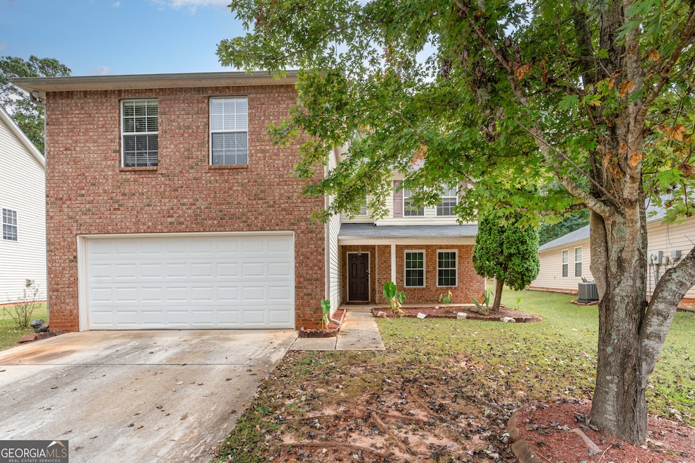
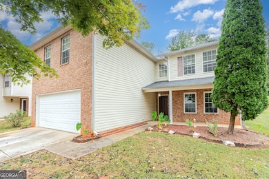
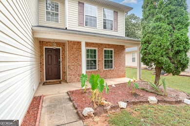
1134 Saint Phillips Ct Locust Grove, GA 30248
Estimated payment $1,927/month
Highlights
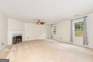
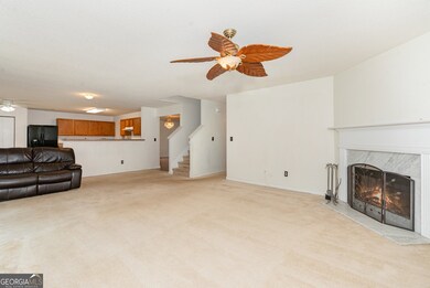
- Traditional Architecture
- Breakfast Area or Nook
- Soaking Tub
- 1 Fireplace
- Country Kitchen
- 1-minute walk to Tanger Station Park
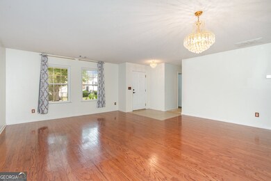
About This Home
( BACK ON THE MARKET NO FAULT TO THE SELLER OR PROPERTY!) Welcome to 1134 Saint Phillips Court - a spacious, well-maintained gem in the heart of sought-after Henry County! This impressive residence offers 6 bedrooms, 4 full bathrooms, and over 3,600 square feet of living space, making it one of the best values per square foot in the area. Lovingly maintained by the original owner, the home is located in the established and desirable community of Hawthorne Lind Park. Enjoy the peace of a mature neighborhood while benefiting from the exciting growth just outside the community-including a brand-new Publix currently under construction and several other new developments that add convenience and value to the area. Don't miss this rare opportunity to own a large, move-in ready home in a prime location with exceptional long-term potential!
Home Details
Home Type
- Single Family
Est. Annual Taxes
- $4,890
Year Built
- Built in 2003
Lot Details
- 0.31 Acre Lot
- Back Yard Fenced
- Level Lot
HOA Fees
- $17 Monthly HOA Fees
Parking
- 2 Car Garage
Home Design
- Traditional Architecture
- Composition Roof
- Aluminum Siding
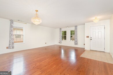
Interior Spaces
- 3,600 Sq Ft Home
- 2-Story Property
- 1 Fireplace
- Family Room
- Pull Down Stairs to Attic
Kitchen
- Country Kitchen
- Breakfast Area or Nook
- Oven or Range
- Dishwasher
Flooring
- Carpet
- Vinyl
Bedrooms and Bathrooms
- Soaking Tub
Schools
- Locust Grove Elementary And Middle School
- Locust Grove High School
Utilities
- Central Heating and Cooling System
- High Speed Internet
- Cable TV Available
Community Details
- Association fees include ground maintenance
- Hawthorne Lind Park Subdivision
Map
Home Values in the Area
Average Home Value in this Area
Tax History
| Year | Tax Paid | Tax Assessment Tax Assessment Total Assessment is a certain percentage of the fair market value that is determined by local assessors to be the total taxable value of land and additions on the property. | Land | Improvement |
|---|---|---|---|---|
| 2025 | $5,542 | $142,520 | $16,000 | $126,520 |
| 2024 | $5,542 | $139,680 | $16,000 | $123,680 |
| 2023 | $4,552 | $125,720 | $16,000 | $109,720 |
| 2022 | $4,397 | $120,600 | $16,000 | $104,600 |
| 2021 | $3,161 | $86,240 | $16,000 | $70,240 |
| 2020 | $3,116 | $85,000 | $12,000 | $73,000 |
| 2019 | $2,853 | $76,480 | $10,000 | $66,480 |
| 2018 | $2,616 | $70,520 | $9,200 | $61,320 |
| 2016 | $2,373 | $64,040 | $8,000 | $56,040 |
| 2015 | $2,204 | $57,360 | $7,200 | $50,160 |
| 2014 | $2,055 | $53,320 | $5,600 | $47,720 |
Property History
| Date | Event | Price | List to Sale | Price per Sq Ft |
|---|---|---|---|---|
| 10/20/2025 10/20/25 | Pending | -- | -- | -- |
| 10/17/2025 10/17/25 | For Sale | $285,000 | 0.0% | $79 / Sq Ft |
| 10/12/2025 10/12/25 | Pending | -- | -- | -- |
| 10/02/2025 10/02/25 | For Sale | $285,000 | -- | $79 / Sq Ft |
Purchase History
| Date | Type | Sale Price | Title Company |
|---|---|---|---|
| Deed | $156,600 | -- |
Mortgage History
| Date | Status | Loan Amount | Loan Type |
|---|---|---|---|
| Open | $159,640 | No Value Available |
Source: Georgia MLS
MLS Number: 10614654
APN: 130C-01-089-000
Disclaimer: Certain information contained herein is derived from information provided by parties other than Homes.com. All information provided is deemed reliable, but is not guaranteed to be accurate and should be independently verified.
![]() The data relating to real estate for sale on this web site comes in part from the Broker Reciprocity Program of Georgia MLS. Real estate listings held by brokerage firms other than Redfin are marked with the Broker Reciprocity logo and detailed information about them includes the name of the listing brokers. Information deemed reliable but not guaranteed. Copyright 2025 Georgia MLS. All rights reserved.
The data relating to real estate for sale on this web site comes in part from the Broker Reciprocity Program of Georgia MLS. Real estate listings held by brokerage firms other than Redfin are marked with the Broker Reciprocity logo and detailed information about them includes the name of the listing brokers. Information deemed reliable but not guaranteed. Copyright 2025 Georgia MLS. All rights reserved.
- 1119 Saint Phillips Ct
- 1020 Saint Augustine Pkwy
- 1524 Queen Elizabeth Dr
- 1604 Lady Maria Ct
- 150 Aster Ave
- Cali Plan at Cedar Ridge - Locust Grove Station
- Belfort Plan at Cedar Ridge - Locust Grove Station
- Galen Plan at Cedar Ridge - Locust Grove Station
- Hayden Plan at Cedar Ridge - Locust Grove Station
- Packard Plan at Cedar Ridge - Locust Grove Station
- Flora Plan at Cedar Ridge - Locust Grove Station
- Penwell Plan at Cedar Ridge - Locust Grove Station
- 239 Ferguson Ave
- 269 Baumgard Way
- 188 Sophie Cir
- 134 Aster Ave
- 138 Aster Ave
- 231 Ferguson Ave
- 620 Lobelia Way
- 613 Lobelia Way
