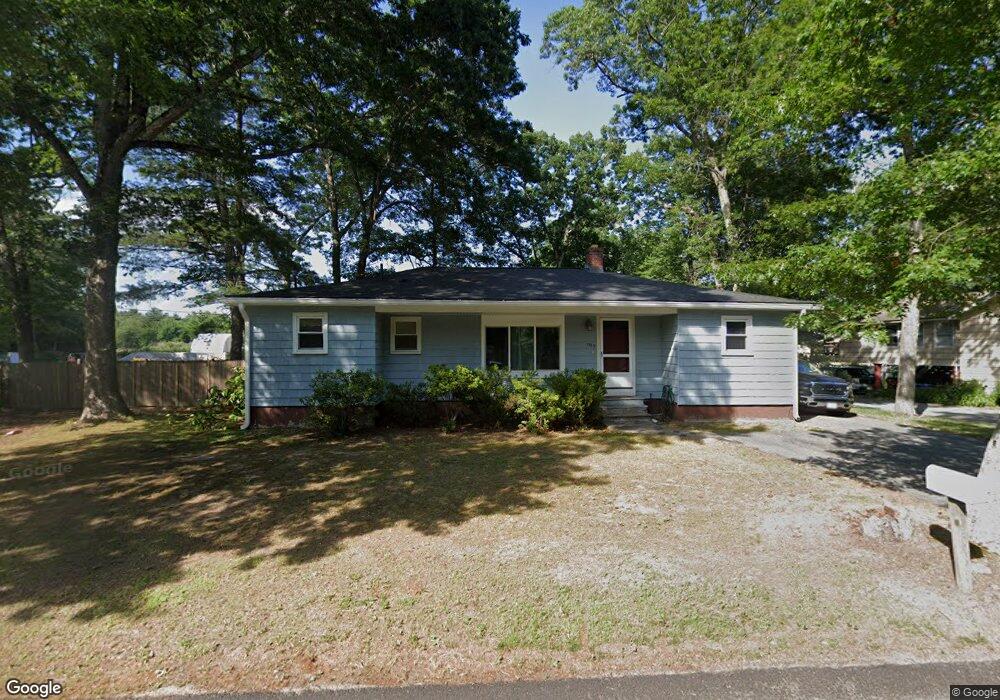
1135 Auburn St Whitman, MA 02382
Estimated Value: $416,000 - $498,000
3
Beds
2
Baths
1,268
Sq Ft
$373/Sq Ft
Est. Value
About This Home
This home is located at 1135 Auburn St, Whitman, MA 02382 and is currently estimated at $472,950, approximately $372 per square foot. 1135 Auburn St is a home located in Plymouth County with nearby schools including Trinity Catholic Academy and Brockton Area Seventh-Day Adventist Academy.
Ownership History
Date
Name
Owned For
Owner Type
Purchase Details
Closed on
Dec 31, 2003
Sold by
Barbone Bruce and Barbone Hazel
Bought by
Kelsch Brandon M and Kelsch Dawn
Current Estimated Value
Purchase Details
Closed on
Jan 7, 1998
Sold by
Fnma
Bought by
Barbone Bruce and Barbone Hazel
Purchase Details
Closed on
Mar 12, 1997
Sold by
Lombardi David M
Bought by
Federal National Mortgage Association
Purchase Details
Closed on
Dec 23, 1991
Sold by
Charlebois Edward A and Charlebois Kathleen
Bought by
Lombardi David M and Lombardi Darcia M
Create a Home Valuation Report for This Property
The Home Valuation Report is an in-depth analysis detailing your home's value as well as a comparison with similar homes in the area
Home Values in the Area
Average Home Value in this Area
Purchase History
| Date | Buyer | Sale Price | Title Company |
|---|---|---|---|
| Kelsch Brandon M | $270,000 | -- | |
| Barbone Bruce | $109,000 | -- | |
| Federal National Mortgage Association | $100,000 | -- | |
| Lombardi David M | $118,000 | -- |
Source: Public Records
Mortgage History
| Date | Status | Borrower | Loan Amount |
|---|---|---|---|
| Open | Lombardi David M | $50,000 | |
| Closed | Lombardi David M | $30,000 |
Source: Public Records
Tax History Compared to Growth
Tax History
| Year | Tax Paid | Tax Assessment Tax Assessment Total Assessment is a certain percentage of the fair market value that is determined by local assessors to be the total taxable value of land and additions on the property. | Land | Improvement |
|---|---|---|---|---|
| 2025 | $5,512 | $420,100 | $199,200 | $220,900 |
| 2024 | $5,211 | $409,000 | $195,100 | $213,900 |
| 2023 | $5,017 | $369,700 | $169,400 | $200,300 |
| 2022 | $4,897 | $336,300 | $155,100 | $181,200 |
| 2021 | $4,653 | $300,200 | $136,600 | $163,600 |
| 2020 | $4,595 | $289,900 | $136,600 | $153,300 |
| 2019 | $4,279 | $278,200 | $136,600 | $141,600 |
| 2018 | $4,105 | $256,400 | $129,400 | $127,000 |
| 2017 | $3,867 | $256,400 | $129,400 | $127,000 |
| 2016 | $3,467 | $222,400 | $113,000 | $109,400 |
| 2015 | $3,472 | $222,400 | $113,000 | $109,400 |
Source: Public Records
Map
Nearby Homes
- 1121 Auburn St
- 877 Auburnville Way Unit D4
- 26 Alger St
- 99 Alger St
- 32 Joyce Terrace
- 11 Glenwood St
- 307 Homeland Dr
- 262 Homeland Dr
- 93 Porter St
- 104 Crestfield Dr
- 728 Auburn St Unit F6
- 618 Auburn St
- 485 Temple St
- 4 Locust Hill Ln
- 967 Centre St
- 16 Davis St
- 300 High St
- 24 Churchill Ave
- 78 Linda St
- 91 Clapp St
- 1129 Auburn St
- 1179 Auburn St
- 1132 Auburn St
- 1152 Auburn St
- 1140 Auburn St
- 1199 Auburn St
- 1120 Auburn St
- 1100 Auburn St
- 1055 Auburn St
- 1055 Auburn St Unit 1
- 1090 Auburn St
- 7 Captain Allen Way
- 1225 Auburn St
- 15 Captain Allen Way
- 1045 Auburn St Unit 1
- 1235 Auburn St
- 31 Captain Allen Way
- Lot 13 Captain Allen Way
- 10 Captain Allen Way
- 61 Captain Allen Way