1135 Brogdon Dr Unit 2 Powder Springs, GA 30127
West Cobb NeighborhoodEstimated Value: $448,911 - $512,000
4
Beds
3
Baths
2,236
Sq Ft
$214/Sq Ft
Est. Value
About This Home
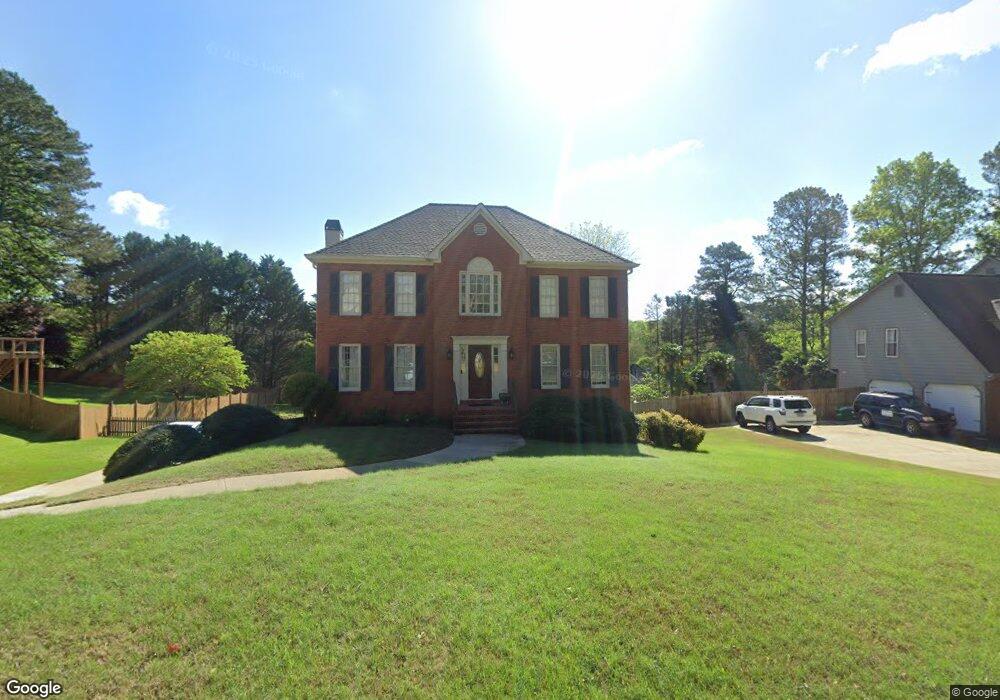
This home is located at 1135 Brogdon Dr Unit 2, Powder Springs, GA 30127 and is currently estimated at $477,478, approximately $213 per square foot. 1135 Brogdon Dr Unit 2 is a home located in Cobb County with nearby schools including Kemp Elementary School, Lovinggood Middle School, and Hillgrove High School.
Ownership History
Date
Name
Owned For
Owner Type
Purchase Details
Closed on
Aug 28, 2000
Sold by
Gramling Leon A and Gramling Dianne L
Bought by
Matazinsky Scott D and Matazinsky Rita B
Current Estimated Value
Home Financials for this Owner
Home Financials are based on the most recent Mortgage that was taken out on this home.
Original Mortgage
$132,400
Outstanding Balance
$47,634
Interest Rate
8.11%
Mortgage Type
New Conventional
Estimated Equity
$429,844
Purchase Details
Closed on
Dec 14, 1993
Sold by
Marvin Waldrop Realty
Bought by
Gramling Leon A
Home Financials for this Owner
Home Financials are based on the most recent Mortgage that was taken out on this home.
Original Mortgage
$114,750
Interest Rate
7.05%
Create a Home Valuation Report for This Property
The Home Valuation Report is an in-depth analysis detailing your home's value as well as a comparison with similar homes in the area
Home Values in the Area
Average Home Value in this Area
Purchase History
| Date | Buyer | Sale Price | Title Company |
|---|---|---|---|
| Matazinsky Scott D | $165,500 | -- | |
| Gramling Leon A | $127,500 | -- |
Source: Public Records
Mortgage History
| Date | Status | Borrower | Loan Amount |
|---|---|---|---|
| Open | Matazinsky Scott D | $132,400 | |
| Previous Owner | Gramling Leon A | $114,750 |
Source: Public Records
Tax History Compared to Growth
Tax History
| Year | Tax Paid | Tax Assessment Tax Assessment Total Assessment is a certain percentage of the fair market value that is determined by local assessors to be the total taxable value of land and additions on the property. | Land | Improvement |
|---|---|---|---|---|
| 2025 | $3,896 | $163,040 | $36,000 | $127,040 |
| 2024 | $3,859 | $161,152 | $16,000 | $145,152 |
| 2023 | $3,316 | $161,152 | $16,000 | $145,152 |
| 2022 | $3,401 | $138,868 | $12,800 | $126,068 |
| 2021 | $2,681 | $105,976 | $12,800 | $93,176 |
| 2020 | $2,681 | $105,976 | $12,800 | $93,176 |
| 2019 | $2,292 | $88,196 | $12,800 | $75,396 |
| 2018 | $2,292 | $88,196 | $12,800 | $75,396 |
| 2017 | $2,042 | $81,456 | $12,800 | $68,656 |
| 2016 | $1,755 | $69,924 | $14,400 | $55,524 |
| 2015 | $1,800 | $69,924 | $14,400 | $55,524 |
| 2014 | $1,374 | $55,072 | $0 | $0 |
Source: Public Records
Map
Nearby Homes
- 1079 Angel Ln
- 1072 Sweet Mia Ln
- 1073 Sweet Mia Ln
- 1077 Sweet Mia Ln
- 4408 Shiloh Trail
- 1150 Sweet Mia Ln
- 777 Chanson Dr SW
- 4562 Willow Oak Trail Unit 3
- 700 Broadlands Ln Unit 1
- 1175 Bowerie Chase
- 990 Casteel Rd
- 506 Balleycastle Point
- 4927 Red Cliff Ct
- 3840 McEachern Farm Dr
- 633 Wynnewood Ct SW
- 3605 Sunset Ridge
- 0 Lost Mountain Rd Unit 7653787
- 0 Lost Mountain Rd Unit 10610707
- 1133 Brogdon Dr Unit 2
- 1137 Brogdon Dr Unit 2
- 1136 Brogdon Dr
- 1092 Angel Ln Unit 1
- 1096 Angel Ln
- 1094 Angel Ln Unit 1
- 1134 Brogdon Dr
- 4208 Honey Creek Way
- 1139 Brogdon Dr Unit I
- 1132 Brogdon Dr Unit 2
- 1090 Angel Ln
- 1088 Angel Ln
- 1088 Angel Ln Unit 37
- 1128 Brogdon Dr
- 1138 Brogdon Dr
- 4206 Honey Creek Way
- 1130 Brogdon Dr
- 0 Angel Ln Unit 8385393
- 0 Angel Ln Unit 8370337
- 0 Angel Ln Unit 8081422