Estimated Value: $128,000 - $190,000
3
Beds
1
Bath
999
Sq Ft
$168/Sq Ft
Est. Value
About This Home
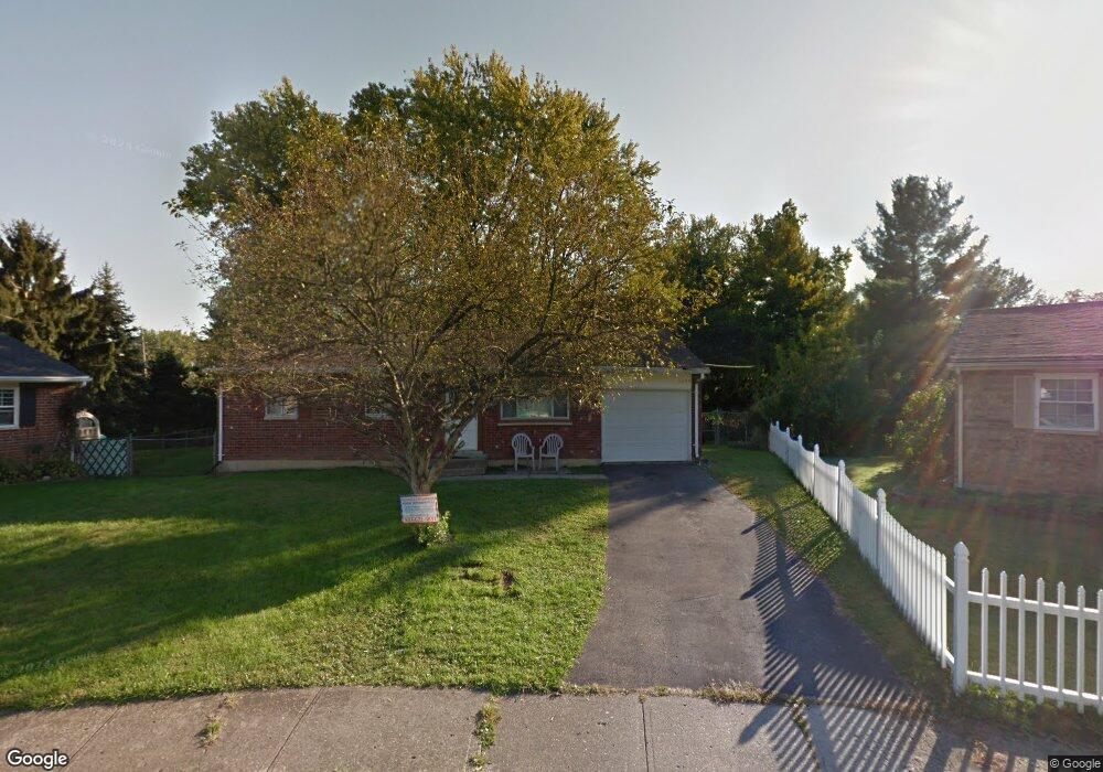
This home is located at 1135 Buckskin Trail, Xenia, OH 45385 and is currently estimated at $167,910, approximately $168 per square foot. 1135 Buckskin Trail is a home located in Greene County with nearby schools including Xenia High School, Summit Academy Community School for Alternative Learners - Xenia, and Legacy Christian Academy.
Ownership History
Date
Name
Owned For
Owner Type
Purchase Details
Closed on
May 18, 2023
Sold by
Barnett Rodney
Bought by
Forsythe Brian Terry
Current Estimated Value
Home Financials for this Owner
Home Financials are based on the most recent Mortgage that was taken out on this home.
Original Mortgage
$130,371
Outstanding Balance
$126,666
Interest Rate
6.27%
Mortgage Type
FHA
Estimated Equity
$41,244
Purchase Details
Closed on
Jul 15, 2015
Sold by
Wayda Dean and Wayda Terri
Bought by
Barnett Rodney
Purchase Details
Closed on
Oct 13, 1992
Bought by
Wayda Dean F and Wayda Wayda
Create a Home Valuation Report for This Property
The Home Valuation Report is an in-depth analysis detailing your home's value as well as a comparison with similar homes in the area
Home Values in the Area
Average Home Value in this Area
Purchase History
| Date | Buyer | Sale Price | Title Company |
|---|---|---|---|
| Forsythe Brian Terry | $135,100 | None Listed On Document | |
| Barnett Rodney | $75,000 | None Listed On Document | |
| Barnett Rodney | $75,000 | None Available | |
| Wayda Dean F | $66,400 | -- |
Source: Public Records
Mortgage History
| Date | Status | Borrower | Loan Amount |
|---|---|---|---|
| Open | Forsythe Brian Terry | $130,371 | |
| Closed | Barnett Rodney | $0 |
Source: Public Records
Tax History Compared to Growth
Tax History
| Year | Tax Paid | Tax Assessment Tax Assessment Total Assessment is a certain percentage of the fair market value that is determined by local assessors to be the total taxable value of land and additions on the property. | Land | Improvement |
|---|---|---|---|---|
| 2024 | $2,076 | $49,790 | $12,780 | $37,010 |
| 2023 | $2,076 | $49,790 | $12,780 | $37,010 |
| 2022 | $1,760 | $35,090 | $7,510 | $27,580 |
| 2021 | $1,739 | $35,090 | $7,510 | $27,580 |
| 2020 | $1,665 | $35,090 | $7,510 | $27,580 |
| 2019 | $1,444 | $28,650 | $7,200 | $21,450 |
| 2018 | $1,449 | $28,650 | $7,200 | $21,450 |
| 2017 | $1,407 | $28,650 | $7,200 | $21,450 |
| 2016 | $1,328 | $25,770 | $7,200 | $18,570 |
| 2015 | $1,332 | $25,770 | $7,200 | $18,570 |
| 2014 | $1,274 | $25,770 | $7,200 | $18,570 |
Source: Public Records
Map
Nearby Homes
- 1272 Bellbrook Ave
- 1208 Bellbrook Ave
- 1778 Arapaho Dr
- 1618 Navajo Dr
- 1144 Rockwell Dr
- 1866 Roxbury Dr
- 1653 Seneca Dr
- 1769 Gayhart Dr
- 1829 Gayhart Dr
- 1568 Cheyenne Dr
- 1908 Whitt St
- 1255 Colorado Dr
- 1342 Kylemore Dr
- 523 Newport Rd
- 1107 Arkansas Dr
- 2758 Wyoming Dr
- 1223 June Dr
- 1233 June Dr
- 1283 June Dr
- 1391 June Dr
- 1127 Buckskin Trail
- 1532 Pueblo Dr
- 1136 Buckskin Trail
- 1358 Bellbrook Ave
- 1524 Pueblo Dr
- 1124 Buckskin Trail
- 1540 Pueblo Dr
- 1117 Buckskin Trail
- 1384 Bellbrook Ave
- 1554 Pueblo Dr
- 1328 Bellbrook Ave
- 1103 Buckskin Trail
- 1398 Bellbrook Ave
- 1110 Buckskin Trail
- 1516 Pueblo Dr
- 1566 Pueblo Dr
- 1412 Bellbrook Ave
- 1066 Moccasin Trail
- 1091 Buckskin Trail
- 1508 Pueblo Dr