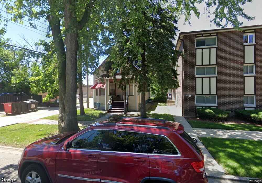
1135 Dunlop Ave Forest Park, IL 60130
Estimated Value: $381,000 - $413,000
3
Beds
1
Bath
1,718
Sq Ft
$230/Sq Ft
Est. Value
About This Home
This home is located at 1135 Dunlop Ave, Forest Park, IL 60130 and is currently estimated at $394,929, approximately $229 per square foot. 1135 Dunlop Ave is a home located in Cook County with nearby schools including Garfield Elementary School, Betsy Ross Elementary School, and Field Stevenson Elementary School.
Ownership History
Date
Name
Owned For
Owner Type
Purchase Details
Closed on
Sep 20, 2002
Sold by
Bandi Mary S
Bought by
Bandi Mary S and Sunkesula Azariah Bhupanipad
Current Estimated Value
Purchase Details
Closed on
Aug 28, 1996
Sold by
Maywood Proviso State Bank
Bought by
Bandi Prashantam and Bandi Mary S
Home Financials for this Owner
Home Financials are based on the most recent Mortgage that was taken out on this home.
Original Mortgage
$82,650
Interest Rate
7.97%
Create a Home Valuation Report for This Property
The Home Valuation Report is an in-depth analysis detailing your home's value as well as a comparison with similar homes in the area
Home Values in the Area
Average Home Value in this Area
Purchase History
| Date | Buyer | Sale Price | Title Company |
|---|---|---|---|
| Bandi Mary S | -- | -- | |
| Bandi Prashantam | $87,000 | -- |
Source: Public Records
Mortgage History
| Date | Status | Borrower | Loan Amount |
|---|---|---|---|
| Previous Owner | Bandi Prashantam | $82,650 |
Source: Public Records
Tax History Compared to Growth
Tax History
| Year | Tax Paid | Tax Assessment Tax Assessment Total Assessment is a certain percentage of the fair market value that is determined by local assessors to be the total taxable value of land and additions on the property. | Land | Improvement |
|---|---|---|---|---|
| 2024 | $7,819 | $32,001 | $4,727 | $27,274 |
| 2023 | $6,424 | $32,001 | $4,727 | $27,274 |
| 2022 | $6,424 | $24,081 | $3,624 | $20,457 |
| 2021 | $4,289 | $24,079 | $3,623 | $20,456 |
| 2020 | $3,893 | $24,079 | $3,623 | $20,456 |
| 2019 | $4,567 | $26,136 | $3,308 | $22,828 |
| 2018 | $4,481 | $26,136 | $3,308 | $22,828 |
| 2017 | $4,306 | $26,136 | $3,308 | $22,828 |
| 2016 | $5,603 | $19,915 | $2,993 | $16,922 |
| 2015 | $6,788 | $23,910 | $2,993 | $20,917 |
| 2014 | $6,116 | $23,910 | $2,993 | $20,917 |
| 2013 | $6,239 | $23,798 | $2,993 | $20,805 |
Source: Public Records
Map
Nearby Homes
- 1124 Lathrop Ave
- 7742 Taylor St
- 7708 Harvard St
- 1008 Lathrop Ave
- 1013 Ferdinand Ave
- 1024 Ferdinand Ave
- 1007 Ferdinand Ave
- 940 Troost Ave
- 946 Ferdinand Ave
- 944 Beloit Ave Unit 2
- 944 Beloit Ave Unit 1
- 944 Beloit Ave Unit 5
- 944 Beloit Ave Unit 4
- 915 Ferdinand Ave
- 900 Dunlop Ave
- 900 Lathrop Ave
- 850 Des Plaines Ave Unit 207
- 1103 Circle Ave
- 1225 Marengo Ave
- 7526 Harrison St
- 1127 Dunlop Ave
- 7635 Roosevelt Rd Unit BACK
- 7635 Roosevelt Rd Unit FRONT
- 1123 Dunlop Ave
- 1121 Dunlop Ave
- 1140 Dunlop Ave
- 7709 Roosevelt Rd
- 1119 Dunlop Ave Unit G
- 1119 Dunlop Ave Unit 1
- 1119 Dunlop Ave Unit 2
- 1119 Dunlop Ave
- 1130 Troost Ave
- 7648 Yuba St
- 1130 Dunlop Ave Unit 2D
- 1130 Dunlop Ave Unit 2B
- 1130 Dunlop Ave Unit 1C
- 1130 Dunlop Ave Unit 1B
- 1130 Dunlop Ave Unit 2C
- 1130 Dunlop Ave Unit 3B
- 1130 Dunlop Ave Unit 1A