Estimated Value: $224,000 - $244,844
4
Beds
3
Baths
1,956
Sq Ft
$118/Sq Ft
Est. Value
About This Home
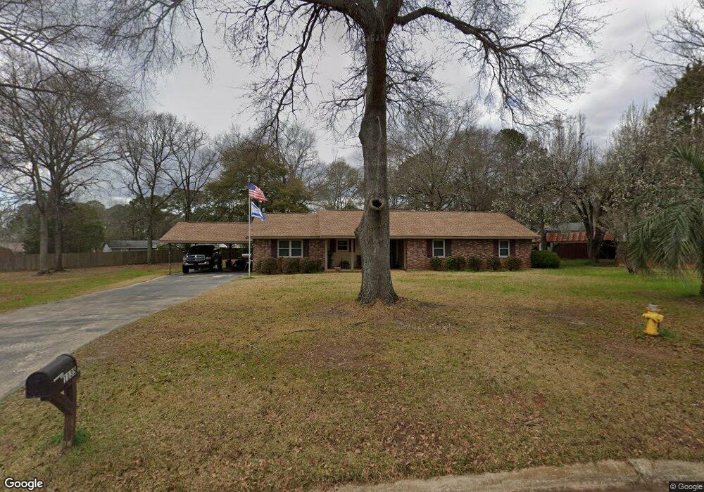
This home is located at 1135 Kingston Rd, Perry, GA 31069 and is currently estimated at $230,711, approximately $117 per square foot. 1135 Kingston Rd is a home located in Houston County with nearby schools including Morningside Elementary School, Perry Middle School, and Perry High School.
Ownership History
Date
Name
Owned For
Owner Type
Purchase Details
Closed on
Aug 7, 1995
Sold by
Moss William F and Moss Levenia H
Bought by
Sutton Gary and Michele S*
Current Estimated Value
Purchase Details
Closed on
Jul 1, 1988
Sold by
Moss Discount Pharmacy Inc
Bought by
Moss William F and Moss Levenia H
Purchase Details
Closed on
Oct 21, 1980
Sold by
Bell Leonard W
Bought by
Moss William F and Moss Levenia H
Purchase Details
Closed on
Jun 16, 1975
Sold by
Mullins W G
Bought by
Bell Leonard W
Create a Home Valuation Report for This Property
The Home Valuation Report is an in-depth analysis detailing your home's value as well as a comparison with similar homes in the area
Home Values in the Area
Average Home Value in this Area
Purchase History
| Date | Buyer | Sale Price | Title Company |
|---|---|---|---|
| Sutton Gary | $97,500 | -- | |
| Moss William F | -- | -- | |
| Moss William F | -- | -- | |
| Bell Leonard W | -- | -- |
Source: Public Records
Tax History Compared to Growth
Tax History
| Year | Tax Paid | Tax Assessment Tax Assessment Total Assessment is a certain percentage of the fair market value that is determined by local assessors to be the total taxable value of land and additions on the property. | Land | Improvement |
|---|---|---|---|---|
| 2024 | $2,401 | $66,588 | $7,200 | $59,388 |
| 2023 | $2,018 | $55,788 | $7,200 | $48,588 |
| 2022 | $1,114 | $50,428 | $7,200 | $43,228 |
| 2021 | $1,012 | $45,760 | $7,200 | $38,560 |
| 2020 | $997 | $44,920 | $7,200 | $37,720 |
| 2019 | $997 | $44,920 | $7,200 | $37,720 |
| 2018 | $997 | $44,920 | $7,200 | $37,720 |
| 2017 | $998 | $44,920 | $7,200 | $37,720 |
| 2016 | $1,000 | $44,920 | $7,200 | $37,720 |
| 2015 | $1,002 | $44,920 | $7,200 | $37,720 |
| 2014 | -- | $44,920 | $7,200 | $37,720 |
| 2013 | -- | $44,920 | $7,200 | $37,720 |
Source: Public Records
Map
Nearby Homes
- 1802 Kings Chapel Rd
- 1152 Lovely Ln
- 1304 Davis Ave
- 1205 Morningside Dr
- 1009 N Davis Dr
- 1405 Cambridge Rd
- 113 Flat Rock Ln
- 100 Flat Rock Ln
- 1312 Keith Dr
- 1402 Park Ave
- 1406 Main St
- 1212 Swift St
- 706 Hillcrest Ave
- 0 Carroll Aly
- 1207 Swift St
- 132 Sadie Heights Blvd
- 138 Sadie Heights Blvd
- 137 Sadie Heights Blvd
- 135 Sadie Heights Blvd
- 1432 Duncan Ave
- 1137 Kingston Rd
- 1047 King Cir
- 1045 King Cir
- 1049 King Cir
- 1133 Kingston Rd
- 115 Kingston Village Dr
- 116 Kingston Village Dr
- 114 Kingston Village Dr
- 1043 King Cir
- 1051 King Cir
- 113 Kingston Village Dr
- 1400 Kingston Rd
- 1401 Kingston Rd
- 112 Kingston Village Dr
- 111 Kingston Village Dr
- 1053 King Cir
- 1131 Kingston Rd
- 1041 King Cir
- 110 Kingston Village Dr
- 1402 Kingston Rd