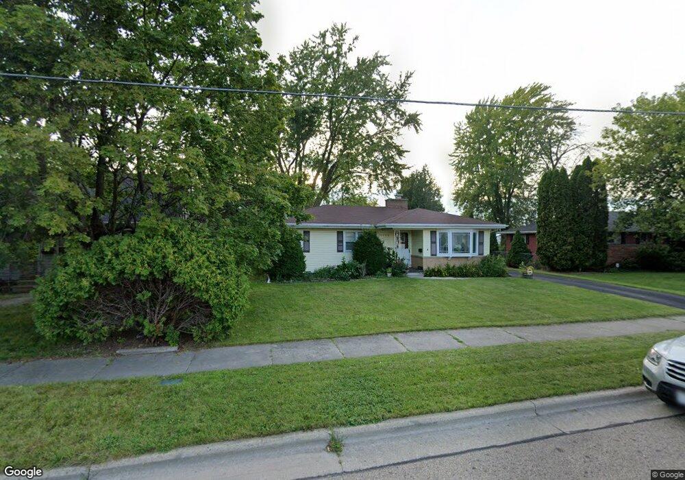
1135 Maple St Neenah, WI 54956
Estimated Value: $213,104 - $262,000
4
Beds
2
Baths
2,412
Sq Ft
$99/Sq Ft
Est. Value
About This Home
This home is located at 1135 Maple St, Neenah, WI 54956 and is currently estimated at $239,276, approximately $99 per square foot. 1135 Maple St is a home located in Winnebago County with nearby schools including Horace Mann Middle School, Coolidge Elementary School, and Neenah Middle School.
Ownership History
Date
Name
Owned For
Owner Type
Purchase Details
Closed on
Jul 31, 2018
Sold by
Walter Randolph L and Walker Irene P
Bought by
We Rent Houses Real Estate Group Llc
Current Estimated Value
Home Financials for this Owner
Home Financials are based on the most recent Mortgage that was taken out on this home.
Original Mortgage
$65,000
Interest Rate
4.5%
Mortgage Type
Future Advance Clause Open End Mortgage
Create a Home Valuation Report for This Property
The Home Valuation Report is an in-depth analysis detailing your home's value as well as a comparison with similar homes in the area
Home Values in the Area
Average Home Value in this Area
Purchase History
| Date | Buyer | Sale Price | Title Company |
|---|---|---|---|
| We Rent Houses Real Estate Group Llc | $64,000 | None Available |
Source: Public Records
Mortgage History
| Date | Status | Borrower | Loan Amount |
|---|---|---|---|
| Closed | We Rent Houses Real Estate Group Llc | $65,000 |
Source: Public Records
Tax History
| Year | Tax Paid | Tax Assessment Tax Assessment Total Assessment is a certain percentage of the fair market value that is determined by local assessors to be the total taxable value of land and additions on the property. | Land | Improvement |
|---|---|---|---|---|
| 2024 | $3,446 | $179,100 | $25,200 | $153,900 |
| 2023 | $2,882 | $97,200 | $15,800 | $81,400 |
| 2022 | $2,850 | $145,700 | $28,500 | $117,200 |
| 2021 | $2,631 | $145,700 | $28,500 | $117,200 |
| 2020 | $2,960 | $145,700 | $28,500 | $117,200 |
| 2019 | $2,475 | $145,700 | $28,500 | $117,200 |
| 2018 | $2,413 | $117,800 | $22,700 | $95,100 |
| 2017 | $2,442 | $117,800 | $22,700 | $95,100 |
| 2016 | $2,128 | $117,800 | $22,700 | $95,100 |
| 2015 | $2,611 | $117,800 | $22,700 | $95,100 |
| 2014 | $2,634 | $117,800 | $22,700 | $95,100 |
| 2013 | $2,768 | $117,800 | $22,700 | $95,100 |
Source: Public Records
Map
Nearby Homes
- 136 W Cecil St
- 140 W Cecil St
- 960 Higgins Ave
- 831 S Commercial St Unit 833
- 830 Congress St
- 681 Oak St
- 663 Chestnut St
- 2285 North St
- 714 Maple St
- 205 Division St
- 231 Bosworth Ln
- 304 Division St
- 619 Roosevelt St
- 540 Elm St
- 1228 Cameron Cir Unit 82
- 529 Fairview Ave
- 726 S Park Ave
- 629 Belmont Ct
- 743 Madison St
- 760 Kensington Rd
- 1131 Maple St
- 1143 Maple St
- 1138 Maple St
- 1134 Maple St
- 1142 Maple St
- 1130 Maple St
- 1126 Maple St
- 1212 S Commercial St
- 1218 S Commercial St
- 1146 Maple St
- 1150 Maple St
- 1205 S Commercial St
- 1151 Maple St
- 1156 Maple St
- 1229 S Commercial St
- 1124 Maple St
- 1135 Higgins Ave
- 1139 Higgins Ave
- 1143 Higgins Ave
- 1131 Higgins Ave