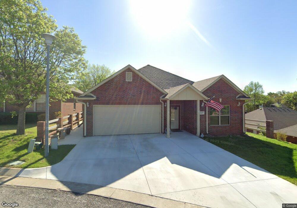
1135 S Birch St Sapulpa, OK 74066
Estimated Value: $250,755 - $277,000
3
Beds
2
Baths
1,801
Sq Ft
$145/Sq Ft
Est. Value
About This Home
This home is located at 1135 S Birch St, Sapulpa, OK 74066 and is currently estimated at $260,689, approximately $144 per square foot. 1135 S Birch St is a home with nearby schools including Sapulpa Middle School, Sapulpa Junior High School, and Sapulpa High School.
Ownership History
Date
Name
Owned For
Owner Type
Purchase Details
Closed on
Oct 22, 2014
Sold by
Wells Carl V and Wells Sandra S
Bought by
Widdoes David R and Widdoes Donette K
Current Estimated Value
Purchase Details
Closed on
Jun 14, 2012
Sold by
Beatty Brent and Beatty Tangie L
Bought by
Wells Carl and Wells Sandra S
Home Financials for this Owner
Home Financials are based on the most recent Mortgage that was taken out on this home.
Original Mortgage
$90,000
Interest Rate
3.86%
Mortgage Type
Unknown
Create a Home Valuation Report for This Property
The Home Valuation Report is an in-depth analysis detailing your home's value as well as a comparison with similar homes in the area
Home Values in the Area
Average Home Value in this Area
Purchase History
| Date | Buyer | Sale Price | Title Company |
|---|---|---|---|
| Widdoes David R | -- | None Available | |
| Wells Carl | $179,500 | None Available |
Source: Public Records
Mortgage History
| Date | Status | Borrower | Loan Amount |
|---|---|---|---|
| Previous Owner | Wells Carl | $90,000 |
Source: Public Records
Tax History Compared to Growth
Tax History
| Year | Tax Paid | Tax Assessment Tax Assessment Total Assessment is a certain percentage of the fair market value that is determined by local assessors to be the total taxable value of land and additions on the property. | Land | Improvement |
|---|---|---|---|---|
| 2025 | $2,802 | $24,773 | $3,480 | $21,293 |
| 2024 | $2,802 | $24,051 | $3,480 | $20,571 |
| 2023 | $2,802 | $23,351 | $3,480 | $19,871 |
| 2022 | $2,604 | $22,671 | $3,480 | $19,191 |
| 2021 | $2,562 | $21,591 | $3,480 | $18,111 |
| 2020 | $2,553 | $21,645 | $3,480 | $18,165 |
| 2019 | $2,667 | $22,499 | $3,480 | $19,019 |
| 2018 | $2,605 | $21,526 | $5,400 | $16,126 |
| 2017 | $2,591 | $21,526 | $5,400 | $16,126 |
| 2016 | $2,464 | $21,526 | $5,400 | $16,126 |
| 2015 | -- | $21,526 | $5,400 | $16,126 |
| 2014 | -- | $21,526 | $5,400 | $16,126 |
Source: Public Records
Map
Nearby Homes
- 813 E Teresa Ave
- 1103 S Division St
- 1109 S Division St
- 0 Division St Unit 2535888
- 1210 Maybelle Dr
- 1440 Mabelle Dr
- 121 E Davis Ave
- 119 E Davis Ave
- 211 E Wells Blvd
- 511 S Maple St
- 120 E Burnham Ave
- 119 E Ross Ave
- 612 S Park St
- 1424 S Main St
- 507 S Park St
- 724 S Main St
- 320 E Mckinley Ave
- 702 S Main St
- 706 E Thompson Ave
- 706 S Poplar St
- 1137 S Birch St
- 1131 S Birch St
- 727 Woodland Ave
- 725 Woodland Ave
- 733 E Teresa Ave
- 735 E Teresa Ave
- 724 Woodland Ave
- 722 Woodland Ave
- 726 E Teresa Ave
- 817 E Teresa Ave
- 902 E Hastain Ave
- 721 Woodland Ave
- 720 Woodland Ave
- 907 E Teresa Ave
- 730 E Teresa Ave
- 728 E Teresa Ave
- 734 E Teresa Ave
- 1102 Colleen Dr
- 904 E Hastain Ave