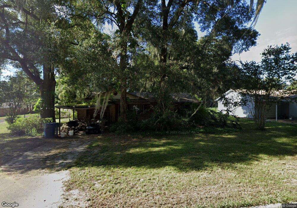
1135 Taylor Rd W Deland, FL 32720
Estimated Value: $248,151 - $312,000
3
Beds
2
Baths
2,056
Sq Ft
$131/Sq Ft
Est. Value
About This Home
This home is located at 1135 Taylor Rd W, Deland, FL 32720 and is currently estimated at $268,538, approximately $130 per square foot. 1135 Taylor Rd W is a home located in Volusia County with nearby schools including Woodward Avenue Elementary School, Deland High School, and Southwestern Middle School.
Ownership History
Date
Name
Owned For
Owner Type
Purchase Details
Closed on
May 7, 2010
Sold by
Bennis William D
Bought by
Foster Nathaniel Lane
Current Estimated Value
Home Financials for this Owner
Home Financials are based on the most recent Mortgage that was taken out on this home.
Original Mortgage
$98,064
Outstanding Balance
$66,050
Interest Rate
5.15%
Mortgage Type
VA
Estimated Equity
$202,488
Purchase Details
Closed on
Oct 6, 2009
Sold by
Bennis William D
Bought by
Bennis William D
Purchase Details
Closed on
Dec 20, 2001
Sold by
Brooks Clara
Bought by
Bennis Harry and Bennis Martha C
Home Financials for this Owner
Home Financials are based on the most recent Mortgage that was taken out on this home.
Original Mortgage
$72,750
Interest Rate
6.49%
Mortgage Type
Purchase Money Mortgage
Purchase Details
Closed on
Jul 15, 1979
Bought by
Foster Nathaniel Lane
Purchase Details
Closed on
Mar 15, 1979
Bought by
Foster Nathaniel Lane
Create a Home Valuation Report for This Property
The Home Valuation Report is an in-depth analysis detailing your home's value as well as a comparison with similar homes in the area
Home Values in the Area
Average Home Value in this Area
Purchase History
| Date | Buyer | Sale Price | Title Company |
|---|---|---|---|
| Foster Nathaniel Lane | $96,000 | E & L Title Services Llc | |
| Bennis William D | -- | Attorney | |
| Bennis Harry | $75,000 | -- | |
| Foster Nathaniel Lane | $34,500 | -- | |
| Foster Nathaniel Lane | $30,900 | -- |
Source: Public Records
Mortgage History
| Date | Status | Borrower | Loan Amount |
|---|---|---|---|
| Open | Foster Nathaniel Lane | $98,064 | |
| Previous Owner | Bennis Harry | $72,750 |
Source: Public Records
Tax History Compared to Growth
Tax History
| Year | Tax Paid | Tax Assessment Tax Assessment Total Assessment is a certain percentage of the fair market value that is determined by local assessors to be the total taxable value of land and additions on the property. | Land | Improvement |
|---|---|---|---|---|
| 2025 | $911 | $74,339 | -- | -- |
| 2024 | $911 | $72,244 | -- | -- |
| 2023 | $911 | $70,140 | $0 | $0 |
| 2022 | $889 | $68,097 | $0 | $0 |
| 2021 | $920 | $66,114 | $0 | $0 |
| 2020 | $911 | $65,201 | $0 | $0 |
| 2019 | $939 | $63,735 | $0 | $0 |
| 2018 | $932 | $62,547 | $0 | $0 |
| 2017 | $920 | $61,261 | $0 | $0 |
| 2016 | $884 | $60,001 | $0 | $0 |
| 2015 | $901 | $59,584 | $0 | $0 |
| 2014 | $898 | $59,111 | $0 | $0 |
Source: Public Records
Map
Nearby Homes
- 1762 Blue Oak Ct
- 1773 Blue Oak Ct
- 1519 Monroe St
- 1581 S Montgomery St
- 0 Hwy 92 Unit MFRA4664896
- 1572 S Montgomery St
- 1513 S Elsasser St
- 1570 S High St
- 1299 Blue Ash Ln
- 0 W Beresford Rd Unit MFRV4941057
- Eclipse Plan at Oak Hammock - Estate Key Collection
- Dawn Plan at Oak Hammock - Estate Key Collection
- Bloom Plan at Oak Hammock - Estate Key Collection
- Celeste Plan at Oak Hammock - Estate Key Collection
- Aura Plan at Oak Hammock - Estate Key Collection
- 1351 Blue Ash Ln
- 1309 Hammock Reserve Dr
- 1383 Blue Ash Ln
- 1387 Blue Ash Ln
- 1301 Hammock Reserve Dr
- 1125 Taylor Rd W
- Margaret St
- 1655 Margaret St
- 1159 Taylor Rd W
- 1115 Taylor Rd W
- 1670 Margaret St
- 1647 Margaret St
- 1670 S Spring Garden Ave
- 1169 Taylor Rd W
- 1160 Taylor Rd W
- 1652 Margaret St
- 1660 S Spring Garden Ave
- 1645 Margaret St
- 1183 Taylor Rd W
- 1650 Margaret St
- 1095 Taylor Rd W
- 1190 Taylor Rd W
- 1643 Margaret St
- 1638 S Spring Garden Ave
- 1667 Pratt St