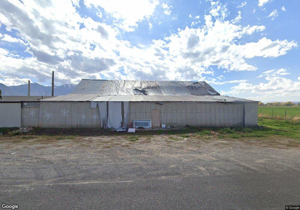
1135 W 6800 S Spanish Fork, UT 84660
Estimated Value: $1,168,000
--
Bed
--
Bath
6,316
Sq Ft
$185/Sq Ft
Est. Value
About This Home
This home is located at 1135 W 6800 S, Spanish Fork, UT 84660 and is currently estimated at $1,168,000, approximately $184 per square foot. 1135 W 6800 S is a home located in Utah County with nearby schools including Brockbank Elementary School, Spanish Fork Jr High School, and Spanish Fork High School.
Ownership History
Date
Name
Owned For
Owner Type
Purchase Details
Closed on
Jun 22, 2021
Sold by
Jensen Brian and Jensen Charlene
Bought by
Jb Spansh Fork 1 Llc
Current Estimated Value
Purchase Details
Closed on
Dec 9, 2016
Sold by
Watson Andrew S
Bought by
Jensen Brian and Jensen Charlene
Purchase Details
Closed on
Jul 28, 2004
Sold by
Watson Ann P T
Bought by
Watson Andrew S
Purchase Details
Closed on
Jul 8, 2004
Sold by
Watson Ann P
Bought by
Watson Andrew S
Create a Home Valuation Report for This Property
The Home Valuation Report is an in-depth analysis detailing your home's value as well as a comparison with similar homes in the area
Home Values in the Area
Average Home Value in this Area
Purchase History
| Date | Buyer | Sale Price | Title Company |
|---|---|---|---|
| Jb Spansh Fork 1 Llc | -- | Stewart Ttl Ins Agcy Of Uta | |
| Jensen Brian | -- | Title West | |
| Watson Andrew S | -- | -- | |
| Watson Andrew S | -- | -- |
Source: Public Records
Tax History Compared to Growth
Tax History
| Year | Tax Paid | Tax Assessment Tax Assessment Total Assessment is a certain percentage of the fair market value that is determined by local assessors to be the total taxable value of land and additions on the property. | Land | Improvement |
|---|---|---|---|---|
| 2025 | $652 | $83,200 | $29,200 | $54,000 |
| 2024 | $652 | $65,200 | $0 | $0 |
| 2023 | $652 | $65,200 | $0 | $0 |
| 2022 | $682 | $67,000 | $29,600 | $37,400 |
| 2021 | $609 | $51,400 | $17,400 | $34,000 |
| 2020 | $604 | $49,500 | $15,500 | $34,000 |
| 2019 | $532 | $44,500 | $10,500 | $34,000 |
| 2018 | $528 | $42,200 | $10,500 | $31,700 |
| 2017 | $491 | $38,200 | $0 | $0 |
| 2016 | $507 | $38,200 | $0 | $0 |
| 2015 | $511 | $38,200 | $0 | $0 |
| 2014 | $511 | $38,200 | $0 | $0 |
Source: Public Records
Map
Nearby Homes
- 1299 W 250 S
- 1377 W 450 S
- 6550 S 1050 W
- 429 S 1280 W
- 333 S 1170 W
- 1026 W 350 S
- Aspen Plan at River Point
- Solitude Plan at River Point
- Snowbasin Plan at River Point
- Telluride Plan at River Point
- Breckenridge Plan at River Point
- Sundance Plan at River Point
- Vail Plan at River Point
- Brighton Plan at River Point
- Powder Mountain Plan at River Point
- Alta Plan at River Point
- Snowbird Plan at River Point
- 1336 W 800 S Unit 22
- 956 W 40 N
- 1256 W 800 S Unit 25
- 1150 W 6800 S
- 6832 S 1050 W
- 1236 W Larson Rd
- 748 W 6800 S
- 1233 W 6930 S
- 1341 W 6800 S
- 3699 South
- 266 S 1400 W Unit 918
- 258 S 1400 W Unit 919
- 278 S 1400 W Unit 917
- 286 S 1400 W Unit 916
- 242 S 1400 W Unit 921
- 242 S 1400 W
- 298 S 1400 W
- 302 S 1400 W Unit 914
- 304 S 1400 W Unit 913
- 304 S 1400 W
- 243 S 1400 W
- 243 S 1400 W Unit 922
- 279 S 1400 W Unit 926