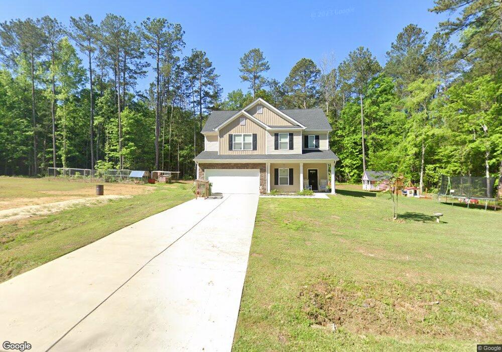
1135 White Rock Rd Chapin, SC 29036
Estimated Value: $438,000 - $698,000
4
Beds
4
Baths
2,977
Sq Ft
$179/Sq Ft
Est. Value
About This Home
This home is located at 1135 White Rock Rd, Chapin, SC 29036 and is currently estimated at $532,918, approximately $179 per square foot. 1135 White Rock Rd is a home located in Richland County with nearby schools including Lake Murray Elementary School, Chapin Intermediate, and Chapin High School.
Ownership History
Date
Name
Owned For
Owner Type
Purchase Details
Closed on
Dec 21, 2020
Sold by
Deweese Susan
Bought by
Lourigan Susan D and Lourigan Steven M
Current Estimated Value
Home Financials for this Owner
Home Financials are based on the most recent Mortgage that was taken out on this home.
Original Mortgage
$255,000
Interest Rate
2.6%
Mortgage Type
New Conventional
Purchase Details
Closed on
Mar 17, 2017
Sold by
Adams David A
Bought by
Malinowski Bill
Purchase Details
Closed on
Nov 21, 2000
Sold by
Perrine Mary E
Bought by
Perrine Steven C
Create a Home Valuation Report for This Property
The Home Valuation Report is an in-depth analysis detailing your home's value as well as a comparison with similar homes in the area
Home Values in the Area
Average Home Value in this Area
Purchase History
| Date | Buyer | Sale Price | Title Company |
|---|---|---|---|
| Lourigan Susan D | -- | None Available | |
| Malinowski Bill | $6,100 | None Available | |
| Perrine Steven C | -- | -- |
Source: Public Records
Mortgage History
| Date | Status | Borrower | Loan Amount |
|---|---|---|---|
| Previous Owner | Lourigan Susan D | $255,000 |
Source: Public Records
Tax History Compared to Growth
Tax History
| Year | Tax Paid | Tax Assessment Tax Assessment Total Assessment is a certain percentage of the fair market value that is determined by local assessors to be the total taxable value of land and additions on the property. | Land | Improvement |
|---|---|---|---|---|
| 2024 | $3,115 | $396,600 | $0 | $0 |
| 2023 | $3,115 | $13,796 | $0 | $0 |
| 2022 | $2,696 | $344,900 | $13,400 | $331,500 |
| 2021 | $2,737 | $13,800 | $0 | $0 |
| 2020 | $709 | $870 | $0 | $0 |
| 2019 | $396 | $870 | $0 | $0 |
| 2018 | $348 | $800 | $0 | $0 |
| 2017 | $344 | $800 | $0 | $0 |
| 2016 | $339 | $800 | $0 | $0 |
| 2015 | $340 | $800 | $0 | $0 |
| 2014 | $326 | $13,400 | $0 | $0 |
| 2013 | -- | $800 | $0 | $0 |
Source: Public Records
Map
Nearby Homes
- 1078 White Rock Rd
- 145 Monroe Preserve Ln
- 149 Monroe Preserve Ln
- 113 Monroe Preserve Ln
- 117 Monroe Preserve Ln
- 109 Monroe Preserve Ln
- 105 Monroe Preserve Ln
- 114 Monroe Preserve Ln
- 133 Monroe Preserve Ln
- 110 Monroe Preserve Ln
- 3691 Kennerly Rd
- 100 Stone Hill Rd
- 2071 Harvestwood Ln
- 11437 Broad River
- 0 Mt Olivet Church Rd Unit 617090
- 787 Kimsey Dr
- 1115 Portrait Hill Dr
- 297 Massey Cir
- 199 Lockleigh Ln
- 756 Kimsey Dr
- 1128 White Rock Rd
- 1048 White Rock Rd
- 1060 White Rock Rd
- 1109 White Rock Rd
- 1058 White Rock Rd
- 1068 White Rock Rd
- 1001 White Rock Rd
- 1009 White Rock Rd
- 1120 White Rock Rd
- 1070 White Rock Rd
- 0 Back Acres Rd
- 125 Stone Hill Rd
- 11629 Broad River Rd
- 901 Mount Vernon Church Rd
- 119 Stone Hill Rd
- 124 Stone Hill Rd
- 117 Stone Hill Rd
- 114 Stone Hill Rd
- 112 Stone Hill Rd
- 1010 Mount Vernon Church Rd