Estimated Value: $100,000 - $143,687
2
Beds
1
Bath
830
Sq Ft
$148/Sq Ft
Est. Value
About This Home
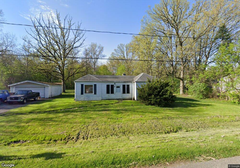
This home is located at 1136 Harding Dr, Flint, MI 48507 and is currently estimated at $122,672, approximately $147 per square foot. 1136 Harding Dr is a home located in Genesee County with nearby schools including Anderson Elementary School, McGrath Elementary School, and Grand Blanc West Middle School.
Ownership History
Date
Name
Owned For
Owner Type
Purchase Details
Closed on
Nov 12, 2021
Sold by
Knight David D and Knight Cathy A
Bought by
Clark Randy
Current Estimated Value
Home Financials for this Owner
Home Financials are based on the most recent Mortgage that was taken out on this home.
Original Mortgage
$60,000
Outstanding Balance
$54,638
Interest Rate
3.14%
Mortgage Type
New Conventional
Estimated Equity
$68,034
Purchase Details
Closed on
Jun 12, 2000
Sold by
Knight David D
Bought by
Knight David D and Knight Cathy A
Create a Home Valuation Report for This Property
The Home Valuation Report is an in-depth analysis detailing your home's value as well as a comparison with similar homes in the area
Home Values in the Area
Average Home Value in this Area
Purchase History
| Date | Buyer | Sale Price | Title Company |
|---|---|---|---|
| Clark Randy | $70,000 | Crossroads Title | |
| Clark Randy | $70,000 | Crossroads Title | |
| Knight David D | -- | -- |
Source: Public Records
Mortgage History
| Date | Status | Borrower | Loan Amount |
|---|---|---|---|
| Open | Clark Randy | $60,000 | |
| Closed | Clark Randy | $60,000 |
Source: Public Records
Tax History
| Year | Tax Paid | Tax Assessment Tax Assessment Total Assessment is a certain percentage of the fair market value that is determined by local assessors to be the total taxable value of land and additions on the property. | Land | Improvement |
|---|---|---|---|---|
| 2025 | $2,354 | $63,800 | $0 | $0 |
| 2024 | $1,359 | $62,000 | $0 | $0 |
| 2023 | $1,296 | $51,600 | $0 | $0 |
| 2022 | $1,797 | $49,100 | $0 | $0 |
| 2021 | $1,777 | $42,800 | $0 | $0 |
| 2020 | $1,196 | $36,100 | $0 | $0 |
| 2019 | $1,178 | $34,700 | $0 | $0 |
| 2018 | $1,643 | $34,100 | $0 | $0 |
| 2017 | $1,588 | $32,200 | $0 | $0 |
| 2016 | $1,571 | $25,700 | $0 | $0 |
| 2015 | $1,521 | $25,700 | $0 | $0 |
| 2012 | -- | $33,900 | $33,900 | $0 |
Source: Public Records
Map
Nearby Homes
- 0 Harding Dr Unit 20251056693
- 0 Jefferson Blvd
- 1226 Harding Dr
- 00 Mckinley Blvd
- 000 Mckinley Blvd
- 1075 E Hill Rd
- 0000 Mckinley Blvd
- 0000 Coolidge Dr
- 00 Coolidge Dr
- 000 Coolidge Dr
- 1045 Leisure Dr Unit 7
- 1642 Wagon Wheel Ln
- 0 E Hill Rd Unit 20261004433
- 1142 Leisure Dr
- 5400 Ali Dr
- 1329 Arrowwood Ln
- 1380 Sunset Blvd
- 5128 Sandalwood Cir Unit 20
- 5152 Sandalwood Cir
- 5308 Sandalwood Ct
- 1150 Harding Dr
- 1126 Harding Dr
- 0 Harding Dr Unit 30062258
- 0 Harding Dr Unit 5021223128
- 0 Harding Dr Unit 50092036
- 0 Harding Dr
- 0 Harding Dr Unit G21223128
- 1137 Harding Dr
- 1147 Harding Dr
- 1154 Harding Dr
- 1154 Harding Dr
- 1125 Harding Dr
- 1112 Harding Dr
- 1153 Harding Dr
- 1111 Jefferson Blvd
- 1159 Harding Dr
- 1122 Washington Dr
- 1166 Harding Dr
- 1111 Harding Dr
- 1106 Harding Dr