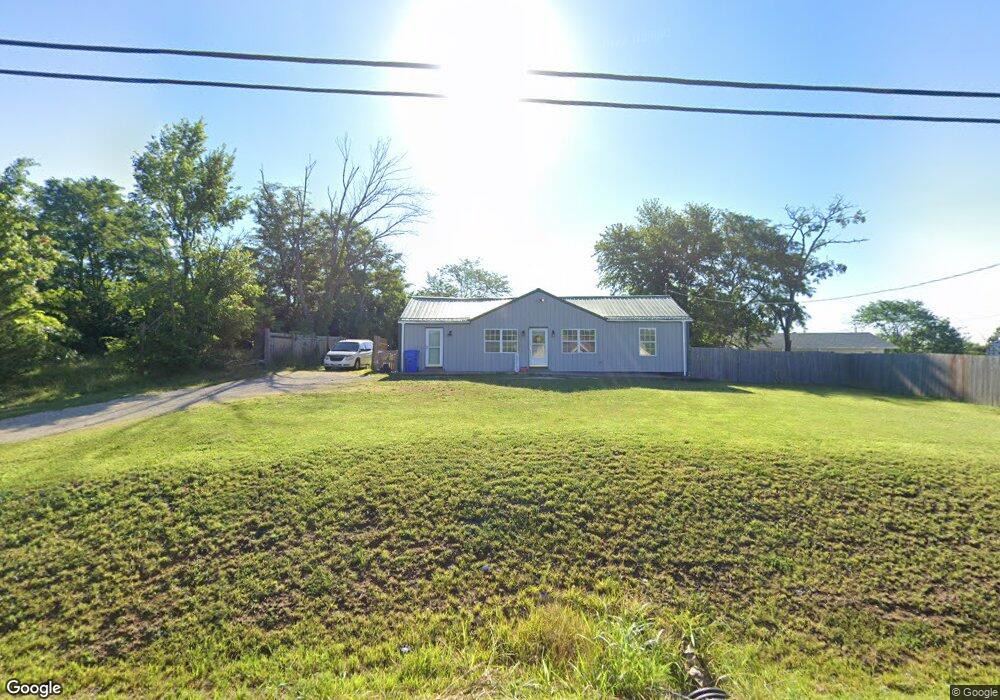
11362 State Route 21 Hillsboro, MO 63050
Estimated Value: $258,000 - $394,000
--
Bed
1
Bath
1,560
Sq Ft
$223/Sq Ft
Est. Value
About This Home
This home is located at 11362 State Route 21, Hillsboro, MO 63050 and is currently estimated at $348,488, approximately $223 per square foot. 11362 State Route 21 is a home with nearby schools including Hillsboro Elementary School, Hillsboro Primary School, and Hillsboro Middle Elementary School.
Ownership History
Date
Name
Owned For
Owner Type
Purchase Details
Closed on
Nov 19, 2020
Sold by
Noack Travis A
Bought by
Lepage Thomas and Lepage Danette
Current Estimated Value
Home Financials for this Owner
Home Financials are based on the most recent Mortgage that was taken out on this home.
Original Mortgage
$243,000
Outstanding Balance
$216,235
Interest Rate
2.8%
Mortgage Type
New Conventional
Estimated Equity
$132,253
Purchase Details
Closed on
Mar 8, 2018
Sold by
Noack Travis A
Bought by
Doria Christopher A and Doria Juliana M
Purchase Details
Closed on
Aug 15, 2017
Sold by
Vrana Nelson R
Bought by
Noack Travis A
Home Financials for this Owner
Home Financials are based on the most recent Mortgage that was taken out on this home.
Original Mortgage
$93,750
Interest Rate
3.96%
Mortgage Type
Commercial
Create a Home Valuation Report for This Property
The Home Valuation Report is an in-depth analysis detailing your home's value as well as a comparison with similar homes in the area
Home Values in the Area
Average Home Value in this Area
Purchase History
| Date | Buyer | Sale Price | Title Company |
|---|---|---|---|
| Lepage Thomas | -- | None Available | |
| Doria Christopher A | -- | None Available | |
| Noack Travis A | -- | Heritage Title Co |
Source: Public Records
Mortgage History
| Date | Status | Borrower | Loan Amount |
|---|---|---|---|
| Open | Lepage Thomas | $243,000 | |
| Previous Owner | Noack Travis A | $93,750 |
Source: Public Records
Tax History Compared to Growth
Tax History
| Year | Tax Paid | Tax Assessment Tax Assessment Total Assessment is a certain percentage of the fair market value that is determined by local assessors to be the total taxable value of land and additions on the property. | Land | Improvement |
|---|---|---|---|---|
| 2025 | $2,401 | $43,200 | $8,800 | $34,400 |
| 2024 | $2,401 | $39,800 | $8,800 | $31,000 |
| 2023 | $2,401 | $39,800 | $8,800 | $31,000 |
| 2022 | $2,414 | $39,800 | $8,800 | $31,000 |
| 2021 | $2,554 | $39,200 | $8,800 | $30,400 |
| 2020 | $2,372 | $35,300 | $8,000 | $27,300 |
| 2019 | $2,369 | $35,300 | $8,000 | $27,300 |
| 2018 | $2,375 | $35,300 | $8,000 | $27,300 |
| 2017 | $2,948 | $46,100 | $11,300 | $34,800 |
| 2016 | $2,841 | $42,500 | $11,300 | $31,200 |
| 2015 | $1,032 | $42,500 | $11,300 | $31,200 |
| 2013 | $1,032 | $15,400 | $10,300 | $5,100 |
Source: Public Records
Map
Nearby Homes
- 1483 Saint Charles Dr
- 4640 Dylan Dr
- 4633 Dylan Dr
- 905 Winston Ct
- 5039 Hampton Dr
- 5059 Hampton Dr
- 5000 Glory Ridge
- 5033 Whitehead Rd
- 1420 Cortez Dr
- 1417 Cortez Dr
- 4799 State Road B
- 6005 Elm
- 4625 Cedar Dr
- 6360 State Road B
- 32 Ridgewood Dr
- 719 Camelot Estates Dr
- 569 Karen Dr
- 712 Maple St
- 0 Lot 62 01 Acres Unit 23042037
- 0 Brickyard Rd
- 11356 State Route 21
- 11356 Highway 21
- 11366 State Route 21
- 11350 Highway 21
- 11350 Missouri 21
- 11342 State Route 21
- 11342 Highway 21
- 11342 Highway 21
- 11362 Missouri 21
- 11336 State Route 21
- 11336 Highway 21
- 11355 State Route 21
- 11339 Missouri 21
- 11318 Missouri 21
- 100 Christopher Pkwy
- 11281 Missouri 21
- 11279 State Route 21
- 130 Christopher Pkwy
- 11281 Highway 21