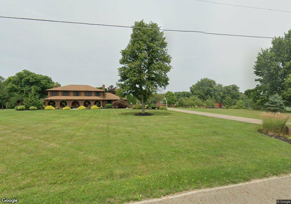
11367 Lair Rd NE Alliance, OH 44601
Estimated Value: $625,000 - $684,059
4
Beds
4
Baths
2,848
Sq Ft
$230/Sq Ft
Est. Value
About This Home
This home is located at 11367 Lair Rd NE, Alliance, OH 44601 and is currently estimated at $654,530, approximately $229 per square foot. 11367 Lair Rd NE is a home located in Stark County with nearby schools including Marlington High School.
Ownership History
Date
Name
Owned For
Owner Type
Purchase Details
Closed on
Jun 3, 2005
Sold by
Johnson Michelle Marie
Bought by
Tucker John A and Tucker Deborah M
Current Estimated Value
Home Financials for this Owner
Home Financials are based on the most recent Mortgage that was taken out on this home.
Original Mortgage
$292,000
Outstanding Balance
$153,911
Interest Rate
5.91%
Mortgage Type
Fannie Mae Freddie Mac
Estimated Equity
$500,619
Purchase Details
Closed on
May 31, 1991
Create a Home Valuation Report for This Property
The Home Valuation Report is an in-depth analysis detailing your home's value as well as a comparison with similar homes in the area
Home Values in the Area
Average Home Value in this Area
Purchase History
| Date | Buyer | Sale Price | Title Company |
|---|---|---|---|
| Tucker John A | $365,000 | -- | |
| -- | $257,000 | -- |
Source: Public Records
Mortgage History
| Date | Status | Borrower | Loan Amount |
|---|---|---|---|
| Open | Tucker John A | $292,000 | |
| Closed | Tucker John A | $54,750 |
Source: Public Records
Tax History Compared to Growth
Tax History
| Year | Tax Paid | Tax Assessment Tax Assessment Total Assessment is a certain percentage of the fair market value that is determined by local assessors to be the total taxable value of land and additions on the property. | Land | Improvement |
|---|---|---|---|---|
| 2025 | -- | $167,020 | $35,280 | $131,740 |
| 2024 | -- | $167,020 | $35,280 | $131,740 |
| 2023 | $4,947 | $139,160 | $31,290 | $107,870 |
| 2022 | $3,998 | $112,420 | $31,290 | $81,130 |
| 2021 | $4,010 | $112,420 | $31,290 | $81,130 |
| 2020 | $4,396 | $109,830 | $31,290 | $78,540 |
| 2019 | $4,367 | $109,850 | $31,300 | $78,550 |
| 2018 | $4,374 | $109,850 | $31,300 | $78,550 |
| 2017 | $4,162 | $97,950 | $20,420 | $77,530 |
| 2016 | $4,764 | $112,100 | $20,420 | $91,680 |
| 2015 | $4,539 | $112,100 | $20,420 | $91,680 |
| 2014 | $670 | $105,380 | $17,550 | $87,830 |
| 2013 | $2,323 | $105,380 | $17,550 | $87,830 |
Source: Public Records
Map
Nearby Homes
- 12252 Snode St NE
- 12415 Snode St NE
- 14350 Reeder Ave NE
- 12355 Edison St NE
- German Church Street North E Unit LotWP001
- 11960 Freshley Ave NE
- 11940 Freshley Ave NE
- 13109 Edison St NE
- 0 New Milford Rd Unit 5119787
- 0 German Church St NE
- 5615 Laubert Rd
- 13975 Greenbower St NE
- 11480 Aebi Ave NE
- 10666 Wilma Ave NE
- 4829 Laubert Rd
- 0 Meadow St NE
- 13334 Cindy St NE
- 13061 Beeson St NE
- 0 Reeder Ave NE
- 14422 Sturbridge Rd NE
- 11445 Lair Rd NE
- 11394 Lair Rd NE
- 11444 Lair Rd NE
- 11495 Lair Rd NE
- 11301 Lair Rd NE
- 11320 Lair Rd NE
- 11256 Lair Rd NE
- 11520 Lair Rd NE
- 11550 Lair Rd NE
- 11573 Lair Rd NE
- 11572 Lair Rd NE
- 11644 Lair Rd NE
- 11322 Lair Rd NE
- 11676 Lair Rd NE
- 11693 Lair Rd NE
- 13365 Mccallum Ave NE
- 11110 Lair Rd NE
- 13301 Mccallum Ave NE
- 11085 Lair Rd NE
- 13529 Mccallum Ave NE