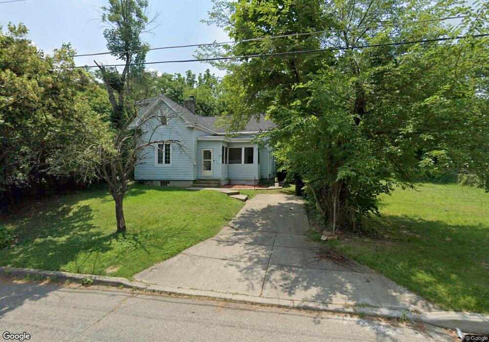
1137 Atwood Ave Cincinnati, OH 45224
College Hill NeighborhoodEstimated Value: $123,000 - $153,762
3
Beds
1
Bath
1,087
Sq Ft
$131/Sq Ft
Est. Value
About This Home
This home is located at 1137 Atwood Ave, Cincinnati, OH 45224 and is currently estimated at $141,941, approximately $130 per square foot. 1137 Atwood Ave is a home located in Hamilton County with nearby schools including Pleasant Hill Elementary School, Robert A. Taft Information Technology High School, and Western Hills High School.
Ownership History
Date
Name
Owned For
Owner Type
Purchase Details
Closed on
Mar 3, 2021
Sold by
Chowdhury Tracy R and Chowdhury Abdul G
Bought by
Chowdhury Abdul G
Current Estimated Value
Purchase Details
Closed on
May 28, 2008
Sold by
The Bank Of New York
Bought by
Chowdhury Abdul
Purchase Details
Closed on
Jun 28, 2007
Sold by
Jallow Tonya and Jallow Sarjo
Bought by
Bank Of New York and Certificateholders Of Cwabs 2005-06
Purchase Details
Closed on
Apr 28, 2005
Sold by
Harris Willie A and Harris Clara I
Bought by
Jallow Sarjo and Jallow Tonya
Home Financials for this Owner
Home Financials are based on the most recent Mortgage that was taken out on this home.
Original Mortgage
$55,200
Interest Rate
8.45%
Mortgage Type
Fannie Mae Freddie Mac
Create a Home Valuation Report for This Property
The Home Valuation Report is an in-depth analysis detailing your home's value as well as a comparison with similar homes in the area
Home Values in the Area
Average Home Value in this Area
Purchase History
| Date | Buyer | Sale Price | Title Company |
|---|---|---|---|
| Chowdhury Abdul G | -- | None Available | |
| Chowdhury Abdul | -- | Resource Title Of Cincinnati | |
| Bank Of New York | $46,000 | None Available | |
| Jallow Sarjo | $69,000 | Title Resolutions |
Source: Public Records
Mortgage History
| Date | Status | Borrower | Loan Amount |
|---|---|---|---|
| Previous Owner | Jallow Sarjo | $55,200 |
Source: Public Records
Tax History Compared to Growth
Tax History
| Year | Tax Paid | Tax Assessment Tax Assessment Total Assessment is a certain percentage of the fair market value that is determined by local assessors to be the total taxable value of land and additions on the property. | Land | Improvement |
|---|---|---|---|---|
| 2024 | $2,178 | $34,220 | $10,388 | $23,832 |
| 2023 | $2,182 | $34,220 | $10,388 | $23,832 |
| 2022 | $1,230 | $17,256 | $8,460 | $8,796 |
| 2021 | $1,355 | $17,256 | $8,460 | $8,796 |
| 2020 | $1,209 | $17,256 | $8,460 | $8,796 |
| 2019 | $1,164 | $15,134 | $7,420 | $7,714 |
| 2018 | $1,165 | $15,134 | $7,420 | $7,714 |
| 2017 | $1,122 | $15,134 | $7,420 | $7,714 |
| 2016 | $1,271 | $13,542 | $7,917 | $5,625 |
| 2015 | $921 | $13,542 | $7,917 | $5,625 |
| 2014 | $926 | $13,542 | $7,917 | $5,625 |
| 2013 | $971 | $13,962 | $8,162 | $5,800 |
Source: Public Records
Map
Nearby Homes
- 1147 Homeside Ave
- 1127 Cedar Ave
- 1137 Homeside Ave
- 5839 Argus Rd
- 6014 Argus Rd
- 1090 Elda Ln
- 6123 Faircrest Ct
- 5923 Lantana Ave
- 5773 Lantana Ave
- 1054 Grayview Ct
- 1417 Cedar Ave
- 6000 Capri Dr
- 5687 Folchi Dr
- 5679 Folchi Dr
- 1428 Ambrose Ave
- 1437 Ambrose Ave
- 6029 Waldway Ln
- 1205 Wionna Ave
- 5974 Sunridge Dr
- 5643 Red Cedar Dr
- 1133 Atwood Ave
- 1139 Atwood Ave
- 1141 Atwood Ave
- 1143 Atwood Ave
- 1134 Cedar Ave
- 1136 Cedar Ave
- 1140 Cedar Ave
- 1130 Cedar Ave
- 1145 Atwood Ave
- 1128 Atwood Ave
- 1124 Atwood Ave
- 1132 Atwood Ave
- 1142 Cedar Ave
- 1136 Atwood Ave
- 1147 Atwood Ave
- 1140 Atwood Ave
- 1148 Cedar Ave
- 1116 Atwood Ave
- 1117 Atwood Ave
- 1124 Cedar Ave