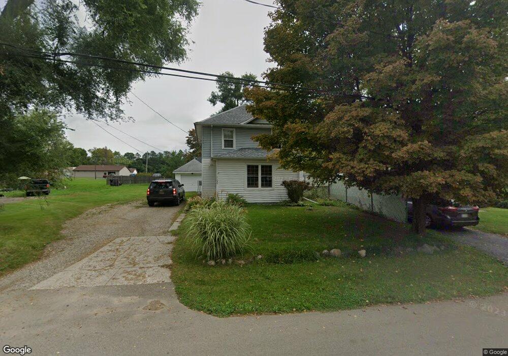
1137 Knapp Ave Jackson, MI 49203
Estimated Value: $126,140 - $165,000
3
Beds
2
Baths
1,472
Sq Ft
$95/Sq Ft
Est. Value
About This Home
This home is located at 1137 Knapp Ave, Jackson, MI 49203 and is currently estimated at $139,535, approximately $94 per square foot. 1137 Knapp Ave is a home located in Jackson County with nearby schools including Middle School at Parkside, Jackson High School, and St. Mary Star of the Sea School.
Ownership History
Date
Name
Owned For
Owner Type
Purchase Details
Closed on
Sep 7, 2000
Sold by
Lowe Donald E and Lowe Christine L
Bought by
Crawford Kevin L
Current Estimated Value
Home Financials for this Owner
Home Financials are based on the most recent Mortgage that was taken out on this home.
Original Mortgage
$85,500
Outstanding Balance
$31,250
Interest Rate
8.14%
Mortgage Type
Purchase Money Mortgage
Estimated Equity
$108,285
Create a Home Valuation Report for This Property
The Home Valuation Report is an in-depth analysis detailing your home's value as well as a comparison with similar homes in the area
Home Values in the Area
Average Home Value in this Area
Purchase History
| Date | Buyer | Sale Price | Title Company |
|---|---|---|---|
| Crawford Kevin L | $90,000 | Midstate Title Company |
Source: Public Records
Mortgage History
| Date | Status | Borrower | Loan Amount |
|---|---|---|---|
| Open | Crawford Kevin L | $85,500 |
Source: Public Records
Tax History
| Year | Tax Paid | Tax Assessment Tax Assessment Total Assessment is a certain percentage of the fair market value that is determined by local assessors to be the total taxable value of land and additions on the property. | Land | Improvement |
|---|---|---|---|---|
| 2025 | $1,507 | $53,400 | $0 | $0 |
| 2024 | $10 | $48,000 | $0 | $0 |
| 2023 | $932 | $44,800 | $0 | $0 |
| 2022 | $1,381 | $35,200 | $0 | $0 |
| 2021 | $1,469 | $41,000 | $0 | $0 |
| 2020 | $1,453 | $41,200 | $0 | $0 |
| 2019 | $1,439 | $38,500 | $0 | $0 |
| 2018 | $1,389 | $39,300 | $0 | $0 |
| 2017 | $1,109 | $39,100 | $0 | $0 |
| 2016 | $746 | $38,400 | $38,400 | $0 |
| 2015 | $1,051 | $36,700 | $36,700 | $0 |
| 2014 | $1,051 | $36,000 | $36,000 | $0 |
| 2013 | -- | $36,000 | $36,000 | $0 |
Source: Public Records
Map
Nearby Homes
- 1156 Knapp St
- 1139 S Dettman Rd
- 2718 Page Ave
- 900 S Roberts St
- Vl Watts St
- O Research Dr
- 781 Tomlinson St
- 509 S Gorham St
- 3975 Mcarthur Rd
- 111 N Forbes St
- VL Losey St
- 1506 Pringle Ave
- 106 N Dwight St
- 2300 Helena Ave
- 149 Mantle Ave
- 210 Watts Rd
- 131 Willow St
- 153 Mantle Ave
- 127 Bates St
- 2401 Vining St
- 1129 Knapp Ave
- 1143 Knapp St
- 1143 Knapp St
- 1138 S Dettman Rd
- 1125 Knapp Ave
- 1145 Knapp Ave
- 1145 Knapp Ave
- 1145 Knapp Ave
- 1134 Knapp St
- 1134 Knapp Ave
- 1144 Knapp Ave
- 1117 Knapp Ave
- 1196 S Dettman Rd
- 1148 Knapp Ave
- 1148 Knapp Ave
- 1120 Knapp Ave
- 1156 Knapp Ave
- 3029 Page Ave
- 1100 Knapp St
- 1198 S Dettman Rd