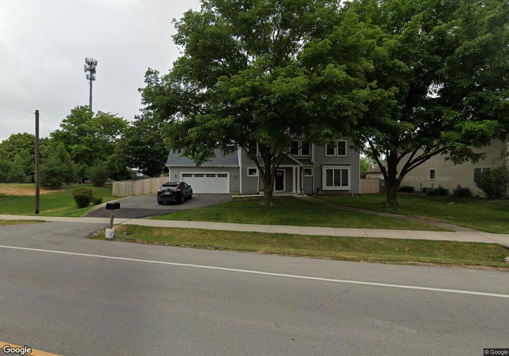
1137 Mccarthy Rd Lemont, IL 60439
Northeast Lemont NeighborhoodEstimated Value: $465,245 - $666,000
4
Beds
3
Baths
2,610
Sq Ft
$209/Sq Ft
Est. Value
About This Home
This home is located at 1137 Mccarthy Rd, Lemont, IL 60439 and is currently estimated at $545,561, approximately $209 per square foot. 1137 Mccarthy Rd is a home located in Cook County with nearby schools including Oakwood School, River Valley School, and Old Quarry Middle School.
Ownership History
Date
Name
Owned For
Owner Type
Purchase Details
Closed on
Apr 15, 2022
Sold by
Gotlund Rhett C
Bought by
Gotlund Rhett C and Gotlund Lily
Current Estimated Value
Home Financials for this Owner
Home Financials are based on the most recent Mortgage that was taken out on this home.
Original Mortgage
$340,000
Outstanding Balance
$313,752
Interest Rate
3.75%
Mortgage Type
New Conventional
Estimated Equity
$231,809
Purchase Details
Closed on
Mar 11, 2014
Sold by
Ahlberg Sharon and Gotlund Richard
Bought by
Gotlund Rhett C
Home Financials for this Owner
Home Financials are based on the most recent Mortgage that was taken out on this home.
Original Mortgage
$135,850
Interest Rate
4.34%
Mortgage Type
New Conventional
Purchase Details
Closed on
Oct 7, 2003
Sold by
Gotlund Ruth E
Bought by
Gotlund Ruth E and Ruth E Gotlund Trust
Create a Home Valuation Report for This Property
The Home Valuation Report is an in-depth analysis detailing your home's value as well as a comparison with similar homes in the area
Home Values in the Area
Average Home Value in this Area
Purchase History
| Date | Buyer | Sale Price | Title Company |
|---|---|---|---|
| Gotlund Rhett C | -- | None Listed On Document | |
| Gotlund Rhett C | $143,000 | First American Title | |
| Gotlund Ruth E | -- | -- |
Source: Public Records
Mortgage History
| Date | Status | Borrower | Loan Amount |
|---|---|---|---|
| Open | Gotlund Rhett C | $340,000 | |
| Previous Owner | Gotlund Rhett C | $135,850 |
Source: Public Records
Tax History
| Year | Tax Paid | Tax Assessment Tax Assessment Total Assessment is a certain percentage of the fair market value that is determined by local assessors to be the total taxable value of land and additions on the property. | Land | Improvement |
|---|---|---|---|---|
| 2025 | $8,806 | $45,688 | $9,352 | $36,336 |
| 2024 | $8,806 | $45,688 | $9,352 | $36,336 |
| 2023 | $7,860 | $45,688 | $9,352 | $36,336 |
| 2022 | $7,860 | $35,796 | $8,273 | $27,523 |
| 2021 | $4,232 | $21,312 | $8,272 | $13,040 |
| 2020 | $4,331 | $21,312 | $8,272 | $13,040 |
| 2019 | $4,573 | $19,773 | $8,272 | $11,501 |
| 2018 | $4,962 | $21,813 | $8,272 | $13,541 |
| 2017 | $4,888 | $21,813 | $8,272 | $13,541 |
| 2016 | $4,138 | $17,526 | $6,833 | $10,693 |
| 2015 | $4,200 | $17,526 | $6,833 | $10,693 |
| 2014 | $4,240 | $17,526 | $6,833 | $10,693 |
| 2013 | $924 | $20,649 | $6,833 | $13,816 |
Source: Public Records
Map
Nearby Homes
- 525 Senon Dr
- 441 Wheeler Dr
- 1004 Saddle Ln
- 11174 Tuscany Ln
- 1268 Durham Ln
- 614 Czacki St
- 700 Czacki St
- 14517 Albany Ave
- 400 Mccarthy Rd Unit 419
- 400 Mccarthy Rd Unit 421
- 1297 Mccarthy Rd
- 402 Stephen St
- 1343 Camelot Ln
- 523 Talcott Ave
- 12183 Morandi Ct
- 12185 Morandi Ct
- 12444 Killarney Dr
- 302 Freehauf St
- 1396 Notre Dame Dr
- 351 Front St Unit 2212
Your Personal Tour Guide
Ask me questions while you tour the home.