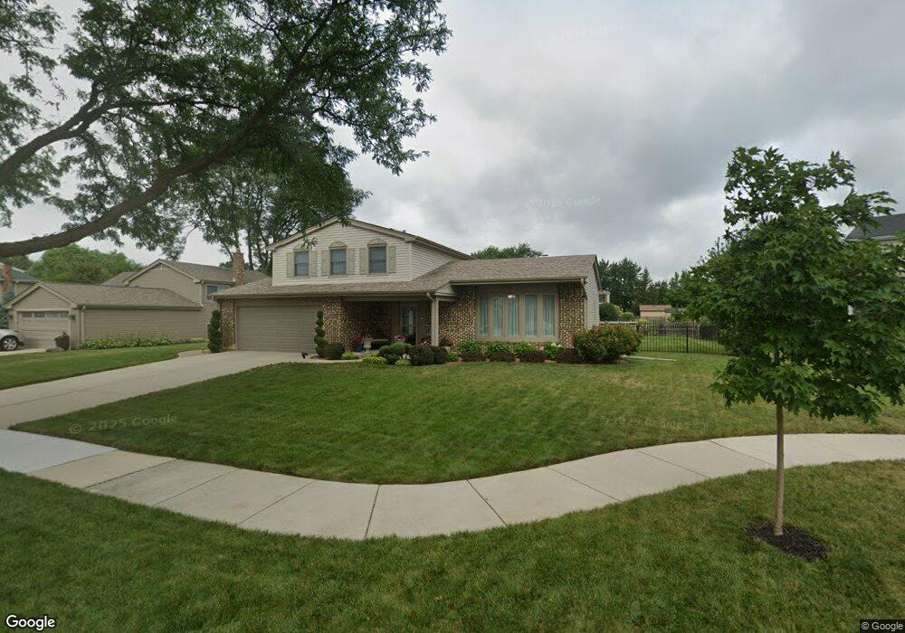
1138 Jamestown Ct Schaumburg, IL 60193
South Schaumburg NeighborhoodEstimated Value: $514,896 - $636,000
3
Beds
3
Baths
1,849
Sq Ft
$304/Sq Ft
Est. Value
About This Home
This home is located at 1138 Jamestown Ct, Schaumburg, IL 60193 and is currently estimated at $561,974, approximately $303 per square foot. 1138 Jamestown Ct is a home located in Cook County with nearby schools including Michael Collins Elementary School, Robert Frost Junior High School, and J B Conant High School.
Ownership History
Date
Name
Owned For
Owner Type
Purchase Details
Closed on
May 9, 2017
Sold by
Naumann David and Naumann Darlene
Bought by
Drost Kiviahan Memahon & Oconnor Llc
Current Estimated Value
Purchase Details
Closed on
Nov 21, 2003
Sold by
Naumann David and Naumann Darlene L
Bought by
Naumann David and Naumann Darlene L
Create a Home Valuation Report for This Property
The Home Valuation Report is an in-depth analysis detailing your home's value as well as a comparison with similar homes in the area
Home Values in the Area
Average Home Value in this Area
Purchase History
| Date | Buyer | Sale Price | Title Company |
|---|---|---|---|
| Drost Kiviahan Memahon & Oconnor Llc | -- | None Available | |
| Naumann David | -- | -- |
Source: Public Records
Tax History Compared to Growth
Tax History
| Year | Tax Paid | Tax Assessment Tax Assessment Total Assessment is a certain percentage of the fair market value that is determined by local assessors to be the total taxable value of land and additions on the property. | Land | Improvement |
|---|---|---|---|---|
| 2024 | $8,693 | $37,000 | $12,320 | $24,680 |
| 2023 | $8,378 | $37,000 | $12,320 | $24,680 |
| 2022 | $8,378 | $37,000 | $12,320 | $24,680 |
| 2021 | $7,038 | $29,216 | $6,720 | $22,496 |
| 2020 | $7,779 | $29,216 | $6,720 | $22,496 |
| 2019 | $7,782 | $32,463 | $6,720 | $25,743 |
| 2018 | $8,112 | $30,465 | $5,880 | $24,585 |
| 2017 | $8,002 | $30,465 | $5,880 | $24,585 |
| 2016 | $7,725 | $30,465 | $5,880 | $24,585 |
| 2015 | $7,057 | $26,212 | $5,040 | $21,172 |
| 2014 | $6,996 | $26,212 | $5,040 | $21,172 |
| 2013 | $6,799 | $26,212 | $5,040 | $21,172 |
Source: Public Records
Map
Nearby Homes
- 1078 Newport Harbor Unit 6101
- 1100 Boston Harbor Unit 7004
- 286 Nantucket Harbor Unit 601
- 421 E Wise Rd
- 1205 Laurel Ln
- 620 S Point Dr
- 731 Highpoint Ct
- 1323 S Roselle Rd
- 1420 Indian Hill Dr
- 826 Thornton Ct Unit 2AL
- 13 W Monterey Ave
- 717 Tipperary Ct Unit 1C
- 409 New York Ln
- 733 Limerick Ln Unit 7333D
- 722 Merlin Dr Unit 16
- 517 E Weathersfield Way
- 712 Tipperary Ct Unit 1C
- 711 Tipperary Ct Unit 2D
- 924 Surrey Dr Unit 1A
- 727 Killarney Ct Unit 2D
- 1142 Jamestown Ct
- 1134 Jamestown Ct
- 1143 Crest Ct
- 1139 Crest Ct
- 1146 Jamestown Ct
- 1128 Jamestown Ct
- 1111 Brunswick Harbor Unit 45
- 1111 Brunswick Harbor Unit 1111
- 1135 Jamestown Ct
- 1147 Crest Ct
- 1139 Jamestown Ct
- 1127 Jamestown Ct
- 1107 Brunswick Harbor Unit 45
- 1107 Brunswick Harbor Unit 1107
- 1107 Brunswick Harbor Unit 4501
- 1109 Brunswick Harbor Unit 45
- 1131 Jamestown Ct
- 1119 Brunswick Harbor Unit 44
- 1113 Brunswick Harbor Unit 44
- 1143 Jamestown Ct