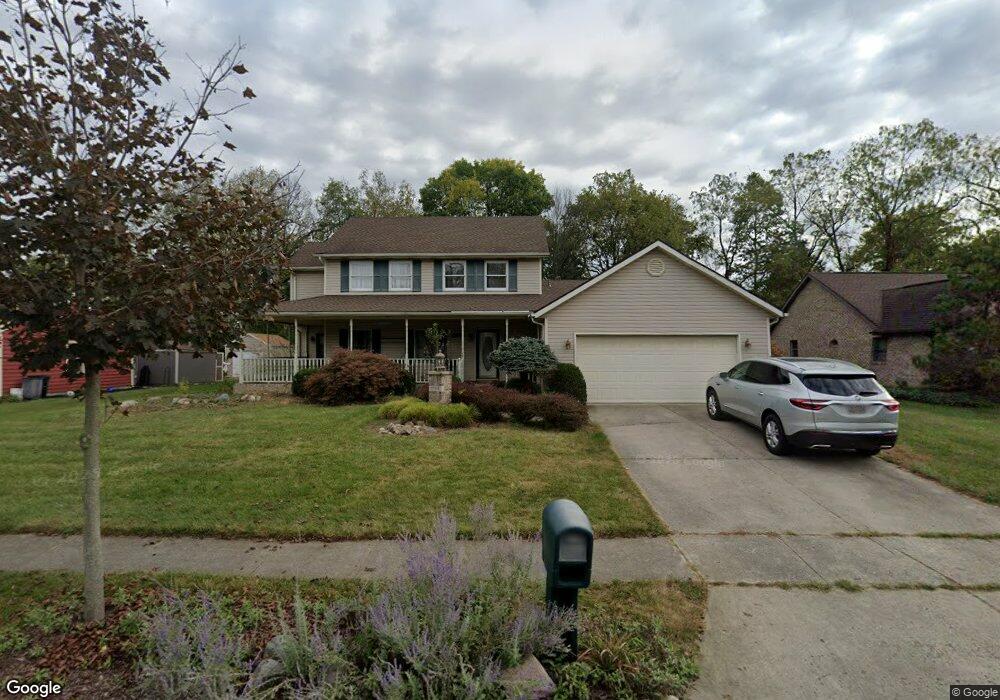
1138 Scanlon Ln Springfield, OH 45503
Estimated Value: $355,787 - $478,000
4
Beds
3
Baths
2,427
Sq Ft
$161/Sq Ft
Est. Value
About This Home
This home is located at 1138 Scanlon Ln, Springfield, OH 45503 and is currently estimated at $390,697, approximately $160 per square foot. 1138 Scanlon Ln is a home located in Clark County with nearby schools including Rolling Hills Elementary School, Northridge Middle School, and Kenton Ridge Middle & High School.
Ownership History
Date
Name
Owned For
Owner Type
Purchase Details
Closed on
May 3, 2018
Sold by
Mclaughlin Chelcey
Bought by
Mclaughlin Charles Lee and Le Mclaughlin Thomas Charles
Current Estimated Value
Purchase Details
Closed on
Jun 18, 1999
Sold by
Borger Christopher L and Borger Kristi N
Bought by
Wells Myron L and Wells Barbara S
Home Financials for this Owner
Home Financials are based on the most recent Mortgage that was taken out on this home.
Original Mortgage
$138,400
Interest Rate
5%
Mortgage Type
Purchase Money Mortgage
Purchase Details
Closed on
Oct 27, 1995
Sold by
Jenkins Larry B
Bought by
Borger Christopher L and Borger Kristi
Home Financials for this Owner
Home Financials are based on the most recent Mortgage that was taken out on this home.
Original Mortgage
$90,000
Interest Rate
7.65%
Mortgage Type
Purchase Money Mortgage
Create a Home Valuation Report for This Property
The Home Valuation Report is an in-depth analysis detailing your home's value as well as a comparison with similar homes in the area
Home Values in the Area
Average Home Value in this Area
Purchase History
| Date | Buyer | Sale Price | Title Company |
|---|---|---|---|
| Mclaughlin Charles Lee | -- | None Available | |
| Wells Myron L | $172,400 | -- | |
| Borger Christopher L | $173,500 | -- |
Source: Public Records
Mortgage History
| Date | Status | Borrower | Loan Amount |
|---|---|---|---|
| Previous Owner | Wells Myron L | $138,400 | |
| Previous Owner | Borger Christopher L | $90,000 |
Source: Public Records
Tax History Compared to Growth
Tax History
| Year | Tax Paid | Tax Assessment Tax Assessment Total Assessment is a certain percentage of the fair market value that is determined by local assessors to be the total taxable value of land and additions on the property. | Land | Improvement |
|---|---|---|---|---|
| 2024 | $3,686 | $84,450 | $19,100 | $65,350 |
| 2023 | $3,686 | $84,450 | $19,100 | $65,350 |
| 2022 | $3,699 | $84,450 | $19,100 | $65,350 |
| 2021 | $3,537 | $73,780 | $14,800 | $58,980 |
| 2020 | $3,541 | $73,780 | $14,800 | $58,980 |
| 2019 | $3,612 | $73,780 | $14,800 | $58,980 |
| 2018 | $3,495 | $69,020 | $15,140 | $53,880 |
| 2017 | $2,970 | $69,679 | $15,145 | $54,534 |
| 2016 | $2,948 | $69,679 | $15,145 | $54,534 |
| 2015 | $3,105 | $68,895 | $15,943 | $52,952 |
| 2014 | $2,718 | $68,895 | $15,943 | $52,952 |
| 2013 | $2,713 | $68,895 | $15,943 | $52,952 |
Source: Public Records
Map
Nearby Homes
- 1148 Foxboro Rd
- 1162 Kingsgate Rd
- 3032 Armsgate Rd Unit 25
- 3029 Bradford Dr Unit 46
- 3631 Kingsgate Ln
- 1509 Kingsgate Rd
- 1501 Kingsgate Rd
- 1139 Greenoak Ct
- 1503 Kingsgate Rd
- 1505 Kingsgate Rd
- 1507 Kingsgate Rd
- 4109 Derr Rd
- 4133 Willowbrook Dr
- 1732 Falmouth Ave
- 1781 Pinehurst Dr
- 647 Villa Rd Unit A
- 542 Villa Rd
- 4050 Tacoma St
- 3500 Oakmont Ct
- 1640 Montego Dr