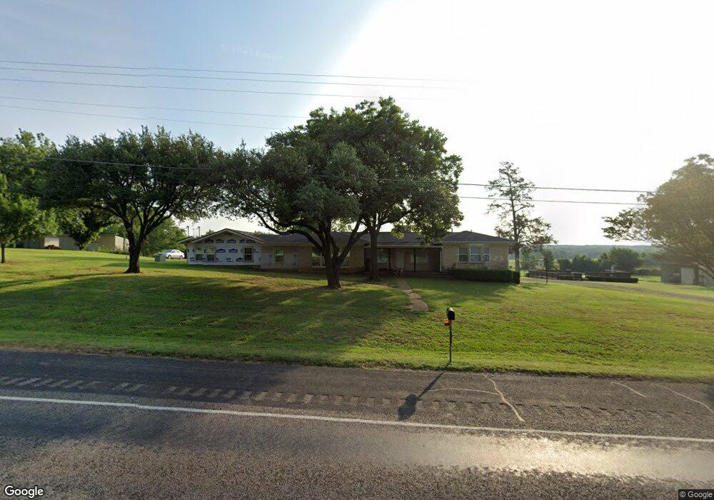
1138 Us Highway 69 Denison, TX 75021
Estimated Value: $319,722 - $442,000
--
Bed
--
Bath
2,168
Sq Ft
$176/Sq Ft
Est. Value
About This Home
This home is located at 1138 Us Highway 69, Denison, TX 75021 and is currently estimated at $380,861, approximately $175 per square foot. 1138 Us Highway 69 is a home with nearby schools including Lamar Elementary School, Scott Middle School, and Denison High School.
Ownership History
Date
Name
Owned For
Owner Type
Purchase Details
Closed on
Jul 19, 2010
Sold by
Gouge Dale R
Bought by
Rice Tyler and Sims Melissa
Current Estimated Value
Home Financials for this Owner
Home Financials are based on the most recent Mortgage that was taken out on this home.
Original Mortgage
$25,360
Outstanding Balance
$16,860
Interest Rate
4.73%
Mortgage Type
Purchase Money Mortgage
Estimated Equity
$364,001
Purchase Details
Closed on
Aug 11, 2009
Sold by
Macpherson Andrew D
Bought by
Rice Deborah Petersen
Create a Home Valuation Report for This Property
The Home Valuation Report is an in-depth analysis detailing your home's value as well as a comparison with similar homes in the area
Home Values in the Area
Average Home Value in this Area
Purchase History
| Date | Buyer | Sale Price | Title Company |
|---|---|---|---|
| Rice Tyler | -- | Grayson County Title | |
| Rice Deborah Petersen | -- | None Available |
Source: Public Records
Mortgage History
| Date | Status | Borrower | Loan Amount |
|---|---|---|---|
| Open | Rice Tyler | $25,360 |
Source: Public Records
Tax History Compared to Growth
Tax History
| Year | Tax Paid | Tax Assessment Tax Assessment Total Assessment is a certain percentage of the fair market value that is determined by local assessors to be the total taxable value of land and additions on the property. | Land | Improvement |
|---|---|---|---|---|
| 2025 | $2,578 | $254,736 | $68,368 | $186,368 |
| 2024 | $3,894 | $241,135 | $0 | $0 |
| 2023 | $2,228 | $219,214 | $0 | $0 |
| 2022 | $3,455 | $199,952 | $0 | $0 |
| 2021 | $3,403 | $181,504 | $33,020 | $148,484 |
| 2020 | $3,312 | $175,418 | $19,711 | $155,707 |
| 2019 | $3,225 | $157,776 | $19,655 | $138,121 |
| 2018 | $2,963 | $138,026 | $16,933 | $121,093 |
| 2017 | $2,933 | $135,740 | $17,008 | $118,732 |
| 2016 | $2,926 | $135,437 | $13,816 | $121,621 |
| 2015 | $0 | $140,220 | $12,745 | $127,475 |
| 2014 | -- | $141,336 | $12,745 | $128,591 |
Source: Public Records
Map
Nearby Homes
- 732 E Bullock St
- 721 E Bullock St
- 715 E Hanna St
- 705 E Hanna St
- TBD N Highway 69
- 621 E Murray St
- 622 E Heron St
- 417 E Texas St
- 21 Chaparral Estates Dr
- TBD Bells Dr
- 1506 S Travis St
- 609 E Monterey St
- TBD E Heron St
- 1534 E Texas St
- 1905 S Lamar Ave
- 1903 S Lamar Ave
- 1901 S Lamar Ave
- 401 E Monterey St
- 54 Doty Ln
- 415 E Monterey St
- 1080 Us Highway 69
- 1103 E Us Highway 69
- 1058 E Us Highway 69
- 1330 Us Highway 69
- 1191 E Us Highway 69
- 1335 Us Highway 69
- 1336 Hwy 69
- 947 Us Highway 69
- 911 E Us Highway 69
- 907 Us Highway 69
- 156 Desvoignes Rd
- 176 Desvoignes Rd
- 1382 Us Highway 69
- 108 Desvoignes Rd
- 1394 Us Highway 69
- 1396 Us Highway 69
- 821 Us Highway 69
- 1391 Us Highway 69
- 827 E Us Highway 69
- 249 Desvoignes Rd