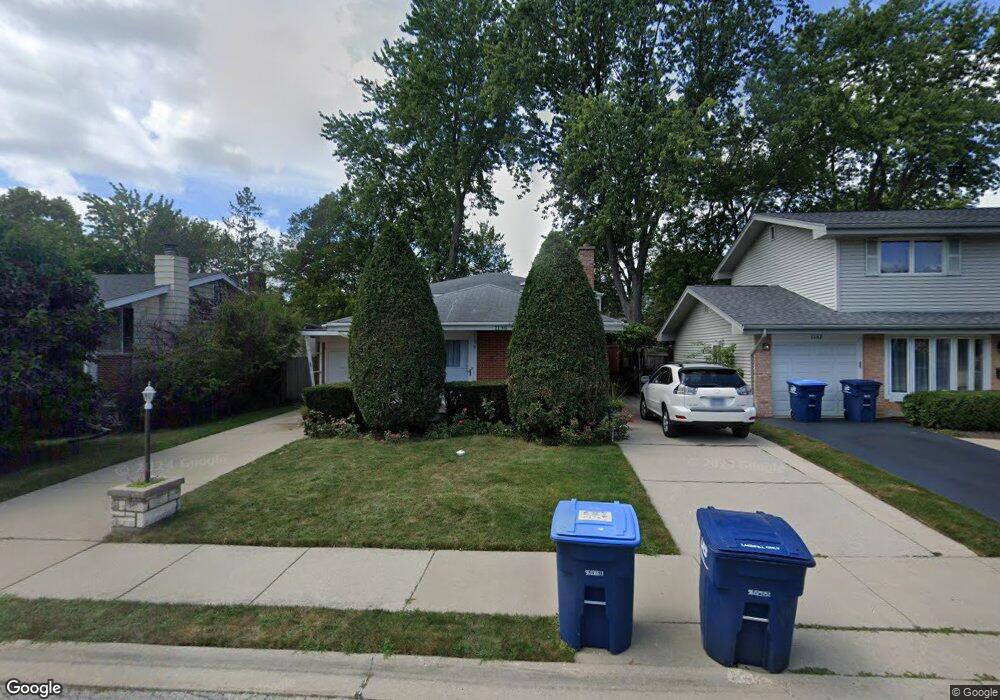
1138 Wayne Ave Deerfield, IL 60015
Estimated Value: $448,000 - $478,000
3
Beds
2
Baths
942
Sq Ft
$489/Sq Ft
Est. Value
About This Home
This home is located at 1138 Wayne Ave, Deerfield, IL 60015 and is currently estimated at $460,317, approximately $488 per square foot. 1138 Wayne Ave is a home located in Lake County with nearby schools including Wilmot Elementary School, Charles J Caruso Middle School, and Deerfield High School.
Ownership History
Date
Name
Owned For
Owner Type
Purchase Details
Closed on
Apr 14, 1995
Sold by
Hangleitner Roger and Hangleitner Phoebe
Bought by
Stremton Saharie and Stremton Maria
Current Estimated Value
Home Financials for this Owner
Home Financials are based on the most recent Mortgage that was taken out on this home.
Original Mortgage
$134,000
Interest Rate
8.42%
Purchase Details
Closed on
Jan 13, 1995
Sold by
Firstar Bank Illinois
Bought by
Hangleitner Roger and Hangleitner Phoebe
Create a Home Valuation Report for This Property
The Home Valuation Report is an in-depth analysis detailing your home's value as well as a comparison with similar homes in the area
Home Values in the Area
Average Home Value in this Area
Purchase History
| Date | Buyer | Sale Price | Title Company |
|---|---|---|---|
| Stremton Saharie | $167,500 | Attorneys Natl Title | |
| Hangleitner Roger | -- | -- |
Source: Public Records
Mortgage History
| Date | Status | Borrower | Loan Amount |
|---|---|---|---|
| Closed | Stremton Saharie | $134,000 |
Source: Public Records
Tax History
| Year | Tax Paid | Tax Assessment Tax Assessment Total Assessment is a certain percentage of the fair market value that is determined by local assessors to be the total taxable value of land and additions on the property. | Land | Improvement |
|---|---|---|---|---|
| 2024 | $9,386 | $112,224 | $35,971 | $76,253 |
| 2023 | $9,386 | $107,700 | $34,521 | $73,179 |
| 2022 | $9,607 | $107,362 | $37,080 | $70,282 |
| 2021 | $9,054 | $103,511 | $35,750 | $67,761 |
| 2020 | $8,709 | $103,729 | $35,825 | $67,904 |
| 2019 | $8,512 | $103,553 | $35,764 | $67,789 |
| 2018 | $7,652 | $96,665 | $37,908 | $58,757 |
| 2017 | $7,530 | $96,357 | $37,787 | $58,570 |
| 2016 | $7,313 | $92,713 | $36,358 | $56,355 |
| 2015 | $7,145 | $90,692 | $34,161 | $56,531 |
| 2014 | $7,236 | $86,995 | $34,406 | $52,589 |
| 2012 | $7,069 | $86,227 | $34,102 | $52,125 |
Source: Public Records
Map
Nearby Homes
- 1302 Hazel Ave
- 1054 Broadmoor Place
- 1165 Linden Ave
- 938 Hemlock St
- 1004 Broadmoor Place
- 1420 Crowe Ave
- 926 Cedar St
- 1030 Chestnut St
- 1525 Hawthorne Place
- 1335 Wilmot Rd
- 1106 Waukegan Rd
- 834 Chestnut St
- 826 Chestnut St
- 1632 Village Green Ct
- 1423 Northwoods Rd
- 954 Osterman Ave
- 930 King Richards Ct
- 1151 Walden Ln
- 1625 Marcie Ct Unit 5
- 1800 Telegraph Rd
- 1132 Wayne Ave
- 1142 Wayne Ave
- 1126 Wayne Ave
- 1133 Stratford Rd
- 1209 Greenwood Ave
- 1127 Stratford Rd
- 1150 Wayne Ave
- 1141 Stratford Rd
- 1217 Greenwood Ave
- 1120 Wayne Ave
- 1147 Wayne Ave
- 1121 Stratford Rd
- 1193 Robbie Ct
- 1155 Wayne Ave
- 1223 Greenwood Ave
- 1114 Wayne Ave
- 1115 Stratford Rd
- 1123 Wayne Ave
- 1187 Greenwood Ave
- 1184 Robbie Ct
Your Personal Tour Guide
Ask me questions while you tour the home.