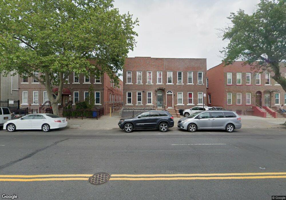
1138 White Plains Rd Bronx, NY 10472
Unionport NeighborhoodEstimated Value: $1,117,000 - $1,314,000
--
Bed
--
Bath
3,321
Sq Ft
$373/Sq Ft
Est. Value
About This Home
This home is located at 1138 White Plains Rd, Bronx, NY 10472 and is currently estimated at $1,239,667, approximately $373 per square foot. 1138 White Plains Rd is a home located in Bronx County with nearby schools including The Dr Emmett W. Bassett School and Holy Family School.
Ownership History
Date
Name
Owned For
Owner Type
Purchase Details
Closed on
Dec 5, 2019
Sold by
1138 White Plains Inc
Bought by
1138 White Plains Road Llc
Current Estimated Value
Purchase Details
Closed on
Mar 17, 2017
Sold by
Islam Kokan and Islam Risfa U
Bought by
1138 White Plains Inc
Purchase Details
Closed on
Dec 9, 1999
Sold by
Varghese Thomas and Varghese Rachel
Bought by
Islam Risfa U and Islam Kokan
Home Financials for this Owner
Home Financials are based on the most recent Mortgage that was taken out on this home.
Original Mortgage
$259,868
Interest Rate
8.26%
Mortgage Type
FHA
Create a Home Valuation Report for This Property
The Home Valuation Report is an in-depth analysis detailing your home's value as well as a comparison with similar homes in the area
Home Values in the Area
Average Home Value in this Area
Purchase History
| Date | Buyer | Sale Price | Title Company |
|---|---|---|---|
| 1138 White Plains Road Llc | -- | -- | |
| 1138 White Plains Inc | -- | -- | |
| Islam Risfa U | $260,000 | -- |
Source: Public Records
Mortgage History
| Date | Status | Borrower | Loan Amount |
|---|---|---|---|
| Previous Owner | Islam Risfa U | $259,868 |
Source: Public Records
Tax History Compared to Growth
Tax History
| Year | Tax Paid | Tax Assessment Tax Assessment Total Assessment is a certain percentage of the fair market value that is determined by local assessors to be the total taxable value of land and additions on the property. | Land | Improvement |
|---|---|---|---|---|
| 2025 | $18,038 | $148,928 | $61,767 | $87,161 |
| 2024 | $18,038 | $144,282 | $51,803 | $92,479 |
| 2023 | $16,390 | $133,614 | $51,463 | $82,151 |
| 2022 | $15,142 | $292,950 | $121,500 | $171,450 |
| 2021 | $0 | $234,450 | $121,500 | $112,950 |
| 2020 | $14,188 | $257,400 | $121,500 | $135,900 |
| 2019 | $13,998 | $240,840 | $121,500 | $119,340 |
| 2018 | $13,073 | $102,780 | $62,221 | $40,559 |
| 2017 | $12,108 | $95,200 | $64,100 | $31,100 |
| 2016 | $11,364 | $88,151 | $65,387 | $22,764 |
| 2015 | $7,378 | $88,123 | $61,323 | $26,800 |
| 2014 | $7,378 | $85,374 | $63,853 | $21,521 |
Source: Public Records
Map
Nearby Homes
- 1210 White Plains Rd
- 1886 Gleason Ave
- 1870 Gleason Ave
- 1955 Haviland Ave
- 1966 Newbold Ave Unit 104
- 1966 Newbold Ave Unit 108
- 1966 Newbold Ave Unit 1510
- 1966 Newbold Ave Unit 405
- 1169 Leland Ave
- 1171 Leland Ave
- 1143 Leland Ave
- 1055 Virginia Ave
- 1262 Leland Ave
- 2016 Haviland Ave
- 1068 Pugsley Ave
- 1314 Virginia Ave Unit 6F
- 1314 Virginia Ave Unit MA
- 1314 Virginia Ave Unit 6G
- 1314 Virginia Ave Unit 5A
- 1934 Chatterton Ave
- 1140 White Plains Rd
- 1136 White Plains Rd
- 1142 White Plains Rd
- 1142 White Plains Rd Unit 4FAM
- 1134 White Plains Rd
- 1144 White Plains Rd
- 1132 White Plains Rd
- 1130 White Plains Rd
- 1130B White Plains Rd
- 1146 White Plains Rd
- 1155 Virginia Ave
- 1153 Virginia Ave
- 1157 Virginia Ave
- 1148 White Plains Rd
- 1159 Virginia Ave Unit 1
- 1159 Virginia Ave
- 1151 Virginia Ave
- 1128 White Plains Rd
- 1161 Virginia Ave
- 1126 White Plains Rd