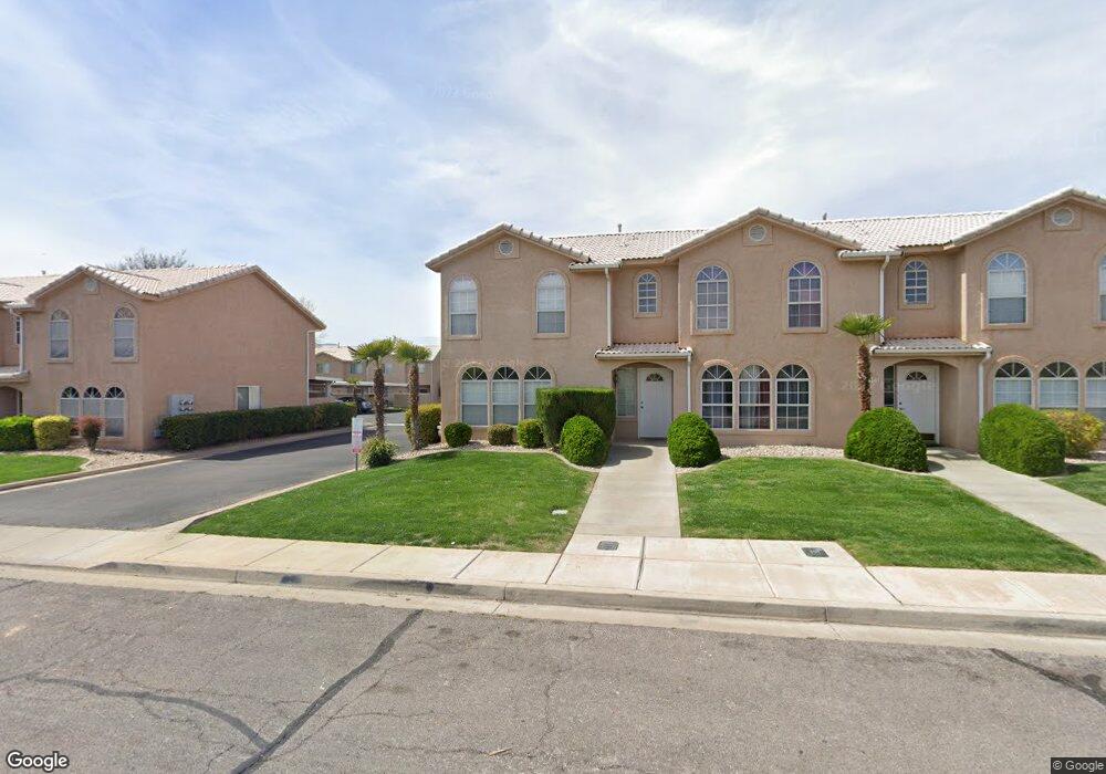
1139 N 1570 W Unit 33 Saint George, UT 84770
Estimated Value: $288,000 - $310,000
3
Beds
3
Baths
1,320
Sq Ft
$226/Sq Ft
Est. Value
About This Home
This home is located at 1139 N 1570 W Unit 33, Saint George, UT 84770 and is currently estimated at $297,933, approximately $225 per square foot. 1139 N 1570 W Unit 33 is a home located in Washington County with nearby schools including Paradise Canyon, Snow Canyon Middle School, and Lava Ridge Intermediate School.
Ownership History
Date
Name
Owned For
Owner Type
Purchase Details
Closed on
Mar 26, 2024
Sold by
Loveridge John A and Loveridge Penny L
Bought by
Loveridge Family Trust and Loveridge
Current Estimated Value
Purchase Details
Closed on
Mar 8, 2021
Sold by
Latour Corporation
Bought by
Loveridge John and Loveridge Penny
Purchase Details
Closed on
Aug 1, 2019
Sold by
Johnson Sharalee H
Bought by
Latour Corporation
Purchase Details
Closed on
Jun 21, 2016
Sold by
Johnson Sharalee H
Bought by
Johnson Sharalee H and Jayson And Sharalee Johnson Trust
Purchase Details
Closed on
Oct 17, 2012
Sold by
Johnson Sharalee H
Bought by
Jonson Sharalee H and The Jayson And Sharalee Johnson Trust
Purchase Details
Closed on
Jun 26, 2012
Sold by
Campbell Kasey and Campbell Amber A
Bought by
Johnson Sharalee H
Home Financials for this Owner
Home Financials are based on the most recent Mortgage that was taken out on this home.
Original Mortgage
$60,000
Interest Rate
3.74%
Mortgage Type
New Conventional
Purchase Details
Closed on
Nov 21, 2006
Sold by
Campbell Kasey
Bought by
Campbell Kasey and Campbell Amber A
Create a Home Valuation Report for This Property
The Home Valuation Report is an in-depth analysis detailing your home's value as well as a comparison with similar homes in the area
Home Values in the Area
Average Home Value in this Area
Purchase History
| Date | Buyer | Sale Price | Title Company |
|---|---|---|---|
| Loveridge Family Trust | -- | None Listed On Document | |
| Loveridge John | -- | Gt Title Services | |
| Latour Corporation | -- | Backman Title Services | |
| Johnson Sharalee H | -- | Title Of Utah Inc | |
| Johnson Sharalee H | -- | First Title Of Utah | |
| Jonson Sharalee H | -- | None Available | |
| Johnson Sharalee H | -- | Skyview Title Ins Agency | |
| Campbell Kasey | -- | First American Title |
Source: Public Records
Mortgage History
| Date | Status | Borrower | Loan Amount |
|---|---|---|---|
| Previous Owner | Johnson Sharalee H | $60,000 |
Source: Public Records
Tax History Compared to Growth
Tax History
| Year | Tax Paid | Tax Assessment Tax Assessment Total Assessment is a certain percentage of the fair market value that is determined by local assessors to be the total taxable value of land and additions on the property. | Land | Improvement |
|---|---|---|---|---|
| 2025 | $1,980 | $289,500 | $70,000 | $219,500 |
| 2023 | $1,999 | $298,600 | $65,000 | $233,600 |
| 2022 | $2,653 | $305,800 | $65,000 | $240,800 |
| 2021 | $976 | $204,500 | $40,000 | $164,500 |
| 2020 | $870 | $171,700 | $35,000 | $136,700 |
| 2019 | $854 | $164,600 | $30,000 | $134,600 |
| 2018 | $806 | $77,880 | $0 | $0 |
| 2017 | $685 | $66,220 | $0 | $0 |
| 2016 | $670 | $59,895 | $0 | $0 |
| 2015 | $642 | $55,055 | $0 | $0 |
| 2014 | $576 | $49,720 | $0 | $0 |
Source: Public Records
Map
Nearby Homes
- 1708 W 1020 N Unit 146
- 1589 W 1270 N
- 1742 W 1020 N Unit 123
- 954 N 1725 W Unit 32
- 1075 N 1400 W Unit 32
- 1782 W 1020 N Unit 133
- 1542 W 1270 N
- 1074 1400 St W
- 1070 1400 St W
- 1748 W 1280 N
- 1793 W 950 N Unit 3
- 1840 W 1100 N Unit 28
- 1840 W 1100 N Unit 17
- 1840 W 1100 N Unit 55
- 1811 W 950 N Unit 95
- 1373 N 1610 W
- 1548 W 1370 N
- 1811 W 1300 N
- 1305 N Royal Cir
- 1108 N 1300 W Unit 26
- 1145 N 1570 W Unit 31
- 1145 N 1570 W
- 1133 N 1570 W
- 1133 N 1570 W Unit 34
- 1149 N 1570 W Unit 30
- 1131 N 1570 W
- 1131 N 1570 W Unit 35
- 1153 N 1570 W Unit 29
- 1127 N 1570 W
- 1127 N 1570 W Unit 36
- 1157 N 1570 W Unit 28
- 1123 N 1570 W
- 1119 N 1570 W
- 1119 N 1570 W Unit 38
- 1146 N 1620 W Unit 16
- 1591 W 1170 N Unit 24
- 1587 W 1170 N Unit 25
- 1595 W 1170 N Unit 23
- 1138 N 1620 W Unit 15
- 1583 W 1170 N Unit 26