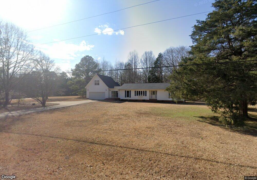
1139 Norman Dr Rock Hill, SC 29732
Estimated Value: $308,000 - $350,287
--
Bed
--
Bath
2,095
Sq Ft
$153/Sq Ft
Est. Value
About This Home
This home is located at 1139 Norman Dr, Rock Hill, SC 29732 and is currently estimated at $321,322, approximately $153 per square foot. 1139 Norman Dr is a home located in York County with nearby schools including Jefferson Elementary School, York Intermediate School, and York Middle School.
Ownership History
Date
Name
Owned For
Owner Type
Purchase Details
Closed on
Apr 25, 2025
Sold by
Wingate Terry B
Bought by
Channell Carson Anthony and Killian Tyler Mackenzie
Current Estimated Value
Home Financials for this Owner
Home Financials are based on the most recent Mortgage that was taken out on this home.
Original Mortgage
$294,500
Outstanding Balance
$293,318
Interest Rate
6%
Mortgage Type
New Conventional
Estimated Equity
$28,004
Purchase Details
Closed on
Aug 3, 2015
Sold by
Wingate Terry B and Wingate Beverly L
Bought by
Wingate Terry B and Wingate Beverly L
Create a Home Valuation Report for This Property
The Home Valuation Report is an in-depth analysis detailing your home's value as well as a comparison with similar homes in the area
Home Values in the Area
Average Home Value in this Area
Purchase History
| Date | Buyer | Sale Price | Title Company |
|---|---|---|---|
| Channell Carson Anthony | $310,000 | None Listed On Document | |
| Wingate Terry B | -- | -- |
Source: Public Records
Mortgage History
| Date | Status | Borrower | Loan Amount |
|---|---|---|---|
| Open | Channell Carson Anthony | $294,500 |
Source: Public Records
Tax History Compared to Growth
Tax History
| Year | Tax Paid | Tax Assessment Tax Assessment Total Assessment is a certain percentage of the fair market value that is determined by local assessors to be the total taxable value of land and additions on the property. | Land | Improvement |
|---|---|---|---|---|
| 2024 | $607 | $5,497 | $787 | $4,710 |
| 2023 | $619 | $5,497 | $787 | $4,710 |
| 2022 | $619 | $5,497 | $787 | $4,710 |
| 2021 | -- | $5,497 | $787 | $4,710 |
| 2020 | $618 | $5,497 | $0 | $0 |
| 2019 | $510 | $4,780 | $0 | $0 |
| 2018 | $491 | $4,780 | $0 | $0 |
| 2017 | $467 | $4,780 | $0 | $0 |
| 2016 | $461 | $4,780 | $0 | $0 |
| 2014 | $522 | $4,780 | $1,000 | $3,780 |
| 2013 | $522 | $5,520 | $1,000 | $4,520 |
Source: Public Records
Map
Nearby Homes
- 2548 Gordon Rd
- 6832 Mandarin Dr
- 6841 Mandarin Dr
- 3805 Hwy. 324 E- #3 S Carolina 324
- 3805 Hwy. 324 E- #2 S Carolina 324
- 3805 Hwy. 324 E- #1 S Carolina 324
- 3805- E S Carolina 324
- 200 Copper Kettle Dr
- 2784 Billy Wilson Rd Unit 15
- 1567 Fayrene Rd
- 1675 Minnie Ln
- 1462 Mathis Rd
- 0 State Road S-46-995
- 4912 York Hwy
- 305 Home Ct
- 2018 Whiskery Ct
- 1419 Dove Landing Rd
- 1217 Maddy Ln
- 4692 Summerlin Place
- 1249 Maddy Ln
- 1140 Norman Dr
- 1163 Norman Dr
- 1191 Barnswallow Rd
- 3112 Mt Gallant Rd
- 1164 Norman Dr
- 1164 Norman Dr
- 1115 Norman Dr
- 6727 Turkey Farm Rd
- 1187 Norman Dr
- 1184 Norman Dr Unit 9
- 6755 Turkey Farm Rd
- 6771 Turkey Farm Rd
- 510 Midnight Cir
- 1146 Louie Rd
- 1211 Norman Dr
- 1187 Barnswallow Rd
- 1200 Norman Dr
- 6767 Turkey Farm Rd
- 1170 Louie Rd
- 1147 Louie Rd