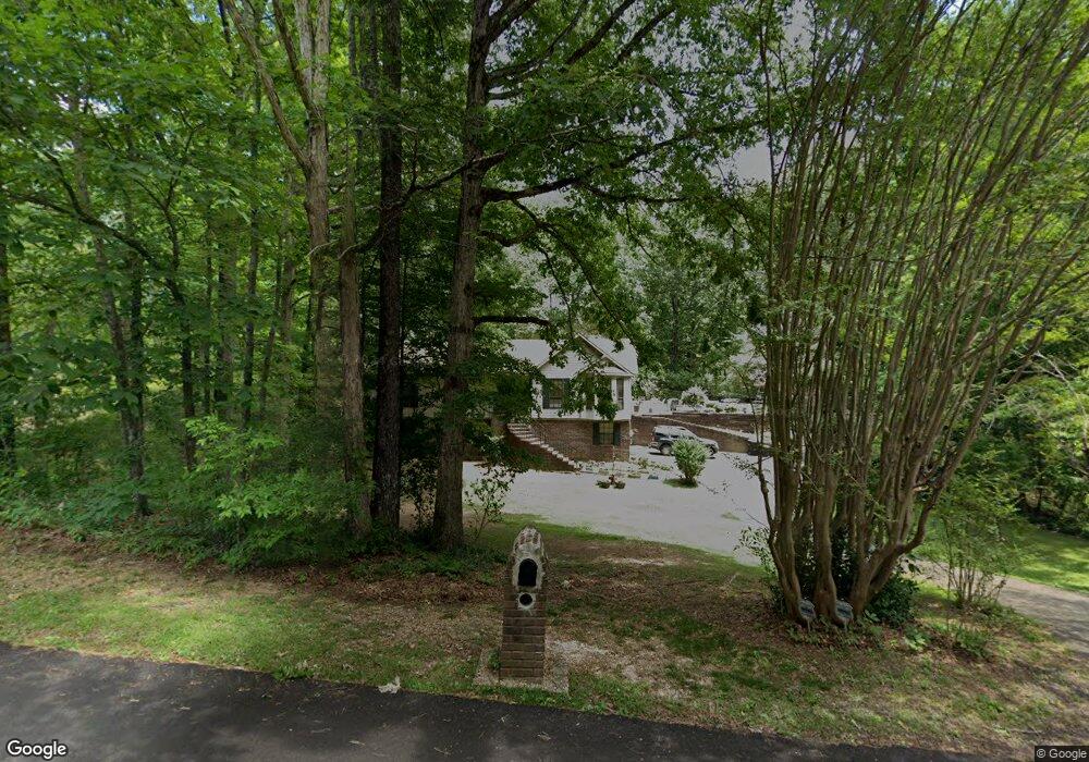
1139 Rock Crest Dr Mc Calla, AL 35111
Estimated Value: $276,000 - $309,000
3
Beds
2
Baths
1,471
Sq Ft
$195/Sq Ft
Est. Value
About This Home
This home is located at 1139 Rock Crest Dr, Mc Calla, AL 35111 and is currently estimated at $287,385, approximately $195 per square foot. 1139 Rock Crest Dr is a home located in Jefferson County with nearby schools including Mcadory Elementary School, Mcadory Middle School, and Mcadory High School.
Ownership History
Date
Name
Owned For
Owner Type
Purchase Details
Closed on
Feb 18, 2005
Sold by
Rose Donald Leon and Rose Mia M
Bought by
Maharrey Danny W and Murphy Timothy Hunter
Current Estimated Value
Home Financials for this Owner
Home Financials are based on the most recent Mortgage that was taken out on this home.
Original Mortgage
$159,120
Outstanding Balance
$80,878
Interest Rate
5.75%
Mortgage Type
Purchase Money Mortgage
Estimated Equity
$206,507
Purchase Details
Closed on
Jun 29, 2001
Sold by
Hyde Franklin D and Hyde Sammie L
Bought by
Rose Donald Leon
Home Financials for this Owner
Home Financials are based on the most recent Mortgage that was taken out on this home.
Original Mortgage
$122,000
Interest Rate
7.17%
Create a Home Valuation Report for This Property
The Home Valuation Report is an in-depth analysis detailing your home's value as well as a comparison with similar homes in the area
Home Values in the Area
Average Home Value in this Area
Purchase History
| Date | Buyer | Sale Price | Title Company |
|---|---|---|---|
| Maharrey Danny W | $198,900 | -- | |
| Rose Donald Leon | $152,500 | Lawyers Title Insurance Corp |
Source: Public Records
Mortgage History
| Date | Status | Borrower | Loan Amount |
|---|---|---|---|
| Open | Maharrey Danny W | $159,120 | |
| Closed | Rose Donald Leon | $122,000 | |
| Closed | Maharrey Danny W | $39,780 |
Source: Public Records
Tax History Compared to Growth
Tax History
| Year | Tax Paid | Tax Assessment Tax Assessment Total Assessment is a certain percentage of the fair market value that is determined by local assessors to be the total taxable value of land and additions on the property. | Land | Improvement |
|---|---|---|---|---|
| 2024 | $1,344 | $26,520 | -- | -- |
| 2022 | $1,091 | $22,840 | $6,500 | $16,340 |
| 2021 | $892 | $18,860 | $6,500 | $12,360 |
| 2020 | $1,090 | $17,470 | $6,500 | $10,970 |
| 2019 | $870 | $18,420 | $0 | $0 |
| 2018 | $877 | $18,560 | $0 | $0 |
| 2017 | $846 | $17,940 | $0 | $0 |
| 2016 | $846 | $17,940 | $0 | $0 |
| 2015 | $910 | $19,220 | $0 | $0 |
| 2014 | $950 | $18,400 | $0 | $0 |
| 2013 | $950 | $18,980 | $0 | $0 |
Source: Public Records
Map
Nearby Homes
- 1134 Rock Crest Dr
- 1114 Rock Crest Dr
- 6525 Shadowrock Cir Unit 10
- 1016 Tall Oaks Cir Unit 1
- 2134 Rock Mountain Dr
- 2157 Lakeside Dr
- 2186 Rock Mountain Lake Dr
- 2216 Lakeside Dr
- 2005 Rock Mountain Dr Unit 5
- 1700 Lakeside Dr
- 2010 Rock Mountain Dr
- 501 Waterside Cir
- 993 Coleman Dr
- 1934 Martin Cir
- 1928 Lakeside Dr
- 1904 Leafwood Cir
- 1901 Lakeside Dr
- 7045 Summerdale Dr
- Beau Ridge Ln
- 8410 Beau Ridge Ln
- 1131 Rock Crest Dr
- 1140 Victoria Dr
- 1136 Victoria Dr
- 1144 Victoria Dr
- 1132 Victoria Dr
- 1130 Rock Crest Dr
- 1126 Rock Crest Dr
- 1138 Rock Crest Dr
- 1128 Victoria Dr
- 1127 Rock Crest Dr
- 1148 Victoria Dr
- 1122 Rock Crest Dr
- 1142 Rock Crest Dr
- 1141 Victoria Dr
- 1145 Victoria Dr
- 1124 Victoria Dr
- 1152 Victoria Dr
- 1152 Lake Victoria Dr
- 1137 Victoria Dr