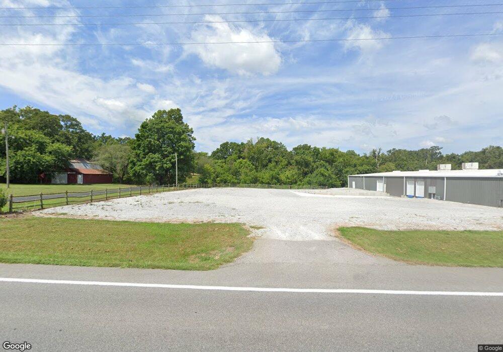
11391 N Highway 59 Gravette, AR 72736
Estimated Value: $186,970
--
Bed
1
Bath
1,264
Sq Ft
$148/Sq Ft
Est. Value
About This Home
This home is located at 11391 N Highway 59, Gravette, AR 72736 and is currently estimated at $186,970, approximately $147 per square foot. 11391 N Highway 59 is a home located in Benton County with nearby schools including Glenn Duffy Elementary School, Gravette Upper Elementary School, and Gravette Middle School.
Ownership History
Date
Name
Owned For
Owner Type
Purchase Details
Closed on
Jun 16, 2015
Sold by
Commissioner Of State Lands
Bought by
Cornelius Lorraine
Current Estimated Value
Purchase Details
Closed on
Oct 9, 2006
Sold by
Henley Kathleen
Bought by
Cornelius Lorraine
Purchase Details
Closed on
Apr 20, 2006
Sold by
Henley Joel E and Henley Kathleen
Bought by
Henley Kathleen
Purchase Details
Closed on
Aug 2, 1999
Bought by
Henley
Purchase Details
Closed on
Nov 29, 1993
Bought by
Oaks
Create a Home Valuation Report for This Property
The Home Valuation Report is an in-depth analysis detailing your home's value as well as a comparison with similar homes in the area
Home Values in the Area
Average Home Value in this Area
Purchase History
| Date | Buyer | Sale Price | Title Company |
|---|---|---|---|
| Cornelius Lorraine | $1,344 | None Available | |
| Cornelius Lorraine | $74,000 | None Available | |
| Henley Kathleen | -- | None Available | |
| Henley | $62,000 | -- | |
| Oaks | $39,000 | -- |
Source: Public Records
Tax History Compared to Growth
Tax History
| Year | Tax Paid | Tax Assessment Tax Assessment Total Assessment is a certain percentage of the fair market value that is determined by local assessors to be the total taxable value of land and additions on the property. | Land | Improvement |
|---|---|---|---|---|
| 2025 | $278 | $6,101 | $5,600 | $501 |
| 2024 | $270 | $6,101 | $5,600 | $501 |
| 2023 | $162 | $3,667 | $3,400 | $267 |
| 2022 | $728 | $19,440 | $3,400 | $16,040 |
| 2021 | $665 | $19,440 | $3,400 | $16,040 |
| 2020 | $607 | $12,960 | $1,800 | $11,160 |
| 2019 | $607 | $12,960 | $1,800 | $11,160 |
| 2018 | $607 | $12,960 | $1,800 | $11,160 |
| 2017 | $214 | $12,960 | $1,800 | $11,160 |
| 2016 | $214 | $12,960 | $1,800 | $11,160 |
| 2015 | $536 | $12,110 | $1,000 | $11,110 |
| 2014 | $186 | $12,110 | $1,000 | $11,110 |
Source: Public Records
Map
Nearby Homes
- 18790 Huntington Dr
- 19000 Huntington Dr
- 10866 Hodge Ln
- 19218 Huntington Dr
- TBD - 3.54 acres Bethel Rd
- TBD - 3.5ac Bethel Rd
- TBD - 8.5ac Bethel Rd
- 19537 Eastfork Ln
- 0 Mt Olive Rd Unit 1309203
- 17322 Bethel Rd
- 305 Irving St SW
- 802 2nd Ave SE
- 300 Huntington St SW
- 17605 Bittersweet Rd
- 704 2nd Ave SW
- 17615 N Mount Olive Rd
- 310 Jenna Ln
- 508 2nd Ave SW
- 17085 Stage Coach Rd
- 609 6th Ave SW
- 11391 N Highway 59
- 11427 N Highway 59
- 11427 N Highway 59
- 11531 Bright Valley Rd
- 11521 Bright Valley Rd
- 11387 N Highway 59
- 11387 & 11389 Highway 59
- 11181 N Hwy 59
- 11108 N Highway 59
- 11102 N Highway 59
- 11209 N Highway 59
- 11527 Bright Valley Rd
- 0 Bethal Rd
- TBD Bethel Rd
- 18551 Bethel Rd
- 18764 Huntington Dr
- 9783 N Hwy 59
- 0 N Hwy 59 Hwy Unit 574198
- 0 S Hwy 59 Hwy Unit 600727
- 0 NE Hwy 59 Ave Unit 623404
