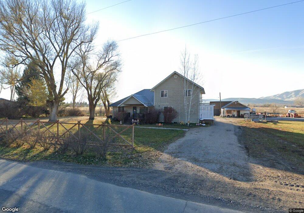
11396 S 4600 W Payson, UT 84651
6
Beds
3
Baths
2,282
Sq Ft
43,996
Sq Ft Lot
About This Home
This home is located at 11396 S 4600 W, Payson, UT 84651. 11396 S 4600 W is a home located in Utah County with nearby schools including Taylor Elementary School, Salem Junior High School, and Valley View Middle School.
Create a Home Valuation Report for This Property
The Home Valuation Report is an in-depth analysis detailing your home's value as well as a comparison with similar homes in the area
Home Values in the Area
Average Home Value in this Area
Tax History
| Year | Tax Paid | Tax Assessment Tax Assessment Total Assessment is a certain percentage of the fair market value that is determined by local assessors to be the total taxable value of land and additions on the property. | Land | Improvement |
|---|---|---|---|---|
| 2024 | $2,158 | $219,670 | $0 | $0 |
| 2023 | $2,099 | $214,170 | $0 | $0 |
| 2022 | $1,842 | $184,855 | $0 | $0 |
| 2021 | $1,626 | $261,700 | $150,200 | $111,500 |
| 2020 | $1,503 | $236,700 | $125,200 | $111,500 |
| 2019 | $1,310 | $211,600 | $110,200 | $101,400 |
| 2018 | $1,225 | $190,600 | $90,200 | $100,400 |
| 2017 | $1,153 | $96,525 | $0 | $0 |
| 2016 | $1,103 | $91,685 | $0 | $0 |
| 2015 | $1,035 | $85,470 | $0 | $0 |
| 2014 | $1,143 | $85,470 | $0 | $0 |
Source: Public Records
Map
Nearby Homes
- 9022 S 4400 W
- 1218 S 1740 W
- 1208 S 1740 W
- 2200 W 1130 St S
- 1963 W 1150 S Unit 1032
- 1967 W 1150 S Unit 1033
- 1971 W 1150 S Unit 1034
- 1973 W 1150 S Unit 1035
- 1979 W 1150 S Unit 1036
- 1983 W 1150 S Unit 1037
- 1964 W 1150 S Unit 1029
- 1968 W 1150 S Unit 1028
- 1972 W 1150 S Unit 1027
- 1984 W 1150 S Unit 1024
- 2011 W 1150 S Unit 1042
- 1992 W 1150 S Unit 1022
- 2031 W 1150 S Unit 1044
- 1045 S 1700 W Unit 1232
- 1045 S 1700 W Unit 311
- 1045 S 1700 W Unit 520
- 1354 S 1700 W
- 1412 S 1700 W
- 1705 W 1210 St S
- 1711 W 1210 S
- 1715 W 1210 S
- 1721 W 1210 S
- 1725 W 1210 S
- 1731 W 1210 S
- 1737 W 1210 S
- 1737 W 1210 S Unit 35
- 1228 S 1740 W
- 10800 S 1700 W
- 11950 S 1700 W
- 1224 S 1740 W
- 1212 S 1740 W
- 1201 S 1700 W
- 1712 W 1210 S Unit 47
- 1706 W 1210 S
- 1208 S 1740 W Unit 30
- 1722 W 1210 S
Your Personal Tour Guide
Ask me questions while you tour the home.