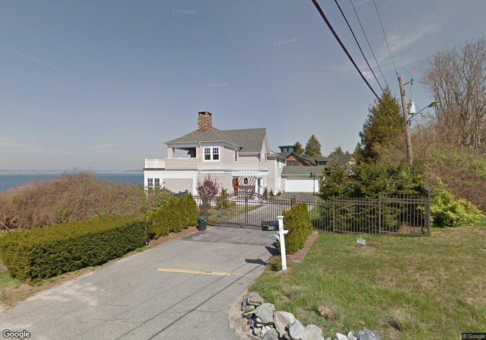
114 Aaron Ave Bristol, RI 02809
Bristol Highlands NeighborhoodEstimated Value: $1,095,000 - $2,381,000
3
Beds
3
Baths
3,004
Sq Ft
$577/Sq Ft
Est. Value
About This Home
This home is located at 114 Aaron Ave, Bristol, RI 02809 and is currently estimated at $1,732,649, approximately $576 per square foot. 114 Aaron Ave is a home located in Bristol County with nearby schools including Mt. Hope High School, Highlander Charter Middle and High School, and Our Lady of Mt. Carmel School.
Ownership History
Date
Name
Owned For
Owner Type
Purchase Details
Closed on
Feb 17, 2015
Sold by
Kulbieda Laureen J
Bought by
Kulbieda Richard M and Kulbieda Laureen J
Current Estimated Value
Purchase Details
Closed on
Dec 27, 2001
Sold by
Murgo Joseph A and Murgo Stephen
Bought by
Kulbeida Richard M and Kulbeida Laureen
Create a Home Valuation Report for This Property
The Home Valuation Report is an in-depth analysis detailing your home's value as well as a comparison with similar homes in the area
Home Values in the Area
Average Home Value in this Area
Purchase History
| Date | Buyer | Sale Price | Title Company |
|---|---|---|---|
| Kulbieda Richard M | -- | -- | |
| Kulbeida Richard M | $728,000 | -- |
Source: Public Records
Mortgage History
| Date | Status | Borrower | Loan Amount |
|---|---|---|---|
| Previous Owner | Kulbeida Richard M | $500,000 | |
| Previous Owner | Kulbeida Richard M | $395,000 | |
| Previous Owner | Kulbeida Richard M | $337,780 |
Source: Public Records
Tax History Compared to Growth
Tax History
| Year | Tax Paid | Tax Assessment Tax Assessment Total Assessment is a certain percentage of the fair market value that is determined by local assessors to be the total taxable value of land and additions on the property. | Land | Improvement |
|---|---|---|---|---|
| 2025 | $19,098 | $1,381,900 | $704,600 | $677,300 |
| 2024 | $19,098 | $1,381,900 | $704,600 | $677,300 |
| 2023 | $18,462 | $1,381,900 | $704,600 | $677,300 |
| 2022 | $17,965 | $1,381,900 | $704,600 | $677,300 |
| 2021 | $16,347 | $1,136,800 | $700,300 | $436,500 |
| 2020 | $15,995 | $1,136,800 | $700,300 | $436,500 |
| 2019 | $15,597 | $1,136,800 | $700,300 | $436,500 |
| 2018 | $15,860 | $1,031,200 | $627,800 | $403,400 |
| 2017 | $14,583 | $977,400 | $567,100 | $410,300 |
| 2016 | $14,436 | $977,400 | $567,100 | $410,300 |
| 2015 | $13,713 | $977,400 | $567,100 | $410,300 |
| 2014 | $14,750 | $1,129,390 | $540,700 | $588,690 |
Source: Public Records
Map
Nearby Homes
- 0 Surf Dr
- 61 Mulberry Rd
- 40 Aaron Ave
- 17 Shore Rd
- 1220 Hope St
- 94 Windward Ln
- 1 Knowlton Ct
- 7 Knowlton Ct
- 3 Knowlton Ct
- 5 Knowlton Ct
- 2 Bagy Wrinkle Cove
- 53 Bagy Wrinkle Cove
- 3 Chestnut St
- 35 Bagy Wrinkle Cove
- 669 Metacom Ave Unit 17
- 683 Metacom Ave Unit 79
- 85 Canario Dr
- 0 Overhill Rd Unit 1382248
- 6 Scott Ln
- 48 Narrows Rd