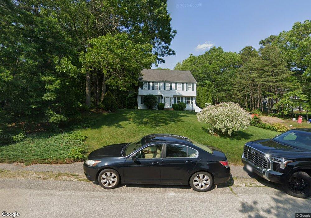
114 Andrews Way Plymouth, MA 02360
Estimated Value: $694,000 - $802,000
3
Beds
2
Baths
1,428
Sq Ft
$528/Sq Ft
Est. Value
About This Home
This home is located at 114 Andrews Way, Plymouth, MA 02360 and is currently estimated at $754,116, approximately $528 per square foot. 114 Andrews Way is a home located in Plymouth County with nearby schools including Indian Brook, Plymouth South Middle School, and Plymouth South High School.
Ownership History
Date
Name
Owned For
Owner Type
Purchase Details
Closed on
Oct 31, 2005
Sold by
Sullivan William L and Sullivan Joan M
Bought by
Kirchdorfer Stephen M and Kirchdorfer Ida
Current Estimated Value
Home Financials for this Owner
Home Financials are based on the most recent Mortgage that was taken out on this home.
Original Mortgage
$333,750
Outstanding Balance
$180,063
Interest Rate
5.79%
Mortgage Type
Purchase Money Mortgage
Estimated Equity
$574,053
Purchase Details
Closed on
Jun 11, 1990
Sold by
Roland P Leary Co Inc
Bought by
Sullivan William L
Home Financials for this Owner
Home Financials are based on the most recent Mortgage that was taken out on this home.
Original Mortgage
$60,000
Interest Rate
10.39%
Mortgage Type
Purchase Money Mortgage
Create a Home Valuation Report for This Property
The Home Valuation Report is an in-depth analysis detailing your home's value as well as a comparison with similar homes in the area
Home Values in the Area
Average Home Value in this Area
Purchase History
| Date | Buyer | Sale Price | Title Company |
|---|---|---|---|
| Kirchdorfer Stephen M | $445,000 | -- | |
| Sullivan William L | $210,000 | -- | |
| Sullivan William L | $210,000 | -- |
Source: Public Records
Mortgage History
| Date | Status | Borrower | Loan Amount |
|---|---|---|---|
| Open | Sullivan William L | $333,750 | |
| Closed | Sullivan William L | $89,000 | |
| Previous Owner | Sullivan William L | $18,000 | |
| Previous Owner | Sullivan William L | $60,000 |
Source: Public Records
Tax History Compared to Growth
Tax History
| Year | Tax Paid | Tax Assessment Tax Assessment Total Assessment is a certain percentage of the fair market value that is determined by local assessors to be the total taxable value of land and additions on the property. | Land | Improvement |
|---|---|---|---|---|
| 2025 | $7,401 | $583,200 | $235,400 | $347,800 |
| 2024 | $7,125 | $553,600 | $214,500 | $339,100 |
| 2023 | $6,870 | $501,100 | $193,700 | $307,400 |
| 2022 | $6,309 | $408,900 | $182,600 | $226,300 |
| 2021 | $6,102 | $377,600 | $182,600 | $195,000 |
| 2020 | $5,873 | $359,200 | $166,100 | $193,100 |
| 2019 | $6,107 | $369,200 | $176,100 | $193,100 |
| 2018 | $5,904 | $358,700 | $163,600 | $195,100 |
| 2017 | $5,568 | $335,800 | $157,100 | $178,700 |
| 2016 | $5,001 | $307,400 | $127,100 | $180,300 |
| 2015 | $4,632 | $298,100 | $116,100 | $182,000 |
| 2014 | $4,377 | $289,300 | $116,100 | $173,200 |
Source: Public Records
Map
Nearby Homes
- 115 Andrews Way
- 39 Miter Dr Unit 8-1
- 24 Drum Dr Unit 24
- 40 Drum Dr Unit 40
- 91 Miter Dr Unit 18-1
- 91 Miter Dr Unit 16-1
- 91 Miter Dr Unit 18-2
- 91 Miter Dr Unit 16-3
- The Hickory Plan at Alden's Reach - Attached & Detached Single Family Homes
- The Pine Plan at Alden's Reach - Attached & Detached Single Family Homes
- The Oak Plan at Alden's Reach - Attached & Detached Single Family Homes
- The Spruce Plan at Alden's Reach - Attached & Detached Single Family Homes
- 91 Miter Dr Unit 3-2
- 91 Miter Dr Unit 25-2
- 88 Miter Dr Unit 1-1
- 90 Miter Dr Unit 1-3
- 82 Miter Dr Unit 2-1
- 87 Miter Dr Unit 6-1
- 83 Miter Dr Unit 6-3
- 81 Miter Dr Unit 7-1
- 114 Andrews Way
- 110 Andrews Way
- 118 Andrews Way
- 106 Andrews Way
- 111 Andrews Way
- 123 Kathleen Dr
- 119 Andrews Way
- 103 Andrews Way
- 100 Andrews Way
- 26 Barbaras Way
- 99 Andrews Way
- 14 Barbaras Way
- 135 Kathleen Dr
- 32 Barbaras Way
- 22 Barbaras Way
- 111 Kathleen Dr
- 96 Andrews Way
- 95 Andrews Way
- 122 Kathleen Dr
- 116 Kathleen Dr