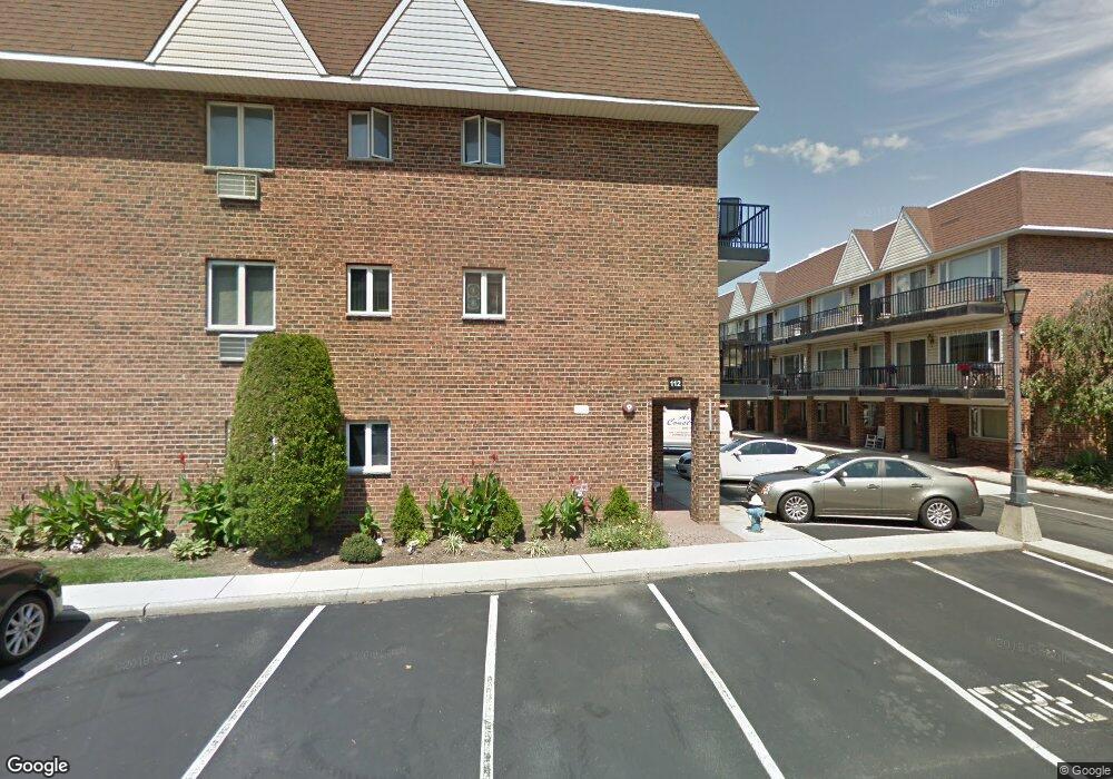
114 Atlantic Ave Unit 88 Lynbrook, NY 11563
Estimated Value: $513,892 - $607,000
3
Beds
2
Baths
1,100
Sq Ft
$509/Sq Ft
Est. Value
About This Home
This home is located at 114 Atlantic Ave Unit 88, Lynbrook, NY 11563 and is currently estimated at $560,446, approximately $509 per square foot. 114 Atlantic Ave Unit 88 is a home located in Nassau County with nearby schools including Lynbrook Senior High School and Our Lady Of Peace School.
Ownership History
Date
Name
Owned For
Owner Type
Purchase Details
Closed on
Oct 5, 2015
Sold by
Paulopol Andreea
Bought by
Jack Marlon B and Jack Arina V
Current Estimated Value
Purchase Details
Closed on
Dec 4, 1998
Sold by
Burns Kenneth G and Burns Denise A
Bought by
Papadopoulos Konstantine and Papadopoulos Nancy
Home Financials for this Owner
Home Financials are based on the most recent Mortgage that was taken out on this home.
Original Mortgage
$94,800
Interest Rate
6.8%
Create a Home Valuation Report for This Property
The Home Valuation Report is an in-depth analysis detailing your home's value as well as a comparison with similar homes in the area
Home Values in the Area
Average Home Value in this Area
Purchase History
| Date | Buyer | Sale Price | Title Company |
|---|---|---|---|
| Jack Marlon B | $325,000 | None Available | |
| Papadopoulos Konstantine | $158,000 | -- |
Source: Public Records
Mortgage History
| Date | Status | Borrower | Loan Amount |
|---|---|---|---|
| Previous Owner | Papadopoulos Konstantine | $94,800 |
Source: Public Records
Tax History Compared to Growth
Tax History
| Year | Tax Paid | Tax Assessment Tax Assessment Total Assessment is a certain percentage of the fair market value that is determined by local assessors to be the total taxable value of land and additions on the property. | Land | Improvement |
|---|---|---|---|---|
| 2025 | $6,569 | $336 | -- | $336 |
| 2024 | $649 | $336 | $0 | $336 |
| 2023 | $6,005 | $336 | $0 | $336 |
| 2022 | $6,892 | $336 | $0 | $336 |
| 2021 | $7,912 | $327 | $0 | $327 |
| 2020 | $9,751 | $790 | $0 | $790 |
| 2019 | $8,259 | $790 | $0 | $790 |
| 2018 | $8,259 | $790 | $0 | $0 |
| 2017 | $6,850 | $790 | $0 | $790 |
| 2016 | $7,750 | $790 | $0 | $790 |
| 2015 | $1,173 | $790 | $0 | $790 |
| 2014 | $1,173 | $790 | $0 | $790 |
| 2013 | $1,076 | $790 | $0 | $790 |
Source: Public Records
Map
Nearby Homes
- 114 Atlantic Ave Unit 89
- 21 Carter Ct
- 108 Earle Ave
- 65 Earle Ave
- 183 Atlantic Ave Unit 2
- 183 Atlantic Ave Unit 8
- 185 Atlantic Ave Unit C-1
- 185 Atlantic Ave Unit C-3
- 200 Atlantic Ave Unit 223
- 200 Atlantic Ave Unit 212
- 200 Atlantic Ave Unit 321
- 59 Manor Rd
- 85 Oakland Ave
- 70 Denton Ave
- 40 Daley Place Unit 124
- 73 Peterson Place
- 60 Hempstead Ave Unit 1K
- 60 Hempstead Ave Unit 1H
- 60 Hempstead Ave Unit 1O
- 60 Hempstead Ave Unit 1J
- 114 Atlantic Ave
- 114 Atlantic Ave
- 114 Atlantic Ave
- 114 Atlantic Ave
- 114 Atlantic Ave
- 114 Atlantic Ave
- 114 Atlantic Ave Unit 84
- 114 Atlantic Ave
- 114 Atlantic Ave
- 114 Atlantic Ave
- 114 Atlantic Ave
- 114 Atlantic Ave Unit 80
- 114 Atlantic Ave Unit 14
- 114 Atlantic Ave Unit 83
- 114 Atlantic Ave Unit 86
- 114 Atlantic Ave Unit 90
- 34 Lincoln Place
- 112 Atlantic Ave Unit 62
- 112 Atlantic Ave Unit 65
- 112 Atlantic Ave