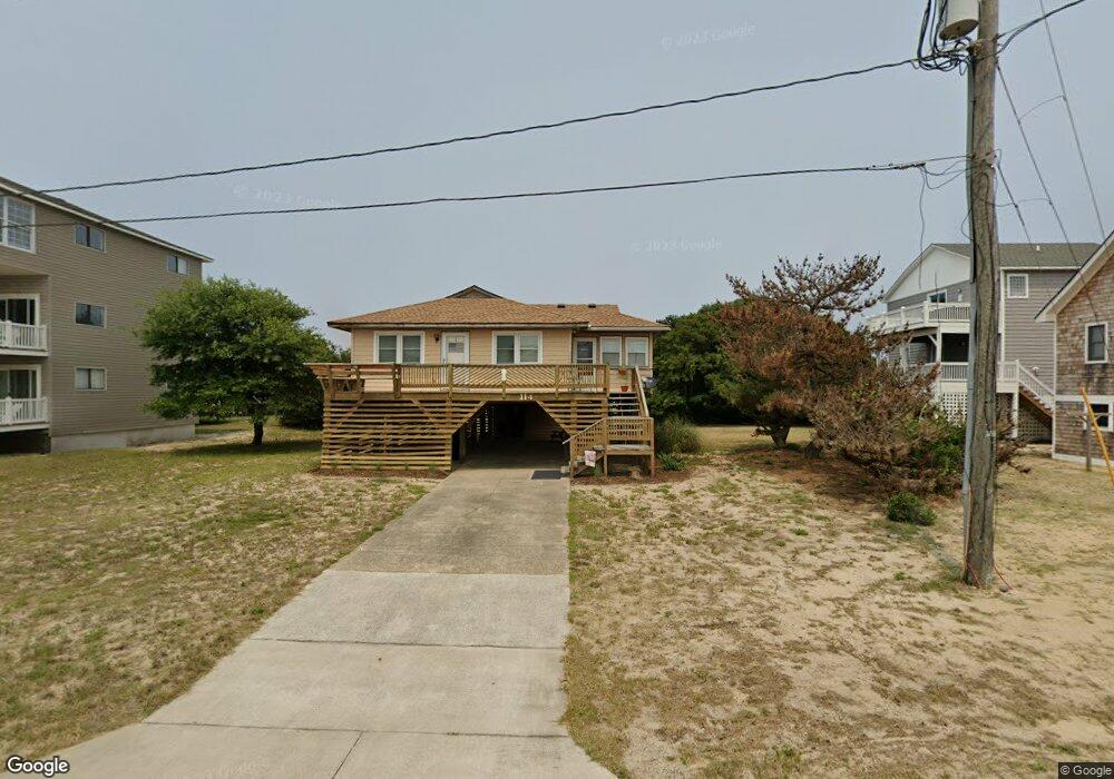
114 Baker Ave Kill Devil Hills, NC 27948
Estimated Value: $540,000 - $2,586,000
3
Beds
1
Bath
840
Sq Ft
$1,284/Sq Ft
Est. Value
About This Home
This home is located at 114 Baker Ave, Kill Devil Hills, NC 27948 and is currently estimated at $1,078,666, approximately $1,284 per square foot. 114 Baker Ave is a home located in Dare County with nearby schools including Nags Head Elementary School, First Flight Middle School, and First Flight High School.
Ownership History
Date
Name
Owned For
Owner Type
Purchase Details
Closed on
Aug 1, 2023
Sold by
Christopher C Sinesi Revocable Trust
Bought by
Clark Chelsea Rae
Current Estimated Value
Home Financials for this Owner
Home Financials are based on the most recent Mortgage that was taken out on this home.
Original Mortgage
$479,600
Outstanding Balance
$467,902
Interest Rate
6.67%
Mortgage Type
New Conventional
Estimated Equity
$610,764
Purchase Details
Closed on
Jul 21, 2015
Sold by
Scanlon Michael and Sinesi Angela
Bought by
Sinesi Christopher C and The Christopher C Sinesi Revocable Trust
Purchase Details
Closed on
Oct 22, 2009
Sold by
Scanlon Helen S
Bought by
Scanlon Michael and Sinesi Angela
Create a Home Valuation Report for This Property
The Home Valuation Report is an in-depth analysis detailing your home's value as well as a comparison with similar homes in the area
Home Values in the Area
Average Home Value in this Area
Purchase History
| Date | Buyer | Sale Price | Title Company |
|---|---|---|---|
| Clark Chelsea Rae | $3,597,000 | None Listed On Document | |
| Sinesi Christopher C | -- | None Available | |
| Scanlon Michael | -- | None Available |
Source: Public Records
Mortgage History
| Date | Status | Borrower | Loan Amount |
|---|---|---|---|
| Open | Clark Chelsea Rae | $479,600 |
Source: Public Records
Tax History
| Year | Tax Paid | Tax Assessment Tax Assessment Total Assessment is a certain percentage of the fair market value that is determined by local assessors to be the total taxable value of land and additions on the property. | Land | Improvement |
|---|---|---|---|---|
| 2025 | $3,094 | $624,800 | $330,000 | $294,800 |
| 2024 | $1,670 | $227,000 | $140,000 | $87,000 |
| 2023 | $909 | $227,000 | $140,000 | $87,000 |
| 2022 | $909 | $227,000 | $140,000 | $87,000 |
| 2021 | $909 | $227,000 | $140,000 | $87,000 |
| 2020 | $1,355 | $227,000 | $140,000 | $87,000 |
| 2014 | $689 | $160,200 | $97,800 | $62,400 |
Source: Public Records
Map
Nearby Homes
- 110 Baker Ave Unit Lot:7 & PT 6
- 101 Carlow Ave Unit Lot 13
- 907 N Virginia Dare Trail Unit Lot 4
- 116 Lowell Ave Unit Lots 3&pt4
- 113 E Aviation Ave
- 113 E Aviation Ave Unit Lot 19
- 203 A S Virginia Dare Trail Unit Lot B
- 1315 N Virginia Dare Trail
- 1319 N Virginia Dare Trail Unit 4F
- 1319 N Virginia Dare Trail Unit 3S
- 1319 N Virginia Dare Trail Unit 3E
- 1319 N Virginia Dare Trail Unit 2K
- 1319 N Virginia Dare Trail Unit 2R
- 1319 N Virginia Dare Trail Unit 3O
- 1319 N Virginia Dare Trail Unit 3Q
- 107 Porthole Ct Unit Lot 33
- 102 Cove Ct Unit 28
- 1401 N Virginia Dare Trail Unit 5A
- 102 E Landing Dr Unit Lot 2
- 1505 N Virginia Dare Trail Unit Lot 19
- 114 Baker Ave
- 110 Baker Ave
- 110 Baker Ave
- 802 N Memorial Blvd Unit 3
- 802 N Memorial Blvd
- 800 N Memorial Blvd
- 113 Ferris Ave
- 115 Ferris Ave
- 108 Baker Ave Unit 8
- 108 Baker Ave
- 108 Baker Ave
- 111 Ferris Ave
- 115 Baker Ave
- 706 N Memorial Blvd
- 113 Baker Ave
- 113 Baker Ave
- 109 Ferris Ave
- 806 N Memorial Blvd
- 111 Baker Ave
- 106 Baker Ave
Your Personal Tour Guide
Ask me questions while you tour the home.