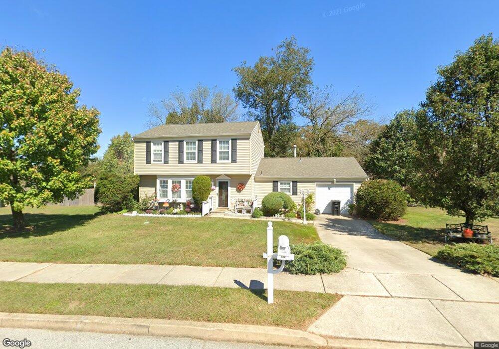
114 Burning Tree Rd Woodbury, NJ 08096
Deptford Township NeighborhoodEstimated Value: $312,900 - $419,000
--
Bed
--
Bath
1,764
Sq Ft
$216/Sq Ft
Est. Value
About This Home
This home is located at 114 Burning Tree Rd, Woodbury, NJ 08096 and is currently estimated at $381,225, approximately $216 per square foot. 114 Burning Tree Rd is a home located in Gloucester County with nearby schools including Deptford Township High School and Holy Angels Catholic School.
Ownership History
Date
Name
Owned For
Owner Type
Purchase Details
Closed on
Mar 1, 2022
Sold by
Lucas David H and Lucas Antoinette
Bought by
Lucas Antoinette
Current Estimated Value
Purchase Details
Closed on
Jan 24, 2015
Sold by
Lucas David H
Bought by
Lucas David H and Lucas Antoinette
Home Financials for this Owner
Home Financials are based on the most recent Mortgage that was taken out on this home.
Original Mortgage
$291,000
Interest Rate
2.79%
Mortgage Type
Reverse Mortgage Home Equity Conversion Mortgage
Create a Home Valuation Report for This Property
The Home Valuation Report is an in-depth analysis detailing your home's value as well as a comparison with similar homes in the area
Home Values in the Area
Average Home Value in this Area
Purchase History
| Date | Buyer | Sale Price | Title Company |
|---|---|---|---|
| Lucas Antoinette | -- | Ciocco John P | |
| Lucas David H | -- | Attorney |
Source: Public Records
Mortgage History
| Date | Status | Borrower | Loan Amount |
|---|---|---|---|
| Previous Owner | Lucas David H | $291,000 |
Source: Public Records
Tax History Compared to Growth
Tax History
| Year | Tax Paid | Tax Assessment Tax Assessment Total Assessment is a certain percentage of the fair market value that is determined by local assessors to be the total taxable value of land and additions on the property. | Land | Improvement |
|---|---|---|---|---|
| 2025 | $6,890 | $192,200 | $57,300 | $134,900 |
| 2024 | $6,669 | $192,200 | $57,300 | $134,900 |
| 2023 | $6,669 | $192,200 | $57,300 | $134,900 |
| 2022 | $6,621 | $192,200 | $57,300 | $134,900 |
| 2021 | $6,116 | $192,200 | $57,300 | $134,900 |
| 2020 | $6,452 | $192,200 | $57,300 | $134,900 |
| 2019 | $6,329 | $192,200 | $57,300 | $134,900 |
| 2018 | $6,187 | $192,200 | $57,300 | $134,900 |
| 2017 | $6,022 | $192,200 | $57,300 | $134,900 |
| 2016 | $5,899 | $192,200 | $57,300 | $134,900 |
| 2015 | $5,716 | $192,200 | $57,300 | $134,900 |
| 2014 | $5,568 | $192,200 | $57,300 | $134,900 |
Source: Public Records
Map
Nearby Homes
- 106 Shelly Ln
- 103 Wycombe Ave
- 101 Wycombe Ave
- 133 Hampshire Dr
- 1573 Delsea Dr
- 24 Sturbridge Ave
- 230 Hampshire Dr
- 105 Hampshire Dr
- 1005 Warren Ct
- 805 Cattell Rd
- 1106 Cumberland Ave
- 1554 Good Intent Rd
- 1002 Cumberland Ave
- 1209 Cooper St
- 951 New Jersey Ave
- 14 Laurel Ct
- 1831 Delsea Dr
- 12 Ambrose Ct
- 114 Carnation Dr
- 924 Virginia Ave
- 112 Burning Tree Rd
- 116 Burning Tree Rd
- 117 Yardley Rd
- 205 Red Stone Ridge
- 115 Yardley Rd
- 203 Red Stone Ridge
- 110 Burning Tree Rd
- 113 Burning Tree Rd
- 115 Burning Tree Rd
- 118 Burning Tree Rd
- 113 Yardley Rd
- 117 Burning Tree Rd
- 111 Burning Tree Rd
- 201 Red Stone Ridge
- 203 Shelly Ln
- 111 Yardley Rd
- 112 Southview Dr
- 301 Shelly Ln
- 110 Southview Dr
- 114 Southview Dr