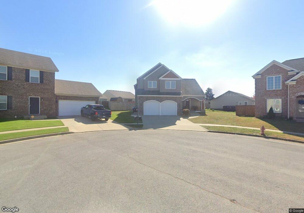
114 Castanet Ct Unit 26 Georgetown, KY 40324
Northeast Georgetown NeighborhoodEstimated Value: $333,000 - $377,000
3
Beds
3
Baths
2,096
Sq Ft
$168/Sq Ft
Est. Value
About This Home
This home is located at 114 Castanet Ct Unit 26, Georgetown, KY 40324 and is currently estimated at $353,075, approximately $168 per square foot. 114 Castanet Ct Unit 26 is a home located in Scott County with nearby schools including Creekside Elementary School, Garth Elementary School, and Georgetown Middle School.
Ownership History
Date
Name
Owned For
Owner Type
Purchase Details
Closed on
Mar 1, 2024
Sold by
Christal Enterprises Llc
Bought by
Lewis Frank J and Lewis Kelly K
Current Estimated Value
Home Financials for this Owner
Home Financials are based on the most recent Mortgage that was taken out on this home.
Original Mortgage
$324,500
Outstanding Balance
$319,163
Interest Rate
6.69%
Mortgage Type
New Conventional
Estimated Equity
$33,912
Purchase Details
Closed on
Dec 8, 2014
Sold by
East Main Estates Llc
Bought by
Piatt Nancy and Loucony Greg
Home Financials for this Owner
Home Financials are based on the most recent Mortgage that was taken out on this home.
Original Mortgage
$20,886
Interest Rate
4.09%
Mortgage Type
Unknown
Create a Home Valuation Report for This Property
The Home Valuation Report is an in-depth analysis detailing your home's value as well as a comparison with similar homes in the area
Home Values in the Area
Average Home Value in this Area
Purchase History
| Date | Buyer | Sale Price | Title Company |
|---|---|---|---|
| Lewis Frank J | $349,500 | Bluegrass Land Title | |
| Piatt Nancy | $25,000 | Kentucky Land Title Agency I |
Source: Public Records
Mortgage History
| Date | Status | Borrower | Loan Amount |
|---|---|---|---|
| Open | Lewis Frank J | $324,500 | |
| Previous Owner | Piatt Nancy | $20,886 |
Source: Public Records
Tax History Compared to Growth
Tax History
| Year | Tax Paid | Tax Assessment Tax Assessment Total Assessment is a certain percentage of the fair market value that is determined by local assessors to be the total taxable value of land and additions on the property. | Land | Improvement |
|---|---|---|---|---|
| 2024 | $2,424 | $269,500 | $0 | $0 |
| 2023 | $1,995 | $266,400 | $40,000 | $226,400 |
| 2022 | $1,611 | $230,000 | $34,000 | $196,000 |
| 2021 | $1,657 | $216,400 | $34,000 | $182,400 |
| 2020 | $1,413 | $203,800 | $34,000 | $169,800 |
| 2019 | $1,401 | $199,800 | $0 | $0 |
| 2018 | $1,593 | $183,616 | $0 | $0 |
| 2017 | $1,601 | $183,616 | $0 | $0 |
| 2016 | $1,033 | $128,232 | $0 | $0 |
| 2015 | $200 | $25,000 | $0 | $0 |
| 2014 | -- | $25,000 | $0 | $0 |
| 2011 | $16 | $25,000 | $0 | $0 |
Source: Public Records
Map
Nearby Homes
- 116 Santa Barbara Blvd
- 115 Pickett Ln
- 132 Felix St
- 107 Pony Place
- 114 Seth Way
- 106 Lake Forest Dr
- 121 Marjorie Place
- 161 Bill Perkins Ln
- 160 Bill Perkins Ln
- 148 Ruth Miller Dr
- 150 Ruth Miller Dr
- 168 Ruth Miller Dr
- 155 Bill Perkins Ln
- 174 Ruth Miller Dr
- 145 Ruth Miller Dr
- Tract 2 Wahland Hall Path
- 721 E College St
- 719 Lancaster Ct
- 214 Pleasant View Dr
- 715 E College St
- 114 Castanet Ct
- 116 Casanet Ct
- 116 Castanet Ct Unit 27
- 112 Castanet Ct
- 112 Castanet Ct Unit 25
- 117 Santa Monica Dr
- 115 Santa Monica Dr
- 131 Santa Monica Dr
- 113 Santa Monica Dr
- 135 Santa Monica Dr
- 110 Castanet Ct
- 115 Castanet Ct
- 129 Santa Monica Dr
- 111 Santa Monica Dr
- 113 Castanet Ct
- 108 Castanet Ct
- 111 Castanet Ct
- 111 Castanet Ct Unit 30
- 0 Santa Monica Dr
- 0 Santa Monica Dr