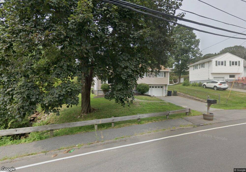
114 Concord Rd Marlborough, MA 01752
Estimated Value: $572,000 - $664,000
3
Beds
2
Baths
1,500
Sq Ft
$414/Sq Ft
Est. Value
About This Home
This home is located at 114 Concord Rd, Marlborough, MA 01752 and is currently estimated at $621,641, approximately $414 per square foot. 114 Concord Rd is a home located in Middlesex County with nearby schools including Marlborough High School, New Covenant Christian School, and Glenhaven Academy - JRI School.
Ownership History
Date
Name
Owned For
Owner Type
Purchase Details
Closed on
Dec 29, 2006
Sold by
Nanartowich Heather J and Nanartowich Michael S
Bought by
Rice Kimberly
Current Estimated Value
Home Financials for this Owner
Home Financials are based on the most recent Mortgage that was taken out on this home.
Original Mortgage
$252,000
Outstanding Balance
$151,264
Interest Rate
6.29%
Mortgage Type
Purchase Money Mortgage
Estimated Equity
$470,377
Purchase Details
Closed on
Mar 29, 2002
Sold by
Alsing Mark J
Bought by
Nanartowich Michael S and Nanartowich Heather J
Home Financials for this Owner
Home Financials are based on the most recent Mortgage that was taken out on this home.
Original Mortgage
$253,100
Interest Rate
6.88%
Mortgage Type
Purchase Money Mortgage
Purchase Details
Closed on
Jan 29, 1999
Sold by
Saez Juan O and Alicea-Saez Margarita
Bought by
Alsing Mark J
Home Financials for this Owner
Home Financials are based on the most recent Mortgage that was taken out on this home.
Original Mortgage
$158,400
Interest Rate
6.67%
Mortgage Type
Purchase Money Mortgage
Purchase Details
Closed on
Jan 2, 1996
Sold by
Brown Lt and Brown David W
Bought by
Saez Juan O and Alicea-Saez Margarita
Home Financials for this Owner
Home Financials are based on the most recent Mortgage that was taken out on this home.
Original Mortgage
$125,000
Interest Rate
7.33%
Mortgage Type
Purchase Money Mortgage
Create a Home Valuation Report for This Property
The Home Valuation Report is an in-depth analysis detailing your home's value as well as a comparison with similar homes in the area
Home Values in the Area
Average Home Value in this Area
Purchase History
| Date | Buyer | Sale Price | Title Company |
|---|---|---|---|
| Rice Kimberly | $315,000 | -- | |
| Nanartowich Michael S | $266,500 | -- | |
| Alsing Mark J | $176,000 | -- | |
| Saez Juan O | $131,600 | -- |
Source: Public Records
Mortgage History
| Date | Status | Borrower | Loan Amount |
|---|---|---|---|
| Open | Rice Kimberly | $252,000 | |
| Previous Owner | Nanartowich Michael S | $253,100 | |
| Previous Owner | Saez Juan O | $158,400 | |
| Previous Owner | Saez Juan O | $30,000 | |
| Previous Owner | Saez Juan O | $125,000 |
Source: Public Records
Tax History Compared to Growth
Tax History
| Year | Tax Paid | Tax Assessment Tax Assessment Total Assessment is a certain percentage of the fair market value that is determined by local assessors to be the total taxable value of land and additions on the property. | Land | Improvement |
|---|---|---|---|---|
| 2025 | $5,707 | $578,800 | $220,000 | $358,800 |
| 2024 | $5,347 | $522,200 | $200,000 | $322,200 |
| 2023 | $5,658 | $490,300 | $168,700 | $321,600 |
| 2022 | $5,543 | $422,500 | $160,700 | $261,800 |
| 2021 | $5,505 | $398,900 | $133,900 | $265,000 |
| 2020 | $4,908 | $346,100 | $127,500 | $218,600 |
| 2019 | $4,355 | $309,500 | $125,000 | $184,500 |
| 2018 | $9,513 | $296,000 | $99,300 | $196,700 |
| 2017 | $3,657 | $238,700 | $98,500 | $140,200 |
| 2016 | $3,438 | $224,100 | $98,500 | $125,600 |
| 2015 | $3,478 | $220,700 | $100,700 | $120,000 |
Source: Public Records
Map
Nearby Homes
- 37 Hosmer St Unit 10
- 37 Hosmer St Unit 20
- 116 Boston Post Rd E Unit 105
- 110 Boston Post Rd E Unit 104
- 323 Robert Rd
- 38 Airport Blvd
- 96 Cook Ln
- 97 Cook Ln
- 181 Boston Post Rd E Unit 26
- 41 Kane Dr
- 256 Robert Rd
- 45 Raffaele Rd
- 261 Boston Post Rd E Unit 1
- 271 Boston Post Rd E Unit 4
- 24 Clinton St
- 16 Clinton St
- 70 Phelps St
- 23 Victoria Ln
- 100 Phelps St Unit 7
- 99 Kings Grant Rd