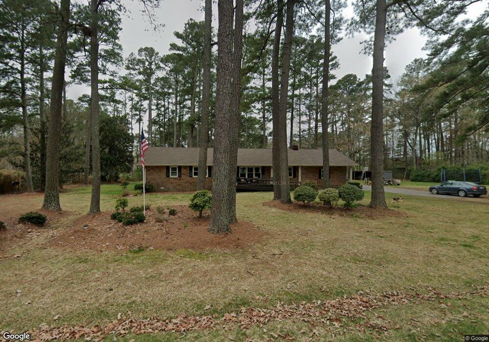
114 D St Moyock, NC 27958
Estimated Value: $510,000 - $621,518
3
Beds
3
Baths
2,422
Sq Ft
$234/Sq Ft
Est. Value
About This Home
This home is located at 114 D St, Moyock, NC 27958 and is currently estimated at $565,759, approximately $233 per square foot. 114 D St is a home located in Currituck County with nearby schools including Moyock Elementary School, Moyock Middle School, and Currituck County High School.
Ownership History
Date
Name
Owned For
Owner Type
Purchase Details
Closed on
Apr 30, 2009
Sold by
Rose Ronnie E and Rose Lisa
Bought by
May Wilbur and May Anna R
Current Estimated Value
Home Financials for this Owner
Home Financials are based on the most recent Mortgage that was taken out on this home.
Original Mortgage
$228,000
Outstanding Balance
$143,428
Interest Rate
5.01%
Mortgage Type
Purchase Money Mortgage
Estimated Equity
$422,331
Create a Home Valuation Report for This Property
The Home Valuation Report is an in-depth analysis detailing your home's value as well as a comparison with similar homes in the area
Home Values in the Area
Average Home Value in this Area
Purchase History
| Date | Buyer | Sale Price | Title Company |
|---|---|---|---|
| May Wilbur | $285,000 | None Available |
Source: Public Records
Mortgage History
| Date | Status | Borrower | Loan Amount |
|---|---|---|---|
| Open | May Wilbur | $228,000 |
Source: Public Records
Tax History
| Year | Tax Paid | Tax Assessment Tax Assessment Total Assessment is a certain percentage of the fair market value that is determined by local assessors to be the total taxable value of land and additions on the property. | Land | Improvement |
|---|---|---|---|---|
| 2025 | $2,230 | $309,500 | $81,900 | $227,600 |
| 2024 | $2,230 | $309,500 | $81,900 | $227,600 |
| 2023 | $2,238 | $309,500 | $81,900 | $227,600 |
| 2022 | $1,709 | $309,500 | $81,900 | $227,600 |
| 2021 | $1,701 | $215,800 | $74,500 | $141,300 |
| 2020 | $1,218 | $215,800 | $74,500 | $141,300 |
| 2019 | $1,218 | $215,800 | $74,500 | $141,300 |
| 2018 | $1,218 | $215,800 | $74,500 | $141,300 |
| 2017 | $1,182 | $215,800 | $74,500 | $141,300 |
| 2016 | $1,182 | $215,800 | $74,500 | $141,300 |
| 2015 | $1,182 | $215,800 | $74,500 | $141,300 |
Source: Public Records
Map
Nearby Homes
- 335-349 Caratoke Hwy
- 111 Jae Ct
- 103 Surf Scoter Loop
- 101 Surf Scoter Loop
- 185 Sawyer Town Rd
- 113 Surf Scoter Loop
- 101 Roberta Loop
- 201 Surf Scoter Loop
- 205 Surf Scoter Loop
- 196 Sawyertown
- 107 Tyler Way
- 103 Tyler Way
- 15+AC Tulls Creek Rd
- 207 Surf Scoter Loop
- 15+AC Caratoke Hwy
- 00000 Caratoke Hwy
- 128 Creekside Dr
- 233 Moyock Landing Dr
- 152 Moyock Landing Dr
- 365 Caratoke Hwy
- 118 D St
- 104 D St
- 167 Puddin Ridge Rd Unit Rd
- 171 Puddin Ridge Rd
- 117 Puddin Ridge Rd
- 122 B St
- 162 Puddin Ridge Rd
- 158 Puddin Ridge Rd
- 168 Puddin Ridge Rd
- 140 B St
- 177 Puddin Ridge Rd
- 156 Puddin Ridge Rd
- 152 Puddin Ridge Rd
- 0 B St Unit 895390
- 0 B St Unit 895383
- 0 B St Unit 895391
- 0 B St Unit 8101413
- 0 B St Unit 105260
- 0 B St
- 170 Puddin Ridge Rd
Your Personal Tour Guide
Ask me questions while you tour the home.