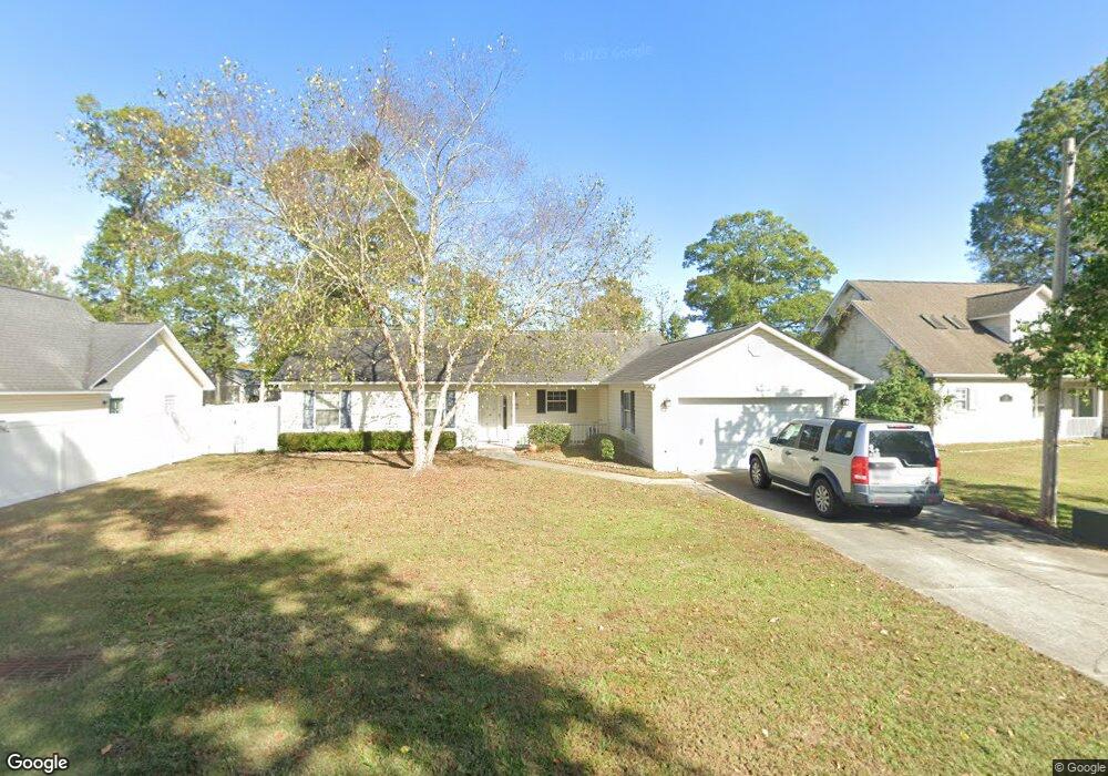
114 Deer Trace Cir Myrtle Beach, SC 29588
Burgess NeighborhoodEstimated Value: $282,111 - $308,000
3
Beds
2
Baths
1,490
Sq Ft
$198/Sq Ft
Est. Value
About This Home
This home is located at 114 Deer Trace Cir, Myrtle Beach, SC 29588 and is currently estimated at $294,778, approximately $197 per square foot. 114 Deer Trace Cir is a home located in Horry County with nearby schools including Burgess Elementary School, St. James Middle School, and St. James Intermediate.
Ownership History
Date
Name
Owned For
Owner Type
Purchase Details
Closed on
Dec 18, 2020
Sold by
Back Janet L
Bought by
Jones Edward B
Current Estimated Value
Home Financials for this Owner
Home Financials are based on the most recent Mortgage that was taken out on this home.
Original Mortgage
$193,000
Outstanding Balance
$171,828
Interest Rate
2.7%
Mortgage Type
VA
Estimated Equity
$122,950
Purchase Details
Closed on
Feb 19, 2003
Sold by
Back Allen L and Back Janet L
Bought by
Back Allen L and Back Janet L
Create a Home Valuation Report for This Property
The Home Valuation Report is an in-depth analysis detailing your home's value as well as a comparison with similar homes in the area
Home Values in the Area
Average Home Value in this Area
Purchase History
| Date | Buyer | Sale Price | Title Company |
|---|---|---|---|
| Jones Edward B | $193,000 | -- | |
| Back Allen L | -- | -- |
Source: Public Records
Mortgage History
| Date | Status | Borrower | Loan Amount |
|---|---|---|---|
| Open | Jones Edward B | $193,000 |
Source: Public Records
Tax History Compared to Growth
Tax History
| Year | Tax Paid | Tax Assessment Tax Assessment Total Assessment is a certain percentage of the fair market value that is determined by local assessors to be the total taxable value of land and additions on the property. | Land | Improvement |
|---|---|---|---|---|
| 2024 | $712 | $9,727 | $2,776 | $6,951 |
| 2023 | $712 | $7,626 | $1,350 | $6,276 |
| 2021 | $811 | $11,440 | $2,026 | $9,414 |
| 2020 | $432 | $7,206 | $1,350 | $5,856 |
| 2019 | $432 | $7,206 | $1,350 | $5,856 |
| 2018 | $369 | $5,616 | $1,080 | $4,536 |
| 2017 | $0 | $5,616 | $1,080 | $4,536 |
| 2016 | $0 | $5,616 | $1,080 | $4,536 |
| 2015 | -- | $5,616 | $1,080 | $4,536 |
| 2014 | $503 | $5,616 | $1,080 | $4,536 |
Source: Public Records
Map
Nearby Homes
- 408 Empyrean Cir Unit lot 01
- 147 Empyrean Cir
- 736 Enchantment Loop
- 179 Empyrean Cir
- 315 Kildare Ct
- ARIA Plan at Sandpiper Place
- DEVON Plan at Sandpiper Place
- KERRY Plan at Sandpiper Place
- LEWIS Plan at Sandpiper Place
- CALI Plan at Sandpiper Place
- CURTIS Plan at Sandpiper Place
- CAMERON Plan at Sandpiper Place
- MANNING Plan at Sandpiper Place
- PERRY Plan at Sandpiper Place
- 544 Fanciful Way
- 528 Fanciful Way
- 312 Trace Run
- 103 Osprey Cove Loop
- 1509 Palmina Loop Unit D
- 156 Osprey Cove Loop
- 116 Deer Trace Cir
- 112 Deer Trace Cir
- 131 Osprey Cove Loop
- 118 Deer Trace Cir
- 133 Osprey Cove Loop
- 110 Deer Trace Cir
- 135 Osprey Cove Loop
- 127 Osprey Cove Loop
- 137 Osprey Cove Loop
- 113 Deer Trace Cir
- 115 Deer Trace Cir
- 408 Empyrean Cir Unit 1
- 117 Deer Trace Cir
- 108 Deer Trace Cir
- 111 Deer Trace Cir
- 125 Osprey Cove Loop
- 139 Osprey Cove Loop
- 119 Deer Trace Cir
- 301 Kildare Ct Unit MB
- 109 Deer Trace Cir