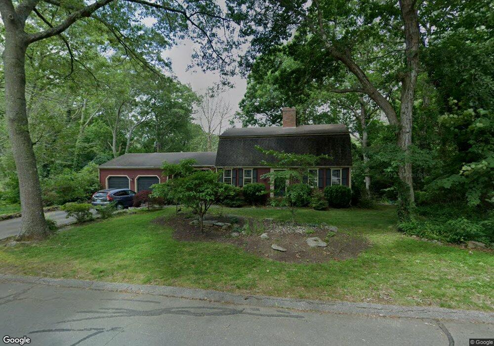
114 Dendron Rd Wakefield, RI 02879
Estimated Value: $755,204 - $838,000
3
Beds
3
Baths
2,056
Sq Ft
$382/Sq Ft
Est. Value
About This Home
This home is located at 114 Dendron Rd, Wakefield, RI 02879 and is currently estimated at $785,301, approximately $381 per square foot. 114 Dendron Rd is a home located in Washington County with nearby schools including South Kingstown High School, Monsignor Matthew Clarke Catholic Regional School, and Bradley School-South.
Ownership History
Date
Name
Owned For
Owner Type
Purchase Details
Closed on
Dec 16, 2005
Sold by
Clawson Allen R
Bought by
Collins Mark T and Collins Elizabeth A
Current Estimated Value
Home Financials for this Owner
Home Financials are based on the most recent Mortgage that was taken out on this home.
Original Mortgage
$245,000
Interest Rate
6.34%
Mortgage Type
Purchase Money Mortgage
Purchase Details
Closed on
Aug 6, 1998
Sold by
Sparhawk Dana Pb and Barnett-Sparhawk Laura
Bought by
Clawson Allen R and Miles Elizabeth A
Purchase Details
Closed on
Nov 3, 1992
Sold by
Anderson Emily P
Bought by
Ruffino Russell G and Ruffino Barbara C
Create a Home Valuation Report for This Property
The Home Valuation Report is an in-depth analysis detailing your home's value as well as a comparison with similar homes in the area
Home Values in the Area
Average Home Value in this Area
Purchase History
| Date | Buyer | Sale Price | Title Company |
|---|---|---|---|
| Collins Mark T | $425,000 | -- | |
| Clawson Allen R | $217,000 | -- | |
| Ruffino Russell G | $229,000 | -- |
Source: Public Records
Mortgage History
| Date | Status | Borrower | Loan Amount |
|---|---|---|---|
| Open | Ruffino Russell G | $233,000 | |
| Closed | Ruffino Russell G | $150,000 | |
| Closed | Ruffino Russell G | $245,000 |
Source: Public Records
Tax History
| Year | Tax Paid | Tax Assessment Tax Assessment Total Assessment is a certain percentage of the fair market value that is determined by local assessors to be the total taxable value of land and additions on the property. | Land | Improvement |
|---|---|---|---|---|
| 2025 | $5,691 | $636,600 | $254,800 | $381,800 |
| 2024 | $5,684 | $514,400 | $188,700 | $325,700 |
| 2023 | $5,684 | $514,400 | $188,700 | $325,700 |
| 2022 | $5,633 | $514,400 | $188,700 | $325,700 |
| 2021 | $5,647 | $390,800 | $145,200 | $245,600 |
| 2020 | $5,647 | $390,800 | $145,200 | $245,600 |
| 2019 | $5,647 | $390,800 | $145,200 | $245,600 |
| 2018 | $5,637 | $359,500 | $138,800 | $220,700 |
| 2017 | $5,504 | $359,500 | $138,800 | $220,700 |
| 2016 | $5,425 | $359,500 | $138,800 | $220,700 |
| 2015 | $5,067 | $326,500 | $126,300 | $200,200 |
| 2014 | $5,054 | $326,500 | $126,300 | $200,200 |
Source: Public Records
Map
Nearby Homes
- 15 Jessica Ln
- 301 Church St Unit 103
- 131 Columbia St
- 48 Stone Bridge Dr
- 37 Columbia St
- 20 Cleveland St
- 57 Rocky Brook Way
- 45 Cherry Ln Unit C
- 39 Hazard Ave
- 143 Summit Ave
- 50 Shadow Farm Way
- 261 Saugatucket Rd
- 1808 Kingstown Rd
- 23 Rockland Dr
- 35 Abbey Rd
- 66 Christopher St
- 260 Sweet Allen Farm Rd Unit 3
- 39 Secluded Dr
- 0 Indian Trail Trail S Unit 1389828
- 13 Prospect Ave
- 33 Eagle Nest Terrace
- 0 Dendron Rd
- 94 Dendron Rd
- 128 Dendron Rd
- 115 Dendron Rd
- 105 Dendron Rd
- 34 Eagle Nest Terrace
- 27 Eagle Nest Terrace
- 129 Dendron Rd
- 42 Roys Rd
- 95 Dendron Rd
- 144 Dendron Rd
- 86 Dendron Rd
- 139 Dendron Rd
- 40 Spruce Ct
- 17 Eagle Nest Terrace
- 32 Spruce Ct
- 27 Greybirch Ct
- 85 Dendron Rd
- 30 Eagle Nest Terrace
Your Personal Tour Guide
Ask me questions while you tour the home.