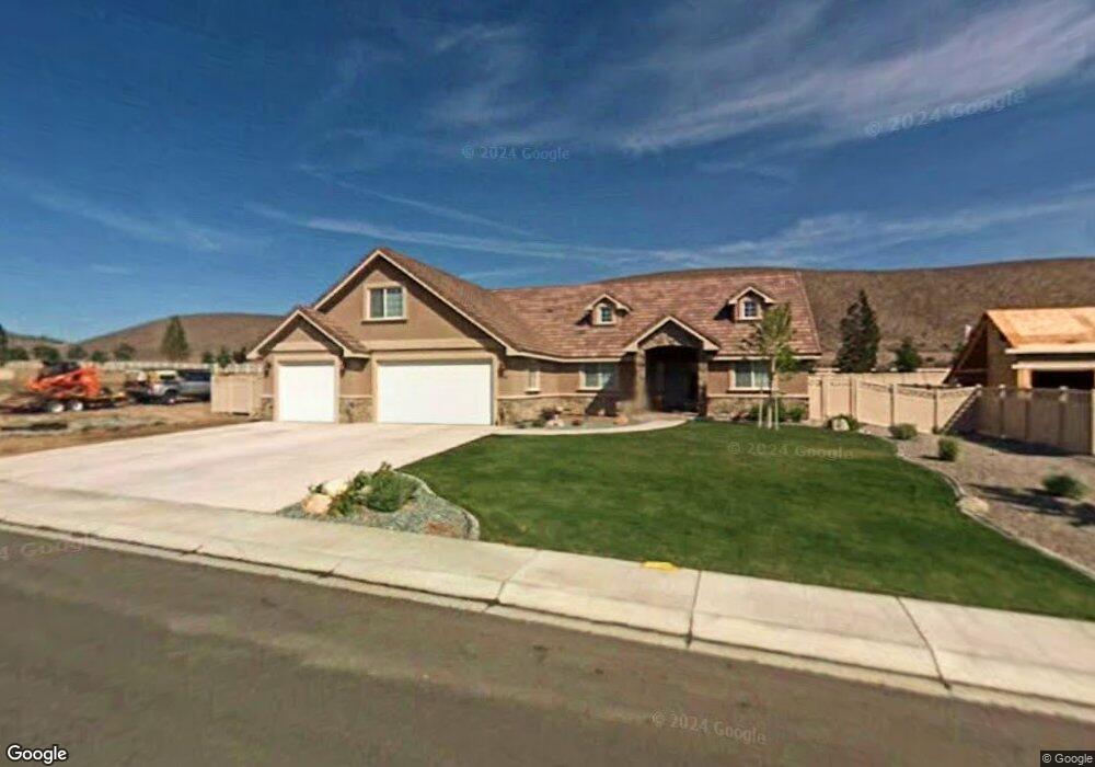
114 Denio Dr Unit LOT 10 Dayton, NV 89403
Estimated Value: $735,000 - $779,723
3
Beds
2
Baths
2,574
Sq Ft
$294/Sq Ft
Est. Value
About This Home
This home is located at 114 Denio Dr Unit LOT 10, Dayton, NV 89403 and is currently estimated at $757,431, approximately $294 per square foot. 114 Denio Dr Unit LOT 10 is a home located in Lyon County with nearby schools including Dayton Elementary School, Dayton Intermediate School, and Dayton High School.
Ownership History
Date
Name
Owned For
Owner Type
Purchase Details
Closed on
May 26, 2010
Sold by
Kirkness Donald C and Corinne Kirkness J
Bought by
Kirkness Donald C and Corinne Kirkness J
Current Estimated Value
Purchase Details
Closed on
Jun 5, 2008
Sold by
Nelson Donald F and Nelson Diane R
Bought by
Kirkness Donald C and Kirkness Corinne J
Create a Home Valuation Report for This Property
The Home Valuation Report is an in-depth analysis detailing your home's value as well as a comparison with similar homes in the area
Home Values in the Area
Average Home Value in this Area
Purchase History
| Date | Buyer | Sale Price | Title Company |
|---|---|---|---|
| Kirkness Donald C | -- | None Available | |
| Kirkness Donald C | $380,000 | Western Title Company Inc |
Source: Public Records
Tax History Compared to Growth
Tax History
| Year | Tax Paid | Tax Assessment Tax Assessment Total Assessment is a certain percentage of the fair market value that is determined by local assessors to be the total taxable value of land and additions on the property. | Land | Improvement |
|---|---|---|---|---|
| 2025 | $3,675 | $198,002 | $58,100 | $139,902 |
| 2024 | $3,567 | $197,760 | $56,000 | $141,759 |
| 2023 | $3,567 | $188,228 | $56,000 | $132,228 |
| 2022 | $2,943 | $167,157 | $47,040 | $120,117 |
| 2021 | $2,857 | $150,097 | $32,988 | $117,109 |
| 2020 | $2,773 | $146,596 | $32,990 | $113,606 |
| 2019 | $2,692 | $128,902 | $22,750 | $106,152 |
| 2018 | $2,614 | $126,093 | $22,750 | $103,343 |
| 2017 | $2,538 | $120,749 | $17,500 | $103,249 |
| 2016 | $2,473 | $108,437 | $14,000 | $94,437 |
| 2015 | $2,468 | $91,987 | $14,000 | $77,987 |
| 2014 | -- | $75,092 | $7,130 | $67,962 |
Source: Public Records
Map
Nearby Homes
- 122 Denio Dr
- 420 Chianti Way
- 134 Denio Dr
- 308 San Roma Dr
- 306 San Roma Dr
- 241 Cecina Dr
- 142 Denio Dr
- 45 Casentino Ct
- 40 Casentino Ct
- 19 Marina Dr
- 110 River Vista Dr
- 77 Ophir Mill Rd
- 00610106 Schaad Ln
- 155 Hall St
- 279 Granite Ct
- 307 Granite Ct
- 325 Stillwater Dr
- 313 Stillwater Dr
- 502 Pebble Ct
- 303 Stillwater Dr
- 114 Denio Dr
- 116 Denio Dr
- 116 Denio Dr Unit 11
- 112 Denio Dr
- 115 Denio Dr
- 118 Denio Dr
- 118 Denio Dr Unit 12
- 118 Denio Dr Unit Denio
- 111 Denio Dr
- 113 Denio Dr Unit 79
- 998 Winters Pkwy
- 117 Denio Dr
- 108 Denio Dr
- 108 Denio Dr Unit 1
- 122 Denio Dr Unit 13
- 1002 Winters Pkwy
- 200 Toscana Dr
- 107 Denio Dr
- 426 Chianti + Rv Gar
- 426 Chianti Way