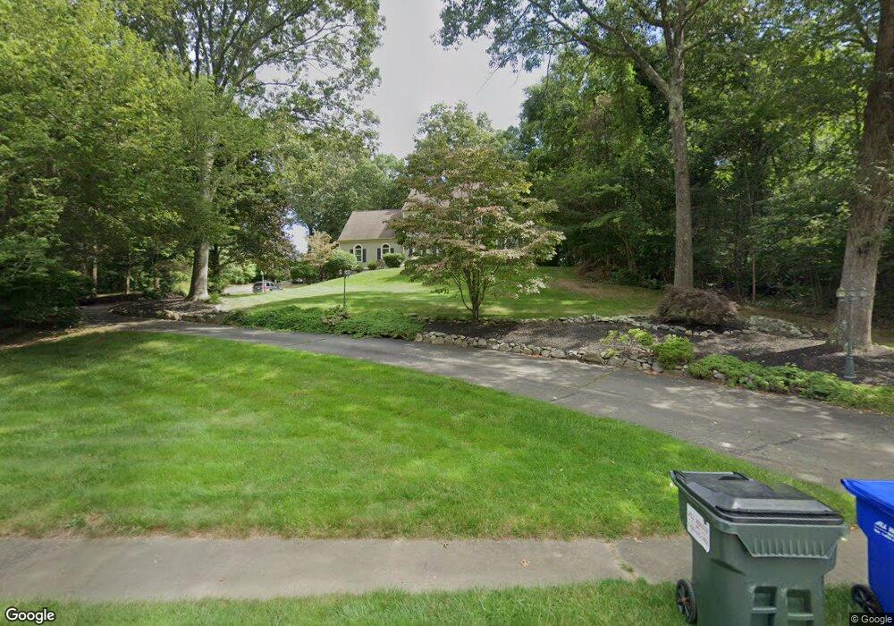
114 Fairview Rd Westbrook, CT 06498
Estimated Value: $819,972 - $955,000
4
Beds
3
Baths
3,274
Sq Ft
$269/Sq Ft
Est. Value
About This Home
This home is located at 114 Fairview Rd, Westbrook, CT 06498 and is currently estimated at $880,243, approximately $268 per square foot. 114 Fairview Rd is a home located in Middlesex County with nearby schools including Daisy Ingraham School, Westbrook Middle School, and Westbrook High School.
Ownership History
Date
Name
Owned For
Owner Type
Purchase Details
Closed on
Jul 10, 2007
Sold by
Walker Douglas and Walker Barbara
Bought by
Cariati William and Cariati Laura
Current Estimated Value
Home Financials for this Owner
Home Financials are based on the most recent Mortgage that was taken out on this home.
Original Mortgage
$365,000
Interest Rate
6.39%
Mortgage Type
Purchase Money Mortgage
Create a Home Valuation Report for This Property
The Home Valuation Report is an in-depth analysis detailing your home's value as well as a comparison with similar homes in the area
Home Values in the Area
Average Home Value in this Area
Purchase History
| Date | Buyer | Sale Price | Title Company |
|---|---|---|---|
| Cariati William | $545,000 | -- |
Source: Public Records
Mortgage History
| Date | Status | Borrower | Loan Amount |
|---|---|---|---|
| Open | Cariati William | $423,000 | |
| Closed | Cariati William | $71,500 | |
| Closed | Cariati William | $365,000 | |
| Previous Owner | Cariati William | $281,000 |
Source: Public Records
Tax History
| Year | Tax Paid | Tax Assessment Tax Assessment Total Assessment is a certain percentage of the fair market value that is determined by local assessors to be the total taxable value of land and additions on the property. | Land | Improvement |
|---|---|---|---|---|
| 2025 | $10,003 | $444,560 | $131,440 | $313,120 |
| 2024 | $9,647 | $444,560 | $131,440 | $313,120 |
| 2023 | $9,478 | $444,560 | $131,440 | $313,120 |
| 2022 | $9,229 | $444,560 | $131,440 | $313,120 |
| 2021 | $8,762 | $350,490 | $78,870 | $271,620 |
| 2020 | $8,762 | $350,490 | $78,870 | $271,620 |
| 2019 | $8,647 | $350,490 | $78,870 | $271,620 |
| 2018 | $8,541 | $350,490 | $78,870 | $271,620 |
| 2017 | $8,541 | $350,490 | $78,870 | $271,620 |
| 2016 | $8,030 | $347,020 | $78,870 | $268,150 |
| 2015 | $7,811 | $347,020 | $78,870 | $268,150 |
| 2014 | $7,562 | $347,020 | $78,870 | $268,150 |
Source: Public Records
Map
Nearby Homes
- 207 Pettipaug Rd
- 369 Pond Meadow Rd
- 11a/11b Pond Circle Rd
- 1 Lake Louise Dr
- 10 Winterberry Cir
- 1020 Old Clinton Rd
- 41 Trolley Rd
- 951 Old Clinton Rd Unit 15
- 29 Salt Island Rd
- 328 Hammock Rd N
- 8 Cook Terrace
- 1780 Boston Post Rd
- 0 Boston Post Rd Unit 24080344
- 14 Denmore Ln
- 118 Sandy Point Rd
- 40 Hammock Rd S
- 39 Sagamore Terrace Rd
- 37 Nolin Rd
- 0 Merritt Ln
- 195 Bokum Rd
- 86 Fairview Rd
- 7 Peters Trail
- 7 Peter's Trail
- 138 Fairview Rd
- 117 Fairview Rd
- 5 Peters Trail
- 11 Peters Trail
- 9 Peters Trail
- Lot 2 Peters Trail
- 2 Peter's Trail
- 75 Fairview Rd
- 149 Fairview Rd
- 1 Peters Trail
- 8 Peters Trail
- 168 Fairview Rd
- 10 Peters Trail
- 49 Fairview Rd
- 173 Fairview Rd
- 12 Peters Trail
- 3 Peters Trail
Your Personal Tour Guide
Ask me questions while you tour the home.