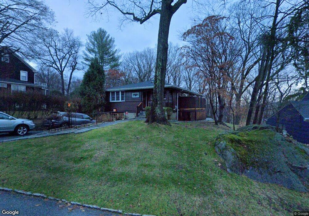
114 High St Hastings On Hudson, NY 10706
Estimated Value: $887,140 - $1,197,000
4
Beds
2
Baths
1,261
Sq Ft
$793/Sq Ft
Est. Value
About This Home
This home is located at 114 High St, Hastings On Hudson, NY 10706 and is currently estimated at $999,785, approximately $792 per square foot. 114 High St is a home located in Westchester County with nearby schools including Hastings High School, Hudson Lab School, and The Orchard School.
Ownership History
Date
Name
Owned For
Owner Type
Purchase Details
Closed on
May 25, 2010
Sold by
Charles David M and Charles Lisa
Bought by
Evans Pamela and Gartner William C
Current Estimated Value
Home Financials for this Owner
Home Financials are based on the most recent Mortgage that was taken out on this home.
Original Mortgage
$580,000
Outstanding Balance
$390,081
Interest Rate
5.12%
Mortgage Type
New Conventional
Estimated Equity
$609,704
Purchase Details
Closed on
May 3, 2007
Sold by
Lee Mihae and Purvis William W
Bought by
Charles Lisa and Charles David M
Home Financials for this Owner
Home Financials are based on the most recent Mortgage that was taken out on this home.
Original Mortgage
$300,000
Interest Rate
6.27%
Mortgage Type
Purchase Money Mortgage
Purchase Details
Closed on
Mar 3, 2003
Sold by
Lee Mihae
Bought by
Purvis William W and Lee Mihae
Create a Home Valuation Report for This Property
The Home Valuation Report is an in-depth analysis detailing your home's value as well as a comparison with similar homes in the area
Home Values in the Area
Average Home Value in this Area
Purchase History
| Date | Buyer | Sale Price | Title Company |
|---|---|---|---|
| Evans Pamela | $725,000 | Chicago Title Insurance Co | |
| Charles Lisa | $680,000 | First American Title Ins Co | |
| Purvis William W | -- | -- |
Source: Public Records
Mortgage History
| Date | Status | Borrower | Loan Amount |
|---|---|---|---|
| Open | Evans Pamela | $580,000 | |
| Previous Owner | Charles Lisa | $300,000 |
Source: Public Records
Tax History Compared to Growth
Tax History
| Year | Tax Paid | Tax Assessment Tax Assessment Total Assessment is a certain percentage of the fair market value that is determined by local assessors to be the total taxable value of land and additions on the property. | Land | Improvement |
|---|---|---|---|---|
| 2024 | $21,146 | $722,200 | $389,500 | $332,700 |
| 2023 | $20,469 | $737,400 | $371,000 | $366,400 |
| 2022 | $20,228 | $685,700 | $371,000 | $314,700 |
| 2021 | $20,950 | $646,900 | $371,000 | $275,900 |
| 2020 | $20,774 | $655,000 | $412,200 | $242,800 |
| 2019 | $20,118 | $655,000 | $412,200 | $242,800 |
| 2018 | $21,524 | $637,100 | $412,200 | $224,900 |
| 2017 | $3,712 | $619,200 | $412,200 | $207,000 |
| 2016 | $477,377 | $595,400 | $412,200 | $183,200 |
| 2015 | $11,339 | $17,500 | $1,700 | $15,800 |
| 2014 | $11,339 | $17,500 | $1,700 | $15,800 |
| 2013 | $11,339 | $17,500 | $1,700 | $15,800 |
Source: Public Records
Map
Nearby Homes
- 29 Brandt St
- 51 Branford Rd
- 25 Fenwick Rd
- 12 Glenn Place
- 42 Ravensdale Rd
- 90 Rosedale Ave
- 99 Pinecrest Pkwy
- 22 Lincoln Ave
- 1 Nodine St Unit 1
- 6 Nodine St Unit 6
- 5 Nodine St Unit 5
- 350 Warburton Ave
- 2 Marble Terrace
- 83 Ravensdale Rd
- 445 Broadway Unit 2R
- 445 Broadway Unit 2-O
- 445 Broadway Unit 3A
- 24 School St
- 31 Hillside Ave
- 244 Mount Hope Blvd