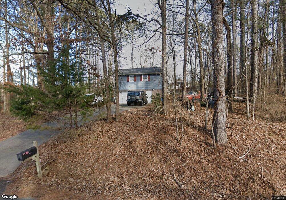
114 Johnson Dr SE Calhoun, GA 30701
Estimated Value: $291,529 - $385,000
3
Beds
2
Baths
2,908
Sq Ft
$119/Sq Ft
Est. Value
About This Home
This home is located at 114 Johnson Dr SE, Calhoun, GA 30701 and is currently estimated at $346,132, approximately $119 per square foot. 114 Johnson Dr SE is a home located in Gordon County with nearby schools including Belwood Elementary School, Red Bud Middle School, and Sonoraville High School.
Ownership History
Date
Name
Owned For
Owner Type
Purchase Details
Closed on
Oct 26, 1999
Sold by
Bowling Fred and Bowling Brenda
Bought by
Hale Jeffrey L and Hale Donna M
Current Estimated Value
Purchase Details
Closed on
Sep 30, 1998
Bought by
Bowling Fred and Bowling Brenda
Purchase Details
Closed on
Sep 1, 1998
Bought by
Patterson Ray and Eula Lee
Purchase Details
Closed on
Jul 7, 1998
Bought by
Amsouth Bank
Create a Home Valuation Report for This Property
The Home Valuation Report is an in-depth analysis detailing your home's value as well as a comparison with similar homes in the area
Home Values in the Area
Average Home Value in this Area
Purchase History
| Date | Buyer | Sale Price | Title Company |
|---|---|---|---|
| Hale Jeffrey L | $89,000 | -- | |
| Bowling Fred | -- | -- | |
| Patterson Ray | $57,500 | -- | |
| Amsouth Bank | -- | -- |
Source: Public Records
Tax History Compared to Growth
Tax History
| Year | Tax Paid | Tax Assessment Tax Assessment Total Assessment is a certain percentage of the fair market value that is determined by local assessors to be the total taxable value of land and additions on the property. | Land | Improvement |
|---|---|---|---|---|
| 2024 | $1,841 | $74,480 | $4,760 | $69,720 |
| 2023 | $1,710 | $69,320 | $4,760 | $64,560 |
| 2022 | $1,690 | $64,560 | $4,760 | $59,800 |
| 2021 | $1,431 | $53,080 | $4,760 | $48,320 |
| 2020 | $1,447 | $52,520 | $4,760 | $47,760 |
| 2019 | $1,455 | $52,520 | $4,760 | $47,760 |
| 2018 | $1,331 | $48,200 | $4,760 | $43,440 |
| 2017 | $1,284 | $45,320 | $4,760 | $40,560 |
| 2016 | $1,287 | $45,320 | $4,760 | $40,560 |
| 2015 | $1,271 | $44,400 | $4,760 | $39,640 |
| 2014 | $1,176 | $42,377 | $4,770 | $37,607 |
Source: Public Records
Map
Nearby Homes
- 0 Curtis Cir SE Unit 10611011
- 0 Curtis Cir SE Unit 7654260
- 00 Curtis Cir
- 0 Lovers Lane Rd SE Unit 10509663
- 251 Tucker Hollow Rd SE
- The Alston Plan at Salacoa - The Overlook at Salacoa
- The Hartwell Plan at Salacoa - The Overlook at Salacoa
- The Perry Plan at Salacoa - The Overlook at Salacoa
- The Dalton Plan at Salacoa - The Overlook at Salacoa
- The Springfield Plan at Salacoa - The Overlook at Salacoa
- The Dexter Plan at Salacoa - The Overlook at Salacoa
- 111 Lewis Dr SE
- 224 Shadowood Dr SE
- 220 Porch Loop SE
- 158 Shadowood Dr SE
- 116 Lavender Cir
- 110 Lavender Cir
- 114 Lavender Cir
- 118 Lavender Cir
- 201 Porch Loop SE
- 118 Jo Ann Dr SE
- 361 Boone Ford Rd SE
- 109 Johnson Dr SE
- 123 Johnson Dr SE
- 344 Boone Ford Rd SE
- 315 Boone Ford Rd SE
- 127 Johnson Dr SE
- 320 Boone Ford Rd SE
- 360 Boone Ford Rd SE
- 131 Johnson Dr SE
- 134 Johnson Dr SE
- 131 Jo Ann Dr SE
- 132 Jo Ann Dr SE
- 0 Jo Ann Dr SE Unit 7442476
- 0 Jo Ann Dr SE Unit 8109956
- 0 Jo Ann Dr SE Unit 8873363
- 0 Jo Ann Dr SE
- 387 Boone Ford Rd SE
- 220 Jo Ann Dr SE
- 130 Chad St SE