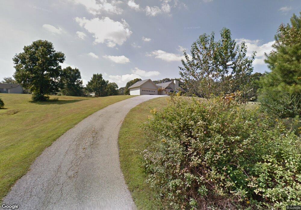
114 K P Way Maysville, GA 30558
Estimated Value: $281,000 - $341,000
3
Beds
2
Baths
1,602
Sq Ft
$190/Sq Ft
Est. Value
About This Home
This home is located at 114 K P Way, Maysville, GA 30558 and is currently estimated at $304,087, approximately $189 per square foot. 114 K P Way is a home located in Banks County with nearby schools including Banks County Primary School, Banks County Elementary School, and Banks County Middle School.
Ownership History
Date
Name
Owned For
Owner Type
Purchase Details
Closed on
Feb 18, 2022
Sold by
Parks Steve
Bought by
Turrill Dale Clayton and Turrill Alesia Lanning
Current Estimated Value
Purchase Details
Closed on
Jan 12, 2021
Sold by
Nix Jewell
Bought by
Parks Steve
Purchase Details
Closed on
Dec 8, 2020
Sold by
Nix Annie Mae
Bought by
Nix William Jewell
Purchase Details
Closed on
Dec 6, 2020
Sold by
Gee Debra Lyn
Bought by
Nix Annie Mae
Create a Home Valuation Report for This Property
The Home Valuation Report is an in-depth analysis detailing your home's value as well as a comparison with similar homes in the area
Home Values in the Area
Average Home Value in this Area
Purchase History
| Date | Buyer | Sale Price | Title Company |
|---|---|---|---|
| Turrill Dale Clayton | $190,000 | -- | |
| Parks Steve | $150,000 | -- | |
| Nix William Jewell | -- | -- | |
| Nix Annie Mae | -- | -- |
Source: Public Records
Tax History Compared to Growth
Tax History
| Year | Tax Paid | Tax Assessment Tax Assessment Total Assessment is a certain percentage of the fair market value that is determined by local assessors to be the total taxable value of land and additions on the property. | Land | Improvement |
|---|---|---|---|---|
| 2025 | $2,152 | $115,103 | $12,000 | $103,103 |
| 2024 | $2,152 | $111,110 | $12,000 | $99,110 |
| 2023 | $2,211 | $108,144 | $12,000 | $96,144 |
| 2022 | $1,670 | $76,681 | $12,000 | $64,681 |
| 2021 | $1,197 | $70,701 | $12,000 | $58,701 |
| 2020 | $1,023 | $61,970 | $6,000 | $55,970 |
| 2019 | $1,027 | $61,970 | $6,000 | $55,970 |
| 2018 | $756 | $50,173 | $4,500 | $45,673 |
| 2017 | $664 | $46,709 | $5,198 | $41,511 |
| 2016 | $696 | $46,709 | $5,198 | $41,511 |
| 2015 | $719 | $50,602 | $9,092 | $41,511 |
| 2014 | $719 | $50,603 | $9,092 | $41,511 |
| 2013 | -- | $50,602 | $9,092 | $41,510 |
Source: Public Records
Map
Nearby Homes
- 108 Lillie Ln
- 75 Meadow Lark Way
- 129 Crane St
- 82 Maywood Ct
- 362 Sims St
- 301 Oak Ridge Dr
- 241 Sims St
- 0 Hunters Glen Unit 7657277
- 0 Hunters Glen Unit 10614427
- 382 Freeman Dr
- 393 W Freeman St
- 116 Valley View Dr
- 0 H D R Dr Unit 10637398
- 0 H D R Dr Unit 7676406
- 0 H D R Dr Unit 10637403
- 199 Deadwyler Rd
- 500 W Freeman St
- 142 Holland Dam Dr
- Plan 2604 at Eagle Heights
- Plan 2505 at Eagle Heights